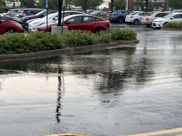
The steady rain that has fallen over Fairfax County throughout the past two days could result in flooding, forecasts indicate.
Citing “excessive rain,” the National Weather Service has issued a Flood Warning for the county that’s expected to remain in place until 6:45 p.m. today (Friday).
“Flooding of rivers, creeks, streams, and other low-lying and flood-prone locations is imminent or occurring,” the alert says. “Low-water crossings may be inundated with water and may not be passable.”
Some flooding has already been reported, with Prosperity Avenue currently closed near Mantua, Fairfax County confirmed.
[2/4 at 3:16 PM] A Flood Warning is in effect until 6:45 PM this evening. Between 1 and 1.5 inches of rain has fallen and additional amounts up to 0.25 are possible. Prosperity Avenue is closed near Mantua due to flooding. Remember, Turn around, don’t drown! #VaWx #FloodSafety pic.twitter.com/reacd5KnDv
— Ready Fairfax (@ReadyFairfax) February 4, 2022
Here are more details from the warning, which went out at 2:52 p.m.:
– At 246 PM EST, radar indicated heavy rain had occurred in the warned area. Broadcast media reported that flooding is already occurring. Between 1 and 1.5 inches of rain have fallen.
– Prosperity Avenue is closed near Mantua due to flooding, and other typical flood prone areas may also flood shortly.
Additional rainfall amounts up to 0.25 inches are possible in the warned area.
– Some locations that will experience flooding include…
Reston… Annandale… Springfield… Vienna… Mantua… Burke… Oakton… Tysons Corner… Wolf Trap… Great Falls… Merrifield… West Springfield… Dunn Loring… North Springfield… Ravensworth… Belleview…
Flood Warning for parts of Fairfax County until 6:45PM. Broadcast media confirmed that flooding is already occurring. Typical flood prone areas may also flood shortly. Turn Around, Don’t Drown. #vawx pic.twitter.com/LoMP5gLi1X
— Washingtonian Weather Geeks (@WashingtonianWx) February 4, 2022
Fairfax County Public Schools won’t hold classes for a third consecutive day this week, citing inclement weather in an announcement released just before 5 p.m.
The region could see freezing rain between 4 a.m. and 9 a.m. tomorrow (Wednesday), according to the National Weather Service, following Monday’s snowstorm that pummeled the region with over half a foot of snow in areas.
The NWS has issued a “Potential Winter Commuting Hazard” for Fairfax County, warning that there is a 30-50% chance of light freezing rain after 4 a.m. “that could turn into a glaze of ice on area roads.”
“Plan ahead by staying off the roads if possible,” the county said in a blog post. “If you do need to travel, allow for additional time and be extra cautious and alert while driving.”
FCPS said in a Facebook post that meal distribution will return at regular locations on Thursday (Jan. 6), and school offices will open later in the day tomorrow (Wednesday).
The school system tentatively expects to open its COVID-19 testing sites to staff and students who are experiencing symptoms, though a final decision won’t be made until tomorrow morning. Pre-registration is required, and only PCR tests will be available.
Testing is not required for students to be able to return to schools, whenever they reopen.
FCPS’ announcement comes after Monday’s snowstorm caused tens of thousands of Fairfax County homes to lose power and hundreds of crashes. As of this evening (Tuesday), Dominion’s power outage map showed over 7,000 customers in the county with electric issues.
The storm disrupted travel, but Fairfax Connector buses were slated to resume tomorrow (Wednesday). County officials asked commuters to use its BusTracker system in case any detours were still in effect.
Freezing rain expected near/just east of I-95 corridor early Wednesday. Winter Weather Advisories are in effect. pic.twitter.com/s7XnZzrFJ5
— NWS Baltimore-Washington (@NWS_BaltWash) January 4, 2022
Waters from the Potomac River could spill over into Fairfax County, with the D.C. area expected to get almost nonstop rain tomorrow (Friday), the National Weather Service warns.
A Coastal Flood Warning will be in place for Northern Virginia, including Fairfax County, starting at 6 p.m. today (Thursday) until 8 a.m. Saturday (Oct. 30).
According to the NWS, showers and thunderstorms from the Midwest are moving east and could bring 1 to 2 inches of rain, along with the risk of flash flooding along the Potomac River and Chesapeake Bay.
Here is more from the NWS alert:
…COASTAL FLOOD WARNING NOW IN EFFECT FROM 6 PM THIS EVENING TO 8 AM EDT SATURDAY…
* WHAT…Two to four feet of inundation above ground level possible in low lying areas.
* WHERE…Prince William/Manassas/Manassas Park, Fairfax and Stafford Counties.
* WHEN…From 6 PM this evening to 8 AM EDT Saturday, especially around the time of high tide.
* IMPACTS…Numerous roads may be closed. Low lying property including homes, businesses, and some critical infrastructure will be inundated. Some shoreline erosion will occur.
The NWS has also issued a Flood Watch that will be in effect from 10 a.m. to 6 p.m. tomorrow, with rainfall potentially reaching 2 to 4 inches in some areas.
“Heavy amounts of rain will cause creeks and streams to slowly rise, possibly out of their banks as well as the potential for flooding in urban areas,” the NWS said.
Several Coastal Flood Warnings have been issued along the Chesapeake Bay and Tidal Potomac River. Water levels are already on the rise and will only rise more throughout the day today and into Friday. Tidal inundation levels of 2-4 feet are expected in low-lying coastal areas. pic.twitter.com/dObvOQdto8
— NWS Baltimore-Washington (@NWS_BaltWash) October 28, 2021
The Fairfax County Office of Emergency Management says the risk of rain will likely arrive in the county around midnight to 2 a.m. Friday, echoing the Fire and Rescue Department’s warning that flooding may lead to road closures.
“Low lying property, including homes, businesses and some critical infrastructure, may be inundated,” OEM said in a blog post. “Take the necessary actions to protect flood-prone property. If travel is required, do not drive around barricades or through water of unknown depth.”
The office also advised keeping children away from creeks or other bodies of water that may rise rapidly, and clearing leaves and other debris from downspouts and storm drains.
[10/28 at 8:35 AM] A Coastal Flood Warning will be in effect at 6 PM this evening to 8 AM Saturday.
🌊2-4 feet of inundation above ground level possible in low lying areas
🚧Numerous roads may be closed
⬆️Flooding will be the worst around high tide#TurnAroundDontDrown #VaWx pic.twitter.com/LDW8LfA8pw— Ready Fairfax (@ReadyFairfax) October 28, 2021
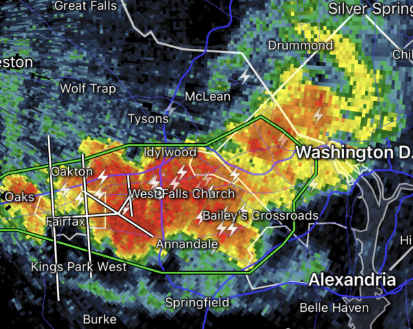
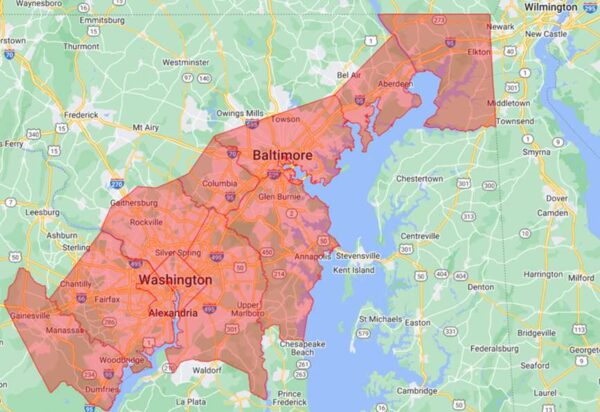
The National Weather Service has issued a Flash Flood Watch for much of the D.C. area, including Fairfax County.
In effect until 2 a.m. tomorrow (Tuesday), the alert says showers and thunderstorms could bring up to 4 inches of rain in some areas, potentially leading to rapidly rising stream and creek waters.
The full alert is below:
…FLASH FLOOD WATCH IN EFFECT UNTIL 2 AM EDT TUESDAY…
The National Weather Service in Sterling Virginia has issued a
* Flash Flood Watch for portions of DC, Maryland and northern Virginia, including the following areas: in DC, District of Columbia. In Maryland, Anne Arundel, Central and Southeast Howard, Central and Southeast Montgomery, Prince Georges and Southern Baltimore. In northern Virginia, Arlington/Falls Church/Alexandria and Fairfax.
* Until 2 AM EDT Tuesday.
* Showers and thunderstorms are expected to produce 1 to 2 inches of rain through this evening, with localized amounts of up to 4 inches possible. Heavy rain in a short amount of time may result in rapid rises of water on small creeks and streams and in urban areas.
PRECAUTIONARY/PREPAREDNESS ACTIONS…
You should monitor later forecasts and be prepared to take action should Flash Flood Warnings be issued.
A Severe Thunderstorm Warning is also in effect for Reston and Herndon until 6:30 p.m., with the NWS warning of 60 mile-per-hour wind gusts that could produce power outages and downed trees.
“At 544 PM EDT, severe thunderstorms were located along a line extending from South Riding to Herndon to Wolf Trap, moving northeast at 50 mph,” the agency said.
With the potential for multiple rounds of showers & thunderstorms into the overnight, a Flash Flood Watch has been issued for the DC metro into parts of northeast MD through 2 AM Tuesday. Flash flooding is possible in small streams and urban areas. Latest: https://t.co/5RyZgoXicj pic.twitter.com/qfUSunieBQ
— NWS Baltimore-Washington (@NWS_BaltWash) October 25, 2021
Updated at 3:30 p.m. — The National Weather Service has now issued an Areal Flood Warning until 9:30 p.m. for central Fairfax County, with Reston, Vienna, Falls Church, Annandale, and Springfield among the locations that could experience flooding. Between 1 and 1.5 inches of rain have already fallen with an additional 1 to 2 inches possible.
Earlier: After a couple of relatively dry weeks, the weather in Fairfax County is about to take a turn for the rainy today (Thursday).
The National Weather Service issued a Flash Flood Watch for the D.C. area at 2:44 p.m. Set to remain in effect until 9 p.m., the alert warns that showers and thunderstorms could produce up to two inches of rain per hour, potentially leading to floods in some areas.
Here is the full alert:
…FLASH FLOOD WATCH IN EFFECT UNTIL 9 PM EDT THIS EVENING…
The National Weather Service in Sterling Virginia has issued a
* Flash Flood Watch for portions of DC, Maryland and northern Virginia, including the following areas: in DC, District of Columbia. In Maryland, Anne Arundel, Carroll, Central and Southeast Howard, Central and Southeast Montgomery, Frederick MD, Northern Baltimore, Northwest Harford, Northwest Howard, Northwest Montgomery, Prince Georges, Southeast Harford and Southern Baltimore. In northern Virginia, Arlington/Falls Church/Alexandria, Eastern Loudoun, Fairfax, Prince William/Manassas/Manassas Park and Western Loudoun.
* Until 9 PM EDT this evening.
* Slow moving showers and thunderstorms will produce very heavy rainfall, potentially leading to areas of flash flooding. Rainfall rates may reach two inches per hour.
The NWS advises residents to monitor weather forecasts later in the day and prepare to take action if the watch escalates into a Flash Flood Warning.
[9/16 at 2:52 PM] A Flash Flood Watch has been issued until 9 PM tonight. Slow moving showers and thunderstorms will produce very heavy rainfall, potentially leading to flash flooding. Stay weather aware this evening and know what to do if a warning is issued. #VaWx pic.twitter.com/CoUkSmc4qC
— Ready Fairfax (@ReadyFairfax) September 16, 2021