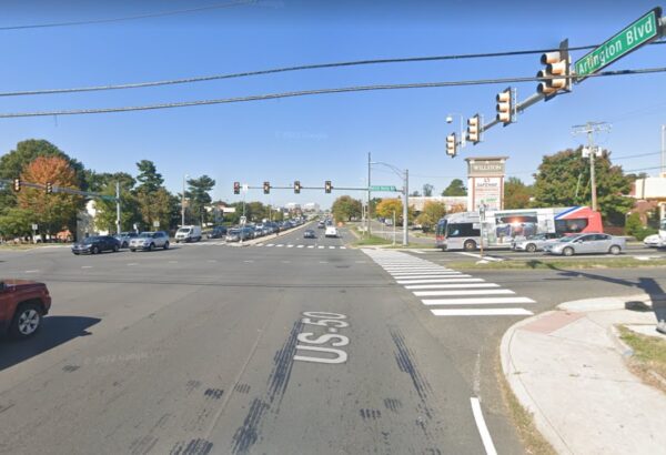
Email signup
A Lee Highway road sign (staff photo by Angela Woolsey)

Fairfax County can officially retire Lee Highway and Lee-Jackson Memorial Highway as its names for routes 29 and 50.

The highways will be renamed after their route numbers effective July 5, the county announced today (Thursday).

The Fairfax County Board of Supervisors voted on Sept. 13 to drop the highway names, which were homages to Confederate generals Robert E. Lee and Stonewall Jackson, but the Commonwealth Transportation Board didn’t approve the changes until May 24.

“The renaming of both roadways signifies our unwavering dedication to acknowledging the experiences of our community, especially our African American neighbors,” Board of Supervisors Chairman Jeff McKay said in a statement. “Thanks to the dedicated work of all the community members who participated in the Confederate Names Task Force, we can put these divisive names behind us and continue to move our County in the right direction.”

According to the county, its records will automatically update on July 5 to reflect the new street names, including for property taxes, voter registrations and Fairfax Water.

However, individual property and business owners will be responsible for updating their address when it comes to their driver’s license, legal documents, utility bills, mail and other services.

The county says it’s developing a grant program to provide financial assistance for those affected by the name changes, though the program needs to be approved by the Board of Supervisors.

The Virginia Department of Transportation will replace the road signs, but the county has agreed to cover those costs, which were previously estimated to range from $1 million to $4 million, depending on the length of the new names.

The Board of Supervisors created the Confederate Names Task Force in 2021 after the Fairfax County History Commission identified hundreds of sites bearing names associated with the Confederacy, including Lee and Lee-Jackson Memorial highways.

According to the task force’s report, Lee Highway covers about 14 miles from Centreville to Falls Church, with a break in the middle where Route 29 meets Route 50 in Fairfax City. It was named after Robert E. Lee in 1919.

Lee-Jackson Memorial consists of about 8 miles of Route 50 in western Fairfax County. The name was adopted in 1922.

The highways have already undergone renamings in other jurisdictions, including Arlington County, Fairfax City and Loudoun County.

0 Comments
Northbound Arlington Blvd at Patrick Henry Drive in Seven Corners (via Google Maps)

(Updated at 4:50 p.m.) One person died and two people were seriously injured in a two-vehicle crash at the Route 50 (Arlington Blvd) and Patrick Henry Drive intersection in Seven Corners early this morning (Friday).

Emergency responders with the Fairfax County Fire and Rescue Department were dispatched to the scene of a crash with injuries around 1:11 a.m., according to scanner traffic on Open MHz.

A preliminary investigation indicated that a 2016 Honda Accord headed east on Arlington Blvd crashed into a 2018 Honda Civic that was trying to make “an abrupt U-turn” from the far-right lane of eastbound Arlington Blvd., the Fairfax County Police Department said in a news release.

According to a dispatcher, one of the vehicles in the crash caught on fire. Christina Hamilton, 37, who’s believed to have been the Civic driver, died after being transported to Inova Fairfax Hospital.

The driver and a passenger in the Accord were hospitalized with injuries not considered life-threatening.

Witnesses told responders that another man had fled the scene and was seen headed toward the nearby Target store. However, police now say the crash doesn’t appear to have been a hit-and-run.

“At this time, detectives do not believe there is anyone outstanding,” the FCPD said. “Detectives continue to investigate to confirm Hamilton was the driver of the Civic.”

Route 50 was closed to traffic between Olin Drive and Patrick Henry until shortly before 6 a.m, according to police.

This is the third fatal crash on Fairfax County roads in 2023 that didn’t involve pedestrians, following a single-vehicle crash on Braddock Road in February and the Jan. 10 crash on Lee Chapel Road that killed two teens. At this time last year, the FCPD had recorded two non-pedestrian-involved fatal crashes.

There have been a total of seven traffic fatalities in the county this year, including highway crashes and pedestrians, according to state data.

Photo via Google Maps

0 Comments
Fairfax County Fire and Rescue truck in Merrifield with lights on (staff photo by Angela Woolsey)

One person has been taken to the hospital with injuries from a three-vehicle crash on Route 50 in the Merrifield area, the Fairfax County Fire and Rescue Department says.

Units are currently on the scene at the Williams Drive intersection just west of the Gatehouse Plaza shopping center.

Westbound Route 50 (Arlington Blvd) has been closed at Gallows Road, and two right lanes are blocked, according to the fire department, which advises drivers to seek alternate routes.

The FCFRD says the injuries of the person taken to the hospital aren’t considered life-threatening.

0 Comments
The intersection of Route 50 (Arlington Blvd) and Allen Street in West Falls Church (via Google Maps)

(Updated at 1:15 p.m.) A man died last night after being hit by a vehicle in the Route 50 (Arlington Blvd) intersection with Allen Street in West Falls Church.

The Fairfax County Police Department reported that officers were at the scene of the crash shortly before 8:30 p.m. The pedestrian was transported to a hospital, where he died, police said.

Based on a preliminary investigation, police say 66-year-old Kamrul Hassan from Falls Church was crossing from the north side of Arlington Blvd to the south when a 2010 Toyota Prius going east struck him in the Allen Street intersection.

The driver had a green light, according to the FCPD.

“Preliminarily, speed and alcohol do not appear to be factors for the driver in the crash,” police said.

The driver remained on site when police arrived. The crash triggered a closure of eastbound Route 50 as detectives with the FCPD’s Crash Reconstruction Unit began an investigation.

Hassan is the 20th pedestrian to die on Fairfax County’s roads this year, according to the FCPD, nearly doubling the 11 pedestrian fatalities recorded at this point in 2021. However, the department only reports crashes it investigated.

The Virginia State Police responds to crashes on major highways like the Beltway or I-95, while the Dulles Toll Road is in the Metropolitan Washington Airports Authority Police’s jurisdiction.

By FFXnow’s count, this is the 27th fatal pedestrian crash in Fairfax County this year. Virginia crash data shows 23 fatalities through October, but November saw pedestrians die on Columbia Pike, Route 29, and I-495.

It has been the deadliest year for pedestrians in the county since at least 2010.

Map via Google Maps

0 Comments
Proposed “Ring Road” street changes at Seven Corners (via Fairfax County)

Fairfax County has come up with a plan to improve Seven Corners and will be explaining it to residents next week.

The Fairfax County Department of Transportation (FCDOT) is holding two virtual meetings on Nov. 8 and 9 to update and ask for feedback from residents on its findings from the Seven Corners Phasing Study.

The four-phase plan will build a “Ring Road” that the county believes will improve pedestrian and bicycle safety, as well as relieve traffic congestion, in the Seven Corners area, particularly where Route 7, Arlington Blvd (Route 50), and Wilson Blvd all meet.

The first phase is to build a Ring Road on the west side of the interchange between Arlington Blvd and Route 7. The Ring Road will then be extended to the south side, and the central interchange will be reconfigured above Arlington Blvd where Route 7, Wilson Blvd, and Sleepy Hollow Road meet. The final phase will complete the Ring Road on the east side of the interchange connecting Wilson and Roosevelt Blvds.

The interchanges in and around Seven Corners are known to be confusing and dangerous. As recently as August, it was the site of a tragedy when a driver veered off the road and fatally hit a pedestrian in a nearby parking lot.

The Seven Corners study dates back a decade when a community task force first started discussing the future of the area.

The task force proposed recommendations in 2015 that were adopted into a plan amendment approved by the Board of Supervisors. At that time, FCDOT committed to a “phasing analysis” to determine how and in what order improvements were to be made.

In June 2020, FCDOT started conducting this analysis looking into “future transportation conditions; incorporated feedback received from previous rounds of outreach; and worked with various stakeholders to identify a recommended phasing approach.”

In Feb. 2021, a community meeting was held to update residents on that work and, again, in November.

Now, a year later, FCDOT is reaching back out to the public for a final round of feedback for the phasing study, which is expected to be completed by early next year.

However, there’s no set timeline yet for the project’s engineering and design phase, which is “dependent upon funding,” FCDOT spokesperson Robin Geiger told FFXnow in an email.

“The County has applied for Smart Scale funding from the Commonwealth for the first phase of the project and expects to hear early next year whether funding has been awarded,” Geiger said.

The county will also apply for federal funding as well. Once funding from local, state, and federal become available, design, utility coordination, and right-of-way acquisition will commence.

Once funding is awarded, Geiger said it should be expected that Phase 1 will take two years to construct.

The timeline for the other three phases is hard to predict at this point since they are “contingent upon the availability of funds.”

“We will continue to apply for funding progressively based on construction start for each phase,” Geiger said.

0 Comments
The Dulles Toll Road exit to Trap Road (via Google Maps)

Two people died in a moped crash on the Dulles Toll Road near the exit to Trap Road last night (Wednesday).

Metropolitan Washington Airports Authority police responded to a report of a single-vehicle crash with multiple injuries in the toll road’s westbound lanes at 9:40 p.m., MWAA said in a statement to FFXnow.

The arriving officers found a moped and one person who was dead in the roadway. A second person was transported to a hospital with critical injuries and later died, according to MWAA.

Police have identified the man found dead at the scene as 23-year-old Nyjell Dae Quan Lewis from D.C. The person who died at the hospital was 20-year-old Kia Renee Hobbs from Suitland, Maryland, according to the authority, which says she is “presumed to be a passenger on the moped.”

“The Dulles Toll Road was closed during the crash reconstruction,” MWAA said. “The case is still under investigation, and no charges have been filed. With the investigation ongoing, we can’t answer any further questions at this time.”

Though MWAA has characterized the incident as a single-vehicle crash, scanner watchers told FFXnow that a car was reportedly involved. An MWAA spokesperson said they “can’t confirm additional details.”

The Fairfax County Fire and Rescue Department also responded to the crash but deferred to MWAA police when asked for information.

The Dulles Toll Road crash was one of two fatal incidents reported in Fairfax County yesterday.

At 11:24 a.m., Fairfax County police and fire personnel were dispatched to the Route 50/Sully Road interchange in Chantilly after a car drove into a light pole. The driver — identified as Arjen Weiss, 62, of Chantilly — was transported to Reston Hospital, where he died.

“Detectives from our Crash Reconstruction Unit determined Weiss was driving westbound on Lee Jackson Memorial Highway on the ramp to northbound Sully Road,” the Fairfax County Police Department said. “His vehicle left the roadway for an unknown reason and struck a light pole. Detectives believe alcohol and speed were not factors in the crash.”

There have now been eight traffic fatalities reported in Fairfax County this month, including four pedestrians and two people who died in a one-car crash on Route 7 in Tysons last week.

0 Comments
A data center or warehouse is proposed for Lee-Jackson Memorial Highway, now known as Route 50 (via Fairfax County)

One of two options — a data center or a warehouse — is proposed for a nearly 79-acre parcel in Chantilly on what used to be called Lee-Jackson Memorial Highway.

The property owner is seeking Fairfax County’s permission to rezone a nearly 5.4-acre portion of the property for a data center or warehouse, according to an Oct. 3 application. The project is coined Chantilly Premier.

“The proposed development would encourage business and commercial endeavors in the area and add to the diverse industrial and commercial tax base surrounding Dulles Airport,” the application says.

Identified as PDCREF2 Chantilly LLC, the applicant says it’s open to dedicating the unused portion of the massive, undeveloped property — known as parcel six — to the county for preservation.

The site is currently zoned for two uses: highway commercial and general industrial. It’s located outside of the floodplain area roughly 1,200 feet west of Route 50’s intersection with Stonecroft Blvd.

The proposal would rezone most of the area that is not a floodplain for industrial uses in order to develop a 402,000-square-foot data center or a 150,000-square-foot warehouse.

Roughly 92% of parcel six will remain undisturbed.

The data center would include 50 parking spaces and two loading spaces. The building would be mostly screened from view from the highway and neighboring properties, according to the application.

The warehouse option is less intense, allowing 164 parking spaces and 30 loading spaces. It would also be screened mostly from view.

The application does not favor one option of the other, saying either use would “add to the diversity of industrial uses in the area and complement the automobile oriented uses to the east.”

The county has not yet accepted the application for review. It is in the initial planning phases.

0 Comments
A road sign for Lee Highway, also known as Route 29, in Merrifield (staff photo by Angela Woolsey)

Lee and Lee-Jackson highways may officially no more.

In a 9-1 decision, the Fairfax County Board of Supervisors voted yesterday (Tuesday) to change names of Lee and Lee-Jackson highways to Route 29 and Route 50 respectively.

“This is a necessary and important change for Fairfax County. We will continue to strive to realize our vision of a more equitable One Fairfax,” wrote Fairfax County Board of Supervisors Chairman Jeff McKay in a statement.

The move comes after a yearlong review by the county’s Confederate Names Task Force, which called on renaming the highways. The task force submitted recommendations in December.

Overall, updates to signage is expected to cost roughly $1.4 million, according to a county memo. An additional $1.5 million is estimated for a financial assistance program that would affect businesses and residential units that may be impacted by the name change.

That financial assistance program will be developed in the fall through a formal proposal.

Supervisor Pat Herrity — the board’s lone Republican — voted against the proposal. Officially changing the names will require the approval of the Commonwealth Transportation Board.

The vote comes at the heels of a June decision to change the Lee District’s magisterial name to the Franconia District.

Evoking Confederate generals Robert E. Lee and Stonewall Jackson, the highways were among 150 sites in the county with names whose Confederate origins were confirmed by a 2020 report from the Fairfax County History Commission. Combined, they represent over 20 miles of roadway from Chantilly on the county’s western end to the Falls Church border in the east.

0 Comments
A road sign for Lee Highway, also known as Route 29, in Merrifield (staff photo by Angela Woolsey)

A formal vote won’t come for another month, but several Fairfax County supervisors indicated support yesterday (Tuesday) for using routes 29 and 50, respectively, as the official names for the roads known for now as Lee and Lee-Jackson Memorial highways.

The Board of Supervisors directed county staff by a 9-1 vote to prepare a resolution for its next meeting on Sept. 13 endorsing Route 29 and Route 50 as the new names after a year-long review process that included a community task force and public surveys.

While route numbers don’t carry the same symbolism as Arlington County renaming its portion of Lee Highway after abolitionist John Langston, board members expressed hope that the move will reduce the confusion of navigating the county in addition to discarding reminders of the area’s Confederate past.

“Frankly, calling them by the route numbers is what a lot of people already do today voluntarily, so I don’t see this as a heavy lift at all for these two major corridors and I think will chart us a better course moving forward,” Chairman Jeff McKay said.

If the resolution passes, it will go to the Commonwealth Transportation Board, which will have the final say, as required by state law.

Evoking Confederate generals Robert E. Lee and Stonewall Jackson, the highways were among 150 sites in the county with names whose Confederate origins were confirmed by a 2020 report from the Fairfax County History Commission. Combined, they represent over 20 miles of roadway from Chantilly on the county’s western end to the Falls Church border in the east.

Recommending that both roads be renamed, the board-appointed Confederate Names Task Force suggested five alternatives each, including the route numbers, in a report finalized in December 2021.

Surveys of property and business owners in the corridor conducted this past spring found that they preferred the route numbers over the other options, which included following Arlington’s lead with Langston Blvd for Lee Highway.

“I think this is basically as close as we’re going to get to consensus on the names,” said Hunter Mill District Supervisor Walter Alcorn, who chairs the board’s transportation committee. “I think this is a very reasonable and practical way to address the challenge that we’re facing, and I think it’s a big step towards moving away from memorializing that time in history and some of those folks and really updating that.” Read More

0 Comments

(Updated at 5 p.m.) A tractor-trailer caught fire on I-495 this afternoon (Wednesday), shutting down all southbound lanes at the Route 50 interchange in Merrifield.

The fire appears to have sparked right as the afternoon rush hour was getting underway. The Fairfax County Fire and Rescue Department reported at 4:16 p.m. that it has units on the scene working to extinguish the fire.

“Currently no clue as to how long the entire roadway will be closed,” a fire department spokesperson told FFXnow.

There have been no reported injuries resulting from the fire, according to FCFRD, which notes that the express lanes are open.

The Virginia Department of Transportation advises that drivers find an alternate route. VDOT traffic cameras suggest vehicles backups on the Beltway extend past Tysons to the Lewinsville Road bridge.

0 Comments
×

Subscribe to our mailing list