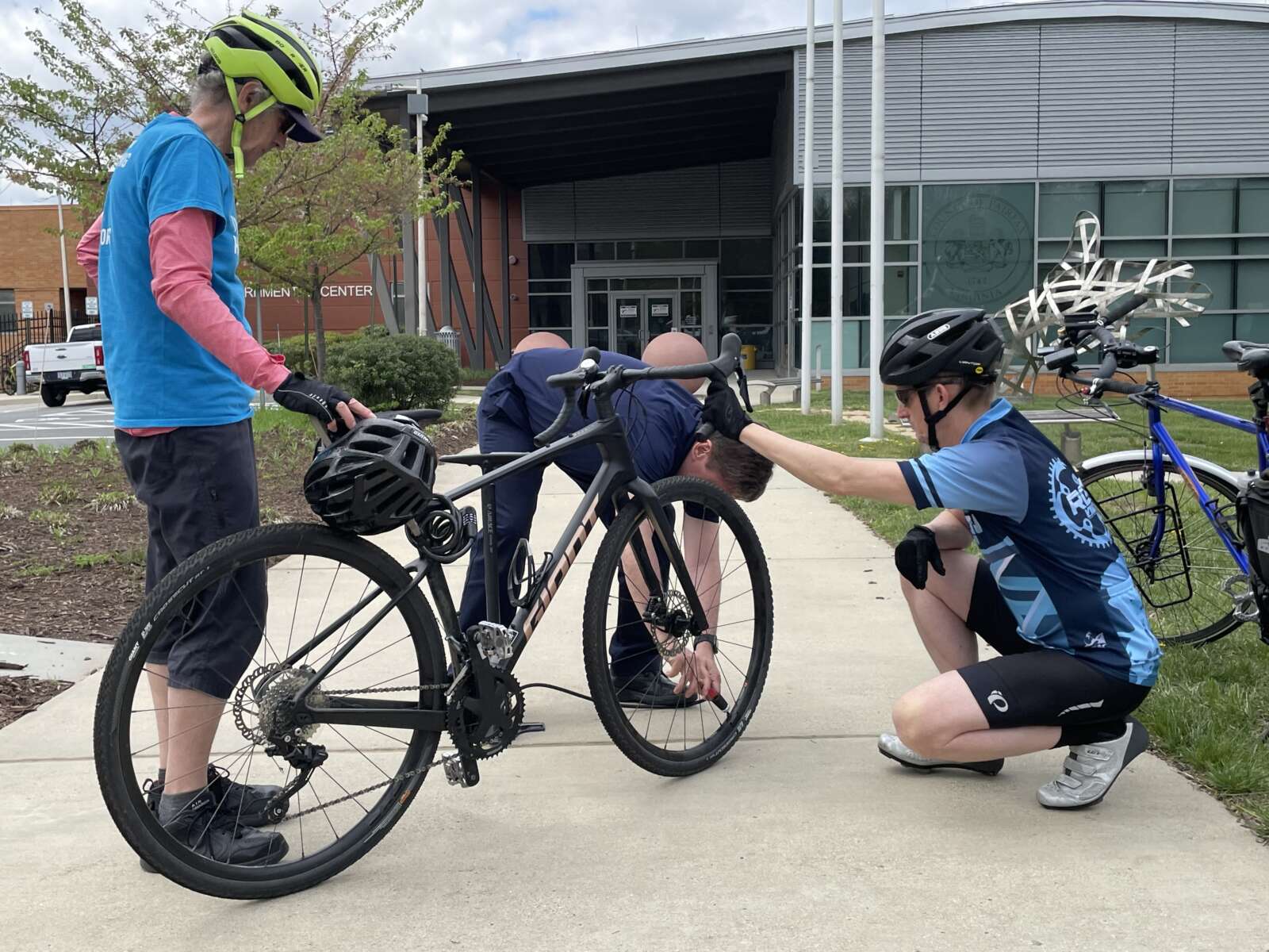
The annual Tour de Hunter Mill bicycle ride will kick into full gear early next month with new routes designed to show off sights and amenities throughout the district.
Registration is now open for the fourth iteration of the May 5 community bike ride, which was introduced in 2021 by Hunter Mill District Supervisor Walter Alcorn.
The event will feature two brand-new routes — one spanning 16 miles and the other covering 27 miles — that both begin and end at the North County Governmental Center (1801 Cameron Glen Drive) in Reston, with a rest stop at Meadowlark Botanical Gardens (9750 Meadowlark Gardens Court) in Wolf Trap.
This year’s routes will incorporate portions of the Washington & Old Dominion Trail and, for the first time, a new shared-use path along Route 7 (Leesburg Pike), according to Alcorn’s office.
The 10-foot-wide path is part of the Virginia Department of Transportation’s Route 7 widening, which is redesigning key intersections and adding a lane in each direction from Reston Avenue to Jarrett Valley Drive just outside of Tysons.
Though VDOT is targeting July 31 for completing the overall project, the trail is already functional enough for cyclists and pedestrians to use — at least between Reston Avenue and Towlston Road, according to Brian Worthy, a spokesperson for Alcorn’s office. A ribbon-cutting ceremony will be scheduled for late May.
“I’m excited that this year’s Tour de Hunter Mill will take advantage of the newest bike trail in the district — the new shared-used path along both sides of Leesburg Pike,” Alcorn said in a statement to FFXnow. “It will allow bikers to get from Reston all the way into Tysons safely, and it expands the transportation options for traveling safely along this busy corridor.”
Co-sponsored by the Fairfax Alliance for Better Bicycling (FABB), Reston Bike Club and Reston Community Center, the Tour de Hunter Mill costs $30 for adults, but children 15 and under can participate for free, as long as they’re accompanied by an adult.
The fee includes custom Tour de Hunter Mill socks for at least the first 165 registrants and a $5 donation to FABB, a volunteer, nonprofit organization that advocates for bicycling to be “safe, accessible and commonplace in Fairfax County for all ages, abilities and skill levels.”
The event will begin at 8 a.m. with riders checking in at a welcome table. After some opening remarks, the 27-mile ride will start at 8:30 a.m., and the shorter route will follow at 8:45 a.m. Once they finish, cyclists will be able to enjoy “food & fun” at the North County Governmental Center from 10 a.m. to noon, according to the registration page.
In a promotional video for the Tour de Hunter Mill, Reston Bike Club Vice Chairman Joel Kuester expressed hope that next year’s routes will utilize the new W&OD Trail bridge over Wiehle Avenue, which was installed earlier this month and is slated to open for use in June.
“Tour is a great way for folks to get out and experience the local roads, the trails and so on, so they know how to get around by bike,” FABB President Bruce Wright said in the video.
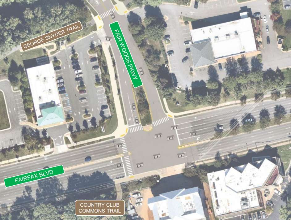
The Fairfax City Council recently approved several bicycle network enhancements along Fair Woods Parkway, its first project since adopting a bicycle master plan in 2021.
The unanimous adoption of the resolution gave city staff the go-ahead to engage engineering consultants to design the bike routes.
The final concept adds curb extensions at four intersections, including Cardinal Road, Cavalry, Scout and Blue Coat Drive, to help slow down cars and make it safer for people to walk. Improvements initially planned for Continental Lane were removed from the project after nearby residents raised concerns.
Staff are also considering adding crosswalks throughout the corridor and a shared-use path for biking and walking on one side of Fair Woods Parkway between Fairfax Blvd and the George Snyder Trail.
The city initiated its project to turn Fair Woods Parkway into a “neighborway” almost two years ago. The process included several rounds of community feedback through various surveys and public meetings.
Previously known as Plantation Parkway, Fair Woods Parkway was chosen for the first neighborway — a low-volume street designed to serve as a safe bicycle route — because of the area’s access to various local destinations and bike paths, Fairfax City Multimodal Transportation Planner Chloe Ritter told the city council during its March 26 meeting.
She noted it also addresses resident requests for improved traffic conditions and better bicycle infrastructure.
“We feel that this proposal provides a number of benefits, including shortening pedestrian crossing distances,” Ritter said. “It improves the visibility for drivers…removes uncontrolled pedestrian crossings and the requirement for vehicles to stop when the signal is green.”
The city’s bicycle master plan designates approximately 20 miles of neighborhood streets as “neighborways.”

While city staff are designing the neighborway, the public will have an opportunity to give their input about halfway through the design phase, per Ritter.
The project’s funding comes from a U.S. Department of Transportation grant via the Regional Surface Transportation Program. This program allocates funds to states and local governments for various public transportation projects, including pedestrian and bicycle infrastructure.
Almost all council members fully endorsed the project — with a few words of caution.
Councilmember Thomas Ross called it a significant move towards “humanizing the transportation network.” However, he also urged staff to evaluate the project’s effectiveness upon completion.
“I would also encourage perhaps a focus group or a discussion group with the community and in a year and a half, two years, whenever it seems appropriate to say, ‘What’s your reaction to this? Is it working? Is it making it safer for people to walk and get around? Is it safer to get in and out of the neighborhood?'” Ross said.
Councilmember Jon Stehle suggested that staff consult with the local police department about incorporating safety-promoting technologies, such as blue light stations, into the design.
“We talked previously about ‘fix-a-flat’ opportunities at certain locations in different areas along bike trails, etcetera,” he said. “There has to be some technology out there that’s up and coming or someone who’s looked at this in a different way that we should at least have the conversation about.”
The city’s webpage for the project says engineering and construction work could tentatively start later this year.
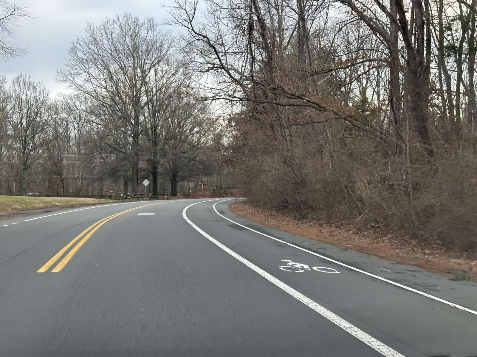
Paving and re-striping season has descended upon Fairfax County once again, ushering in a series of public meetings later this month on proposed projects that include bicycle lanes and improved crosswalks.
Hundreds of miles of roadway will be repaved and re-striped by the Virginia Department of Transportation (VDOT) as part of the program throughout the state.
“VDOT and the Fairfax County Department of Transportation (FCDOT) use this program as an opportunity to increase driver, bicyclist and pedestrian safety with road and crosswalk improvements while minimizing the financial investment in restriping work,” FCDOT says on its website.
The first meeting kicks off next Monday (April 8) at 7 p.m. for the Franconia and Mount Vernon districts.
In the Franconia District, bicycle lanes on Oakwood Road between Van Dorn Street and Crown Royal Drive are proposed, along with crosswalk improvements at Terrapin Place and at the Crown Royal Drive and Founders Hill Place intersection.
The Mount Vernon District is slated for:
- Bike lanes on Laurel Crest Drive between Silverbrook Road and Douglas Fir Drive
- Bike lanes on Old Mount Vernon Road between Drews Court and Maryland Street
- Crosswalk improvements at Laurel Crest Drive and Paper Birch Drive
The Hunter Mill District’s meeting on April 9 will focus on Center Harbor Road in Reston, where bicycle lanes are proposed between Wiehle Avenue and Reston Parkway, and crosswalk improvements proposed at the Sundial Road intersection.
The Providence District meeting is set for April 10, with bike lanes proposed on Anderson Road between Birdwood Avenue and Magarity Road. A Capital Bikeshare station is also proposed near the intersection of Anderson Road and Dartford Drive.
Meetings for the Braddock, Mason and Springfield Districts are slated for April 11. Braddock is expected to have the following projects:
- Bike lanes on Heming Avenue between Heming Place and Braddock Road
- Crosswalk improvements at Heming Avenue and Hogarth Street
- Crosswalk improvements on Heming Ave at Elgar Street and Axton Street
Springfield is only slated for one road restriping that would add crosswalk improvements on Center Road and Garden Road.
The Sully District has the most proposed changes, which will be discussed at a meeting on April 23 at 7 p.m.:
- Bike lanes on Walney Road between Westfields Boulevard and Westmore Street
- Bike lanes on Field Encampment Road between Golden Oaks Lane and Centrewood Drive
- Crosswalk improvements on Field Encampment Road at Cider Barrel Circle and St. Germain Drive
- Crosswalk improvements at Compton Village Drive and Bradenton Drive
Paving begins in the spring and concludes in November. Exact dates for each project will be available 10 days before work is expected to begin.
Work hours are usually limited to outside of rush hours, although residents can expect work vehicles in their neighborhood during the project.
Links for each web meeting are available on FCDOT’s website, along with dial-in information.

Commuters who use Route 29 in the Fairfax Corner area harbor concerns about poor pedestrian and bicycle infrastructure, safety and traffic congestion, the results from a recent Route 29 survey suggest.
The Fairfax Department of Transportation conducted the survey from Feb. 12 to March 1 as part of an ongoing effort to make the 2.9-mile stretch between Buckleys Gate Drive and Jermantown Road more pedestrian and cyclist-friendly.
Nearly 400 people responded to the survey, about half of them saying they commute along the corridor regularly for errands, work or school. Three-quarters of those respondents drive, seven bike, two carpool, one walks, and 64 use various modes of travel.
While many respondents were content with the current state of the corridor, a majority expressed a desire for wider sidewalks and bicycle lanes, along with greater separation for those facilities from the road. The survey also identified frustrations with the roadway’s short turn lanes, which some said create long left-turn delays.

During a virtual public meeting last Tuesday (March 12), FCDOT’s Arpita Chatterjee said the newly unveiled survey findings support the department’s plans to shift away from interchanges, road widenings, and other auto-focused improvements and “explore ways to increase walking and biking along the corridor.”
“The easiest way to describe Route 29 through this corridor is kind of a mess,” Braddock District Supervisor James Walkinshaw said at the meeting. “And this study is our opportunity to develop a much better vision for this stretch of Route 29.”
Almost 20 people who attended the virtual meeting, but just one person spoke. Their comments centered on safety at the Jermantown Road intersection, and they recommended improving sidewalk lighting.
Though staff won’t present its final recommendations until summer 2024, Chatterjee said FCDOT plans to implement mitigation measures for intersections experiencing significant congestion, including Waples Mill and Shirley Gate Road.
“Overall intersection delays were over 100 seconds and side streets delays are even higher,” Chatterjee said. “But that said, we will investigate what mitigation would be possible to get the intersection of Waples Mill and Shirley Gate roads to operate more efficiently, similar or at least close to Legato Road and Monument Drive.”
The online survey will stay open until March 29, and participants can leave a recorded voicemail at 703-890-5898 using the code 3941.
There will be a second virtual meeting in the early part of this summer before staff present their final recommendations to the Board of Supervisors.
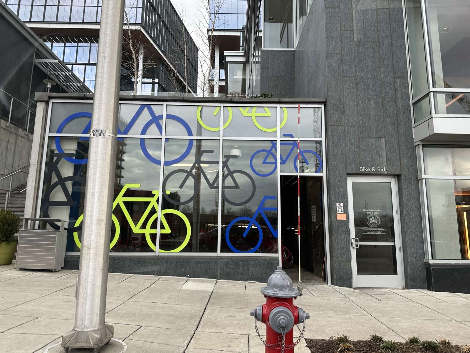
Fairfax County’s new bicycle parking standards are getting refined as part of a broad effort to ensure consistency across the county’s various transportation policies.
At a transportation committee meeting yesterday (Tuesday), the Fairfax County Board of Supervisors expressed support for an update to the bicycle parking guidelines — although the guidelines were not yet available for review.
The county got up to speed with the current age of telework and transit-oriented development by introducing bicycle parking requirements in September.
The “Parking Reimagined” initiative established how many bicycle parking spaces are required and basic rules for the design and general location of the spaces. But staff noted that the new requirements don’t align with guidelines formulated in 2014.
“It’s really great to know we’re thinking about this, that we’re tackling it. Doing this better will have great effects for the county,” said Dranesville District Supervisor Jimmy Bierman, who chairs the committee.
Additionally, the zoning ordinance doesn’t address parking ratios for visitor and long-term parking or provide detailed information about wayfinding signage, rack spacing, security needs and other amenities, county staff said in a presentation to the committee.
The guidelines currently being crafted would be divided by short-term parking for visitors and long-term parking, which is for employees, transit users, apartment residents and bicycle cages or lockers, according to Nicole Wynands, a planner for the Fairfax County Department of Transportation.
For short-term parking, the guidelines will cover location, access, markings, maintenace, rack types and spacing. Long-term parking guidance will detail similar issues, along with room layout, security recommendations, and e-charging.
Wynands noted that the guidelines will provide different ratios based on land use. FCDOT is contemplating a 90-10% split for long-term and short term parking, respectively, in residential areas and a the reverse split for long-term and short term parking respectively in retail areas.
“Retail use has a very different need,” Wyannds said.
Discussion on the proposal was limited, given that the details haven’t been officially reviewed by the board.
The county hopes to release the guidelines to the board soon so the public review process can begin in early March, followed by potential board endorsement by the summer.
Board of Supervisors Chairman Jeff McKay said that, although the guidelines were not yet available, he was supportive of the idea.
Hunter Mill District Supervisor Walter Alcorn said staff should ensure that existing bicycle guidelines for specific areas like Reston are consistent with other, similar policies.
“It seems like there needs to be some sort of normalizing across these different area guidelines,” Alcorn said.
McKay asked staff if there was some way to encourage more commercial residential properties to conform with the county’s guidelines on bicycle parking.
“I’m just wondering if we’re evaluating where we can see with our own vision today where the need for these facilities are,” he said.
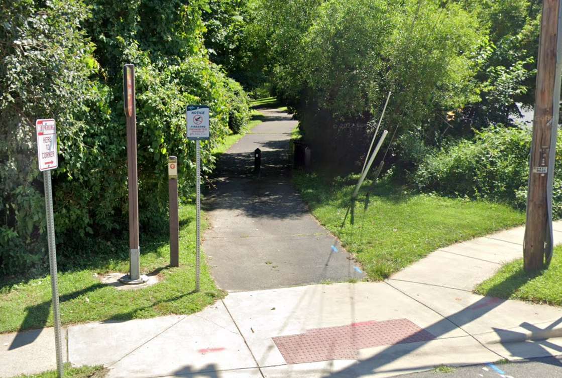
Fairfax City will complete the George Snyder Trail as planned after all.
In response to some community concerns, the Fairfax City Council discussed changing the pedestrian and bicycle project’s scope or even canceling it altogether during its meeting on Tuesday (Jan. 23). But council members failed to agree on any of the proposed alternatives, allowing the city to stay the course by default.
“None of the resolutions received enough support to change the current trail alignment,” City of Fairfax spokesperson Matthew Kaiser confirmed to FFXnow. “Staff will continue to acquire the needed land and come back to council in six months or so for [a construction] bid approval.”
The city has acquired rights-of-way for two of five needed parcels, Fairfax City Transportation Director Wendy Sanford told the council.
Over a decade in the making, the planned trail will run along the south side of Accotink Creek for about 1.8 miles from Chain Bridge Road (Route 123) to Fairfax Blvd (Route 50), connecting the existing George Snyder Trail to the I-66 shared-use path that’s slated to finish this spring.
However, some residents and environmental groups, including the Audubon Society of Northern Virginia, have objected to the proposed route for the 10-foot-wide trail, which will wind through a wooded area and require removing 553 trees. A segment in Shiloh Street Park that would’ve eliminated another 11 trees has been dropped from the plan, according to a city staff report.
The city has said 858 trees and 815 shrubs, all native species, will be planted to offset the lost trees.
Though the design is complete, Sanford said the council could cancel the project, realign the trail east of Fair Woods Parkway to use existing roads more, or construct only the segment west of Fair Woods Parkway.
Staff recommended either sticking with the existing plan or building only the western segment. If it cancels the project, the city would have to repay at least $395,000 in federal funding out of the $3 million it has spent so far, potentially putting it at a disadvantage for receiving future awards, Sanford said.
Most of the project’s $17.6 million budget comes from a concession fee that the I-66 Outside the Beltway toll lanes operator agreed to provide for transportation improvements in the corridor. Sanford said it’s unclear if any of that will need to be returned.
Revising the trail’s eastern segments would require restarting the design and engineering process, according to Sanford.
“This would delay the project, cause additional costs in engineering and potentially higher construction costs due to inflation when we do get to construction,” she told the council. “There’s also no assurance of feasibility for the new alignment or public support for any of the alternatives.”
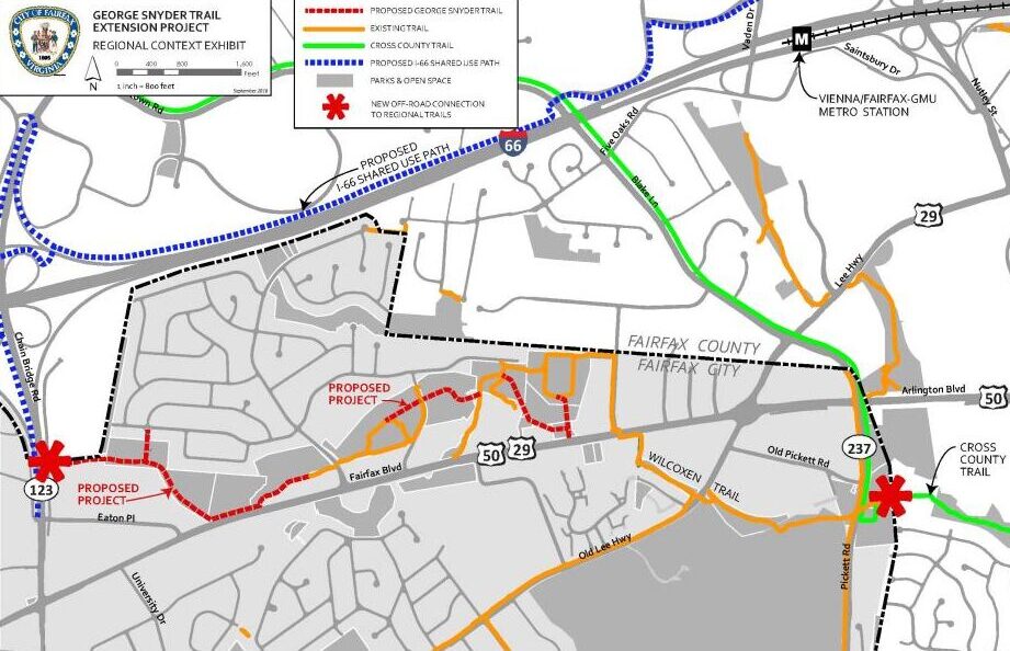
Councilmember Jeffrey Greenfield proposed building the western portion with two tweaks: merging it with the sidewalk on Route 50 where they run parallel and possibly rerouting it through WillowWood Plaza, an office complex on Eaton Place under review for redevelopment as housing. Read More
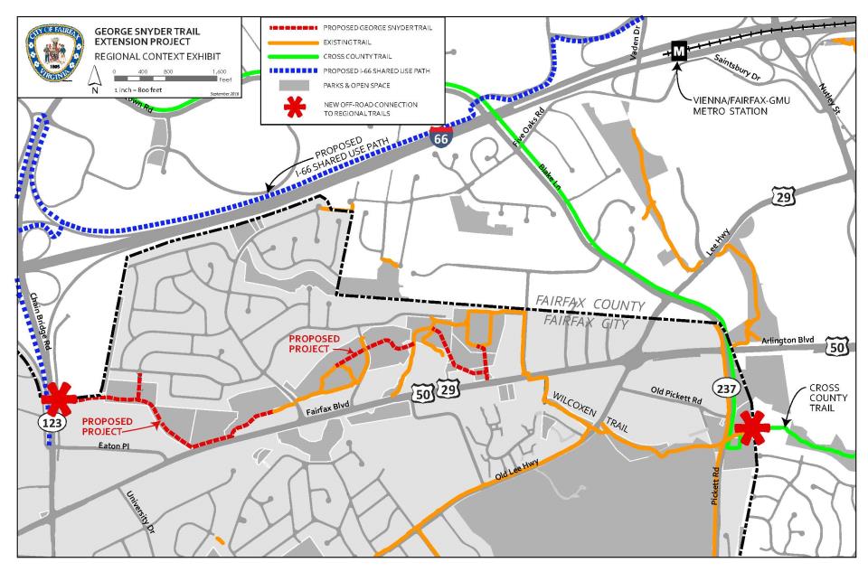
The Fairfax City Council will vote on the future of a much-debated trail planned in the heart of the city later this month.
During a meeting on Tuesday (Jan. 9), the city’s transportation director, Wendy Sanford, presented the council with options for proceeding with the George Snyder Trail project, which will complete a 2-mile trail along the southern side of Accotink Creek between Chain Bridge Road (Route 123) and Fairfax Blvd (Route 50).
Plans for the Snyder trail have been underway for more than a decade, but the project has drawn some criticism from environmentalists who say it will eliminate hundreds of trees, negatively impacting the area’s woodlands.
A group of city residents sent an email to the city council and staff on Jan. 2 urging them to consider alternatives that would add a trail or bicycle lanes on existing streets, such as Fairfax Blvd, Cardinal Road or Eaton Place.
The planned route has gotten support from bicycling advocates, who say it’ll fill a missing link in the region’s bicycle network, particularly in the I-66 corridor.
In a presentation, staff recommended the council either continue with the proposed changes or modify it by only constructing the western portion from Chain Bridge Road to Fair Woods Parkway.
“To continue with the project as proposed, that would mean putting the project out to bid,” Sanford explained. “We have the 100% [design] plans to continue with the right-of-way acquisition.”
If the city cancels the project, Sanford said it would be required to repay some or all of the $3 million it has already spent, potentially affecting the city’s ability to be awarded funds for future projects.
Sanford noted that the suggested modification would reduce the overall cost, while still delivering some of the trail. However, Councilmember So Lim pushed for a cancellation, saying she thinks “it’s all or nothing.”
Councilmember D. Thomas Ross disagreed and said cancelling the project could have a negative impact on taxpayers.
“We’ve heard consistently the concerns about cost of operation and development and maintenance of the trail if it’s completed as proposed,” he said. “It’s going to be nothing compared to what we hear when we start talking about paying up to $3 million.”
Mayor Catherine Reed was also against canceling the project, but said she won’t participate in the scheduled vote on Jan. 23 unless there’s a tie.
“What what we understand about environmental impact is significant. No one is saying here that there’s no impact in building this trail, but we have heard it described as destroying a forest,” Reed said.
Anna Safford, the city’s urban forester, acknowledged the environmental concerns surrounding the trail, but said recreation helps to protect land.
“If you don’t use land, you lose land, but at the same time, recreation isn’t conservation,” Safford said. “And there is a very big difference in the land types along this corridor.” Read More
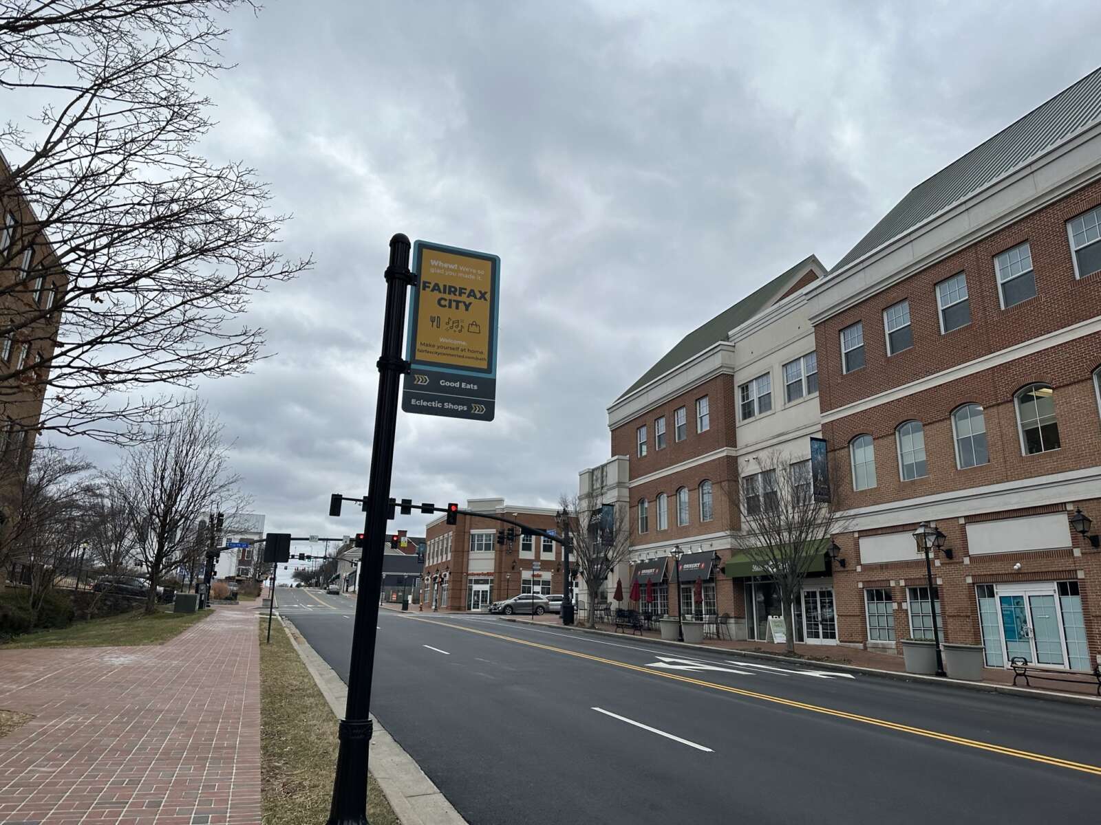
Fairfax City is starting to refine its plans to add bicycle facilities on University Drive.
The project will “implement bicycle facilities on University Drive between Layton Hall Drive and South Street, with shared lane markings through the center of Old Town and bicycle lanes to the north,” according to the city’s website.
It will serve as a link to other multimodal projects currently underway in the area, such as the partially built George Snyder Trail, Chloe Ritter, the city’s multimodal transportation planner, told the Fairfax City Council at a meeting on Oct. 24.
“It connects to the bike lanes that are already existing on University Drive, south of Old Town. It connects to The Flats — the apartments that recently opened,” Ritter explained. “It really brings together a lot of the multimodal projects that we’ve been working on in connecting everything together.”
In addition to the bicycle facilities, the city hired consulting firm Kimley-Horn to evaluate possible changes to the University Drive and Layton Hall Drive intersection.
“The measures of evaluation that we looked at were bicycle and pedestrian safety, vehicle safety traffic operations, transit operations, property impacts implementation, and cost,” Megan Waring, a transportation engineer for the consultant, said at the council meeting.
She said ultimately, the firm recommends a two-way stop and a removal of the northbound, right-turn lane at the intersection, which will be condensed. Waring said that change allows for a pedestrian island that will improve safety.
“It allows us to have bike lanes as we’re coming up and down University, as we have kind of that steep incline or decline, depending on which way you’re traveling,” she said.
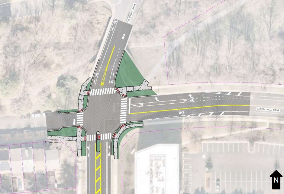
Tightening the intersection would also enable it to accommodate an added crosswalk, giving it a total of four. The crosswalks will also be closer to the intersection.
“So, we’re moving the people, the bikes, and the cars all to a location that’s more centralized, so that all users are able to see each other and make safe passage through the intersection itself,” Waring said.
The recommendations also call for adding a median refuge island, a protected space in the center of the street that facilitates bicycle and pedestrian crossings.
Waring said, together, the recommendations would reduce bicycle and vehicle conflicts, improve pedestrian crossings and maintain transit and vehicle operations. Read More
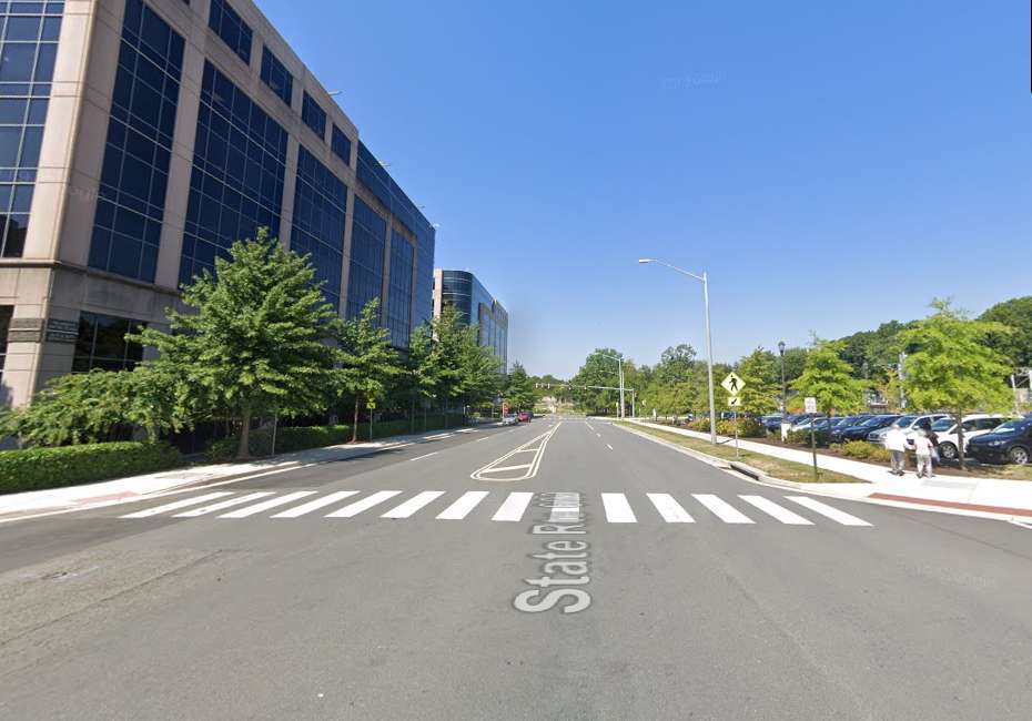
Fairfax County is designing a new layout for Prosperity Avenue near the Dunn Loring Metro station.
The new configuration will reduce the roadway from four to two lanes by adding a road diet and protected bicycle lanes between Gallows Road and Prosperity Metro Plaza, the two-building office center whose tenants include U.S. Customs and Immigration Services’ D.C. field office.
The project will also convert existing on-street bicycle lanes that start to the west and continue until Hilltop Road into protected bike lanes.
Design funding will come from the Metropolitan Washington Council of Governments (COG), whose Transportation Planning Board awarded $80,000 to the project last week as part of its Transit Within Reach program.
COG is “excited” about the county’s proposed improvements to Prosperity Avenue, which currently has a “very wide” design that “encourages drivers to speed and discourages people from walking and biking,” according to John Swanson, the principal transportation planner for the regional nonprofit.
The affected section of Prosperity Avenue has a 35 mph speed limit. A 19-year-old man from Chantilly was killed in a crash on the road last December, but that occurred to the south between Route 29 and Arlington Blvd.
“This part of Fairfax is undergoing a lot of change and the county is really committed to making the Dunn Loring station the center of a vibrant, walkable community,” Swanson said. “…This kind of project will make a real difference at the local level and will serve as a model for the region.”
The idea for the Prosperity Avenue safety project emerged out of discussions that started in April between representatives of businesses along the roadway and Providence District Supervisor Dalia Palchik’s office.
Since then, the district office has been working with county and state transportation staff to develop their proposal.
“I am delighted to see that this project design was approved for funding!” Palchik said in a statement. “After hearing from local businesses about safety concerns for their staff and visitors, my office worked diligently with FCDOT and VDOT on a proposal for a road diet for Prosperity Avenue. This design work will help improve safety for our pedestrians, especially for staff and community members visiting the USCIS offices or attending naturalization ceremonies.”
The Transit Within Reach funds will cover the project design up to 30% completion, according to the Fairfax County Department of Transportation. That will encompass the bicycle lanes from west of the Metro station to Hilltop Avenue, which is expected to be completed around the end of 2024.
The COG funding will also give the county an estimate for how much it’ll cost to implement the project.
“Once complete, FCDOT will identify funding to complete the design and construct the project,” a department spokesperson said.
Launched in 2021, the Transit Within Reach program provides consulting services for the design and preliminary engineering of “small, high-impact bicycle and pedestrian projects,” per COG.
The Transportation Planning Board approved a total of $250,000 in funding from the program at its meeting last Wednesday (Oct. 18). The other projects were a shared-use path in Gaithersburg and a sidewalk in D.C.
FCDOT is also working on a separate study to identify potential improvements on Gallows Road. Staff told community members at a meeting last month that traffic congestion, crashes, a lack of sidewalks and general pedestrian, bicycle and transit safety are all issues on the 7-mile corridor, Annandale Today reported.
While that study won’t assess or make recommendations for Prosperity Avenue, it could “be informed” by the road diet and bicycle lanes project, according to FCDOT.
Image via Google Maps
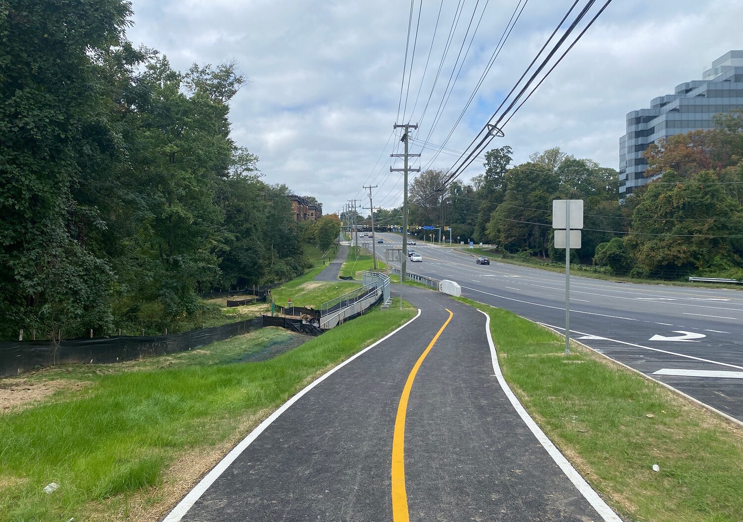
A ditch will no longer force pedestrians and bicyclists to ditch the shared path along Route 29 in Merrifield.
Construction has been substantially completed on a new, unbroken shared-use path spanning about one-third of a mile between Vaden Drive and Nutley Street, the Virginia Department of Transportation announced on Friday (Oct. 6).
The path replaces an asphalt sidewalk that abruptly ended at an Accotink Creek tributary that runs under the roadway. In addition to filling in some missing segments, the project added a central yellow line to the new trail and extended a box culvert over the tributary to support it.
In the works since spring 2019, construction on the improvements began in November 2022. The project cost an estimated $3.8 million, funded by local dollars and a concession fee that the I-66 Express Lanes operator agreed to provide as part of the Outside the Beltway toll lanes extension.
“Construction on the project…is now substantially complete, with minor work occurring in the coming weeks until final completion with minimal impacts,” VDOT said.
#Merrifield area bicyclists & pedestrians – enjoy your new shared-use path along NB Rt 29 from Vaden Dr to Nutley St! This project constructed missing path segments and extended a culvert to carry the new path over an Accotink Creek tributary. 🚴🚶
More: https://t.co/YXq3jlHWhL pic.twitter.com/PeK2t2vq6c
— VDOT Northern VA (@VaDOTNOVA) October 6, 2023
While the new path isn’t especially long, it provides a crucial connection for pedestrians and cyclists to the nearby Vienna Metro station and other area sidewalks and trails, including ones in Towers Park, VDOT says.
However, that accessibility still ends at Nutley Street, since the south side of Route 29 has no sidewalk east of the intersection.
As part of a plan to redevelop the Pan Am Shopping Center, Fairfax County staff recommend implementing “continuous bicycle and pedestrian facilities along Route 29” in the future. The existing Bicycle Master Plan doesn’t show any trail on the south side and indicates that “further analysis and outreach is needed to determine the best fit for bicycle facilities along this roadway,” according to the amendment approved by the Board of Supervisors on Sept. 12.
Developer Federal Realty, which owns the shopping center, has proposed adding a 10-foot-wide shared-use path along Nutley Street with the redevelopment. To the north, VDOT is working to complete its I-66 shared-use trail, which opened a first segment in May that included a tunnel under Nutley.
As of Aug. 9, most remaining sections were slated to open this October, according to VDOT’s project website. That excludes a segment through the Route 50 interchange that’s not projected to open until spring 2024.

