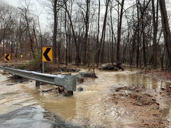
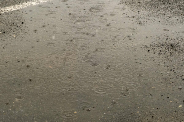
Email signup
Fairfax County is under a Flash Flood Watch area for Oct. 25, 2021 (via Fairfax Alerts)

The National Weather Service has issued a Flash Flood Watch for much of the D.C. area, including Fairfax County.

In effect until 2 a.m. tomorrow (Tuesday), the alert says showers and thunderstorms could bring up to 4 inches of rain in some areas, potentially leading to rapidly rising stream and creek waters.

The full alert is below:

…FLASH FLOOD WATCH IN EFFECT UNTIL 2 AM EDT TUESDAY…

The National Weather Service in Sterling Virginia has issued a

* Flash Flood Watch for portions of DC, Maryland and northern Virginia, including the following areas: in DC, District of Columbia. In Maryland, Anne Arundel, Central and Southeast Howard, Central and Southeast Montgomery, Prince Georges and Southern Baltimore. In northern Virginia, Arlington/Falls Church/Alexandria and Fairfax.

* Until 2 AM EDT Tuesday.

* Showers and thunderstorms are expected to produce 1 to 2 inches of rain through this evening, with localized amounts of up to 4 inches possible. Heavy rain in a short amount of time may result in rapid rises of water on small creeks and streams and in urban areas.

PRECAUTIONARY/PREPAREDNESS ACTIONS…

You should monitor later forecasts and be prepared to take action should Flash Flood Warnings be issued.

A Severe Thunderstorm Warning is also in effect for Reston and Herndon until 6:30 p.m., with the NWS warning of 60 mile-per-hour wind gusts that could produce power outages and downed trees.

“At 544 PM EDT, severe thunderstorms were located along a line extending from South Riding to Herndon to Wolf Trap, moving northeast at 50 mph,” the agency said.

0 Comments

Updated at 3:30 p.m. — The National Weather Service has now issued an Areal Flood Warning until 9:30 p.m. for central Fairfax County, with Reston, Vienna, Falls Church, Annandale, and Springfield among the locations that could experience flooding. Between 1 and 1.5 inches of rain have already fallen with an additional 1 to 2 inches possible.

Earlier: After a couple of relatively dry weeks, the weather in Fairfax County is about to take a turn for the rainy today (Thursday).

The National Weather Service issued a Flash Flood Watch for the D.C. area at 2:44 p.m. Set to remain in effect until 9 p.m., the alert warns that showers and thunderstorms could produce up to two inches of rain per hour, potentially leading to floods in some areas.

Here is the full alert:

…FLASH FLOOD WATCH IN EFFECT UNTIL 9 PM EDT THIS EVENING…

The National Weather Service in Sterling Virginia has issued a

* Flash Flood Watch for portions of DC, Maryland and northern Virginia, including the following areas: in DC, District of Columbia. In Maryland, Anne Arundel, Carroll, Central and Southeast Howard, Central and Southeast Montgomery, Frederick MD, Northern Baltimore, Northwest Harford, Northwest Howard, Northwest Montgomery, Prince Georges, Southeast Harford and Southern Baltimore. In northern Virginia, Arlington/Falls Church/Alexandria, Eastern Loudoun, Fairfax, Prince William/Manassas/Manassas Park and Western Loudoun.

* Until 9 PM EDT this evening.

* Slow moving showers and thunderstorms will produce very heavy rainfall, potentially leading to areas of flash flooding. Rainfall rates may reach two inches per hour.

The NWS advises residents to monitor weather forecasts later in the day and prepare to take action if the watch escalates into a Flash Flood Warning.

0 Comments
×

Subscribe to our mailing list