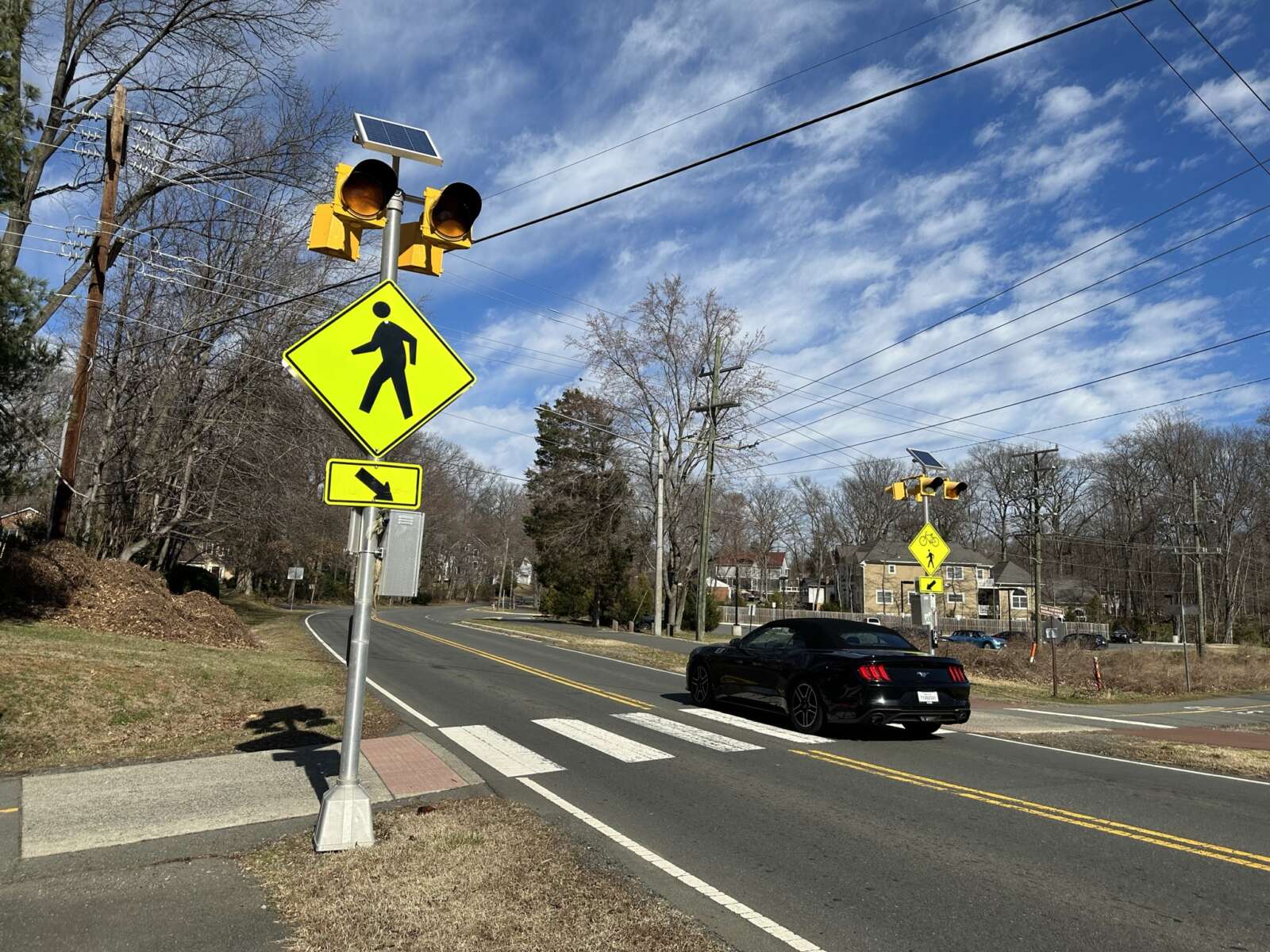
A new ordinance being considered by the Board of Supervisors could require drivers to be more careful around pedestrians.
The new ordinance aligns Fairfax County with a 2023 Code of Virginia change requiring drivers to stop — rather than yield — for pedestrians crossing in the driver’s lane, in an adjacent lane, or approaching the driver’s lane.
The change would require changing signage around the County with an estimated $95,000 bill.
At a Board of Supervisors meeting yesterday, Acting Fairfax County Department of Transportation Director Gregg Steverson said while the policy is enforceable by police County-wide, failing to stop for pedestrians can only have additional fines at intersections with the sign.
Board of Supervisors Chair Jeff McKay said the County will need to work to ensure information gets out about the change.
“It’s complicated for people to understand and complicated for our police to do enforcement,” McKay said. “This is a good thing; it’s an additional tool in our toolbox to prevent pedestrian fatalities and raise awareness about pedestrian laws, but at the same time, it’s going to be a hard one to communicate.”
Supervisor James Walkinshaw said the change sounds relatively simple, but involved extensive behind-the-scenes bureaucratic back and forth over what authority Fairfax County did or didn’t have.
“[We] had many meetings to get this issue resolved,” Walkinshaw said. “It’s more complicated than it sounds when you dig into it, but I’m excited to see us moving forward.”
The ordinance change is scheduled for a public hearing on May 7.
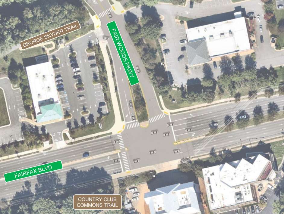
The Fairfax City Council recently approved several bicycle network enhancements along Fair Woods Parkway, its first project since adopting a bicycle master plan in 2021.
The unanimous adoption of the resolution gave city staff the go-ahead to engage engineering consultants to design the bike routes.
The final concept adds curb extensions at four intersections, including Cardinal Road, Cavalry, Scout and Blue Coat Drive, to help slow down cars and make it safer for people to walk. Improvements initially planned for Continental Lane were removed from the project after nearby residents raised concerns.
Staff are also considering adding crosswalks throughout the corridor and a shared-use path for biking and walking on one side of Fair Woods Parkway between Fairfax Blvd and the George Snyder Trail.
The city initiated its project to turn Fair Woods Parkway into a “neighborway” almost two years ago. The process included several rounds of community feedback through various surveys and public meetings.
Previously known as Plantation Parkway, Fair Woods Parkway was chosen for the first neighborway — a low-volume street designed to serve as a safe bicycle route — because of the area’s access to various local destinations and bike paths, Fairfax City Multimodal Transportation Planner Chloe Ritter told the city council during its March 26 meeting.
She noted it also addresses resident requests for improved traffic conditions and better bicycle infrastructure.
“We feel that this proposal provides a number of benefits, including shortening pedestrian crossing distances,” Ritter said. “It improves the visibility for drivers…removes uncontrolled pedestrian crossings and the requirement for vehicles to stop when the signal is green.”
The city’s bicycle master plan designates approximately 20 miles of neighborhood streets as “neighborways.”

While city staff are designing the neighborway, the public will have an opportunity to give their input about halfway through the design phase, per Ritter.
The project’s funding comes from a U.S. Department of Transportation grant via the Regional Surface Transportation Program. This program allocates funds to states and local governments for various public transportation projects, including pedestrian and bicycle infrastructure.
Almost all council members fully endorsed the project — with a few words of caution.
Councilmember Thomas Ross called it a significant move towards “humanizing the transportation network.” However, he also urged staff to evaluate the project’s effectiveness upon completion.
“I would also encourage perhaps a focus group or a discussion group with the community and in a year and a half, two years, whenever it seems appropriate to say, ‘What’s your reaction to this? Is it working? Is it making it safer for people to walk and get around? Is it safer to get in and out of the neighborhood?'” Ross said.
Councilmember Jon Stehle suggested that staff consult with the local police department about incorporating safety-promoting technologies, such as blue light stations, into the design.
“We talked previously about ‘fix-a-flat’ opportunities at certain locations in different areas along bike trails, etcetera,” he said. “There has to be some technology out there that’s up and coming or someone who’s looked at this in a different way that we should at least have the conversation about.”
The city’s webpage for the project says engineering and construction work could tentatively start later this year.
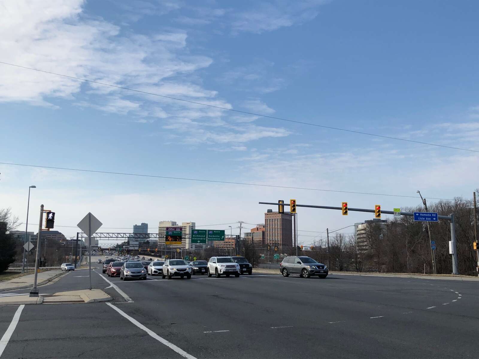
The Northern Virginia Transportation Authority (NVTA) is seeking public input on several projects vying for inclusion in its six-year funding program.
The biggest request by far comes from Fairfax County, which applied for $587.2 million to fund four major projects — more than the other eight localities participating in the fiscal year 2024-2029 Six-Year Program combined.
“With funding requests totaling nearly $1 billion, the projects cover various transportation modes including transit, rail, roadway enhancements, technology, bicycle and pedestrian infrastructure, and intersection/interchange improvements,” the NVTA said in a press release.
Leading the way among Fairfax County’s requests is a multimodal improvements project that would expand about one mile of Route 7 (Leesburg Pike) between the Capital Beltway (I-495) and I-66 in the Pimmit Hills area.
Adding one lane in each direction, the project is intended to make room for the planned Route 7 bus rapid transit (BRT) system, which will initially travel between the Spring Hill Metro station in Tysons and the West Falls Church Metro station. Ultimately, regional and local officials hope to extend the service down to the Mark Center in Alexandria.
In the Pimmit Hills portion of Route 7, the buses will travel in dedicated lanes in the median. Shared-use paths on both sides of the road and improvements at five signalized intersections would also be implemented, according to NVTA’s description of the project.
“The separation of vehicular traffic and the installation of shared use paths will create a safer environment that is accessible to all users,” NVTA says. “The future implementation of BRT will enhance regional sustainability by reducing congestion and getting more people out of automobiles.”
The county is seeking $210 million in regional funding from NVTA for the project, which carries a total estimated cost of $244.4 million.
Other projects submitted by Fairfax County include:
- Frontier Drive Extension (nearly $165 million requested): The road would be extended from the Franconia-Springfield Metro station to Loisdale Road, accompanied by new, separated pedestrian and bicycle facilities.
- Seven Corners Ring Road ($122 million): The first segment of the planned road would add “travel lanes, a bi-directional cycletrack, and parking lanes” from the westbound Arlington Blvd (Route 50) ramp to Leesburg Pike (Route 7).
- Braddock Road Multimodal Improvements ($90 million): The second phase of the project calls for shared-use paths, High-Intensity Activated crosswalk beacons, trail connections and other intersection improvements from Humphries Drive to Southampton Drive near Kings Park.
In addition, the Virginia Railway Express (VRE) has asked for $6.1 million to upgrade its Backlick Road station (6900 Hechinger Drive) in Springfield, including by building a longer, 300-foot platform that can fit eight-car trains.
Updated every two years, NVTA’s six-year programs are supported by sales and grantors’ taxes, the state’s Northern Virginia Transportation District Fund and the Interstate Operations and Enhancement Program. The authority is required to devote 70% of its revenue to regional projects, while the remaining 30% goes directly to its localities.
Public comments on the FY 2024-2029 program are being accepted online, by phone (703-947-7606) and by mail until 11:59 p.m. on May 19. A public hearing will be held at NVTA’s offices (2600 Park Tower Drive, Suite 601, Vienna) at 7 p.m. on May 9.
The Town of Herndon is working on the development of a roadway safety action plan that aligns its priorities with federal and state programs.
The action plan, which would run from this year through at least 2028, will use crash data to identify locations that need to be addressed and open up additional funding for transportation improvement projects.
“One of the challenges with the data is there is a lot of it,” Mike Shindledecker, a transportation engineer for Herndon, said at a town council work session on March 19.
He noted that comparisons to the Federal Highway Administration and Virginia Department of Transportation programs should take into account that the Town of Herndon lacks freeways and highways. Its highest speed limit is 35 mph, significantly lower than that of the state.
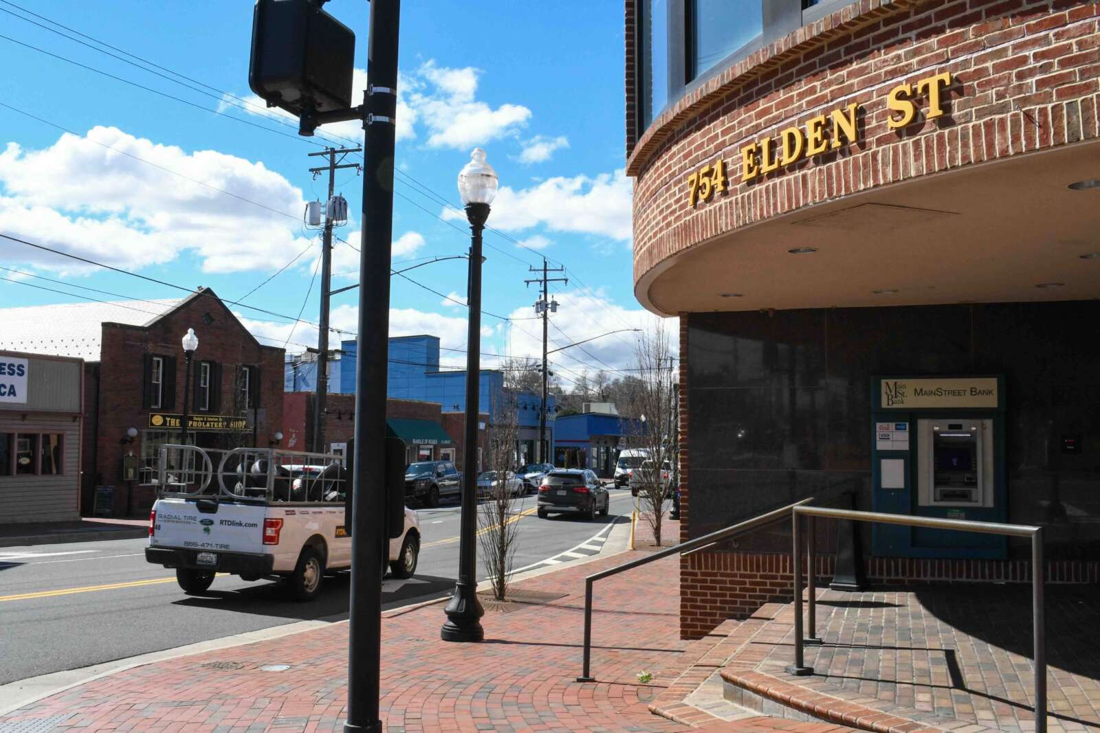
Problematic hotspots in the town include Elden Street, pinpoints along Herndon Parkway and gateway intersections, he told the council.
Shindledecker also noted that the town’s fatality rate is “trending far better than other similar jurisdictions and far better than the state as a whole.”
A five-year comparison shows that the town had more crashes between 2018 and 2022 that resulted in serious injuries and non-visible injuries than other small towns and cities in Virginia and the state as a whole. Serious injuries stand at 8% compared to the statewide average of 5% and the 3% average in towns of similar sizes.
In Herndon, 53% of crashes led to non-visible injuries compared to 19% in towns of comparable size and 8% in the state.
However, crashes that only involve property damage were lower (34%) than in other towns (60%) and the state (67%). Crashes involving injuries were also relatively lower — 5% compared with 18% in other small towns and 19% in the state.
The roadway safety plan will be developed with community input and identify key corridors for focused study. Once problem areas are identified, the town will develop new “technology-driven solutions,” according to the town staff presentation.
The plan will help the town establish a planning structure for transportation projects and safety analyses while also emphasizing engagement and collaboration, equity and transparency.
The action plan will be completed in 2026, followed by an implementation plan in 2027.
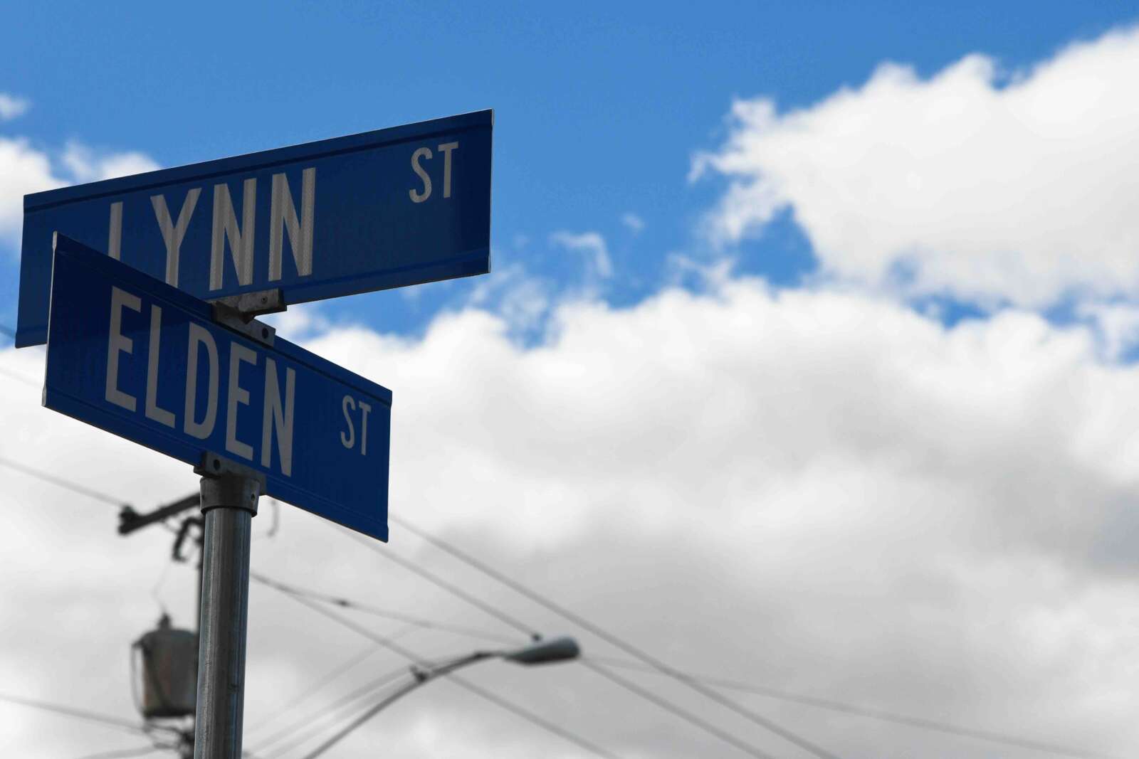
(Updated at 9:40 a.m. on 3/26/2024) A federal funding boost is coming to help improve pedestrian and bicycle facilities on the Town of Herndon’s main through street and more than a dozen other sites around Northern Virginia.
At its meeting last Thursday (March 21), the National Capital Region Transportation Planning Board (TPB) approved $19.5 million through the federal Transportation Alternatives Set-Aside Program for 15 non-highway transportation projects in the state.
Five of the projects to receive funds are in Fairfax County or its towns, led by $2.5 million for a plan to improve the safety, accessibility and walkability of Elden Street.
According to a Town of Herndon presentation, the project includes new ADA ramps and crosswalks, a widened sidewalk that moves around existing barriers, and a grass buffer. Spanning 0.3 miles between Center Street and Ferndale Avenue, the improvements will be in close proximity to the Washington & Old Dominion Trail, Herndon Middle School and St. Joseph’s School.
Over in the Town of Vienna, the Locust Street Trail project will get $1.3 million to facilitate the replacement of an existing sidewalk within a 10-foot-wide shared-use path. The project will also address drainage issues that “frequently make the existing path unusable for extended periods,” per a news release from the TPB.
The funding approved for Fairfax County will go to three different Safe Routes to Schools projects, including $140,000 for Shrevewood Elementary School in Idylwood. Developed in response to a fatal crash in 2019, the project will add three new crosswalks with a sidewalk or a shared use path connection.
“In addition to making it safer to walk or bike to school, this project will expand safe access for kids to the W&OD Trail, a key link in the National Capital Trail Network,” the TPB’s summary said.
The project has received another $1 million through other Transporation Alternatives Set-Aside funding, fulfilling the county’s full request, according to the board.
A Safe Routes to Schools program for Lake Braddock Elementary School in Annandale got around $356,000 to improve pedestrian safety and connectivity across the road and school entrance. It includes ADA ramps, new crosswalks and new pedestrian refuge islands.
More broadly, the school system’s overall SRTS program will get $276,000 to educate students on safe walking and bicycling.
“The project will develop maps with suggested safe routes, safety education, bike rodeos, walk and bike to school days, monthly challenges with rewards, build a bike give a bike programs, and the development of park and walk programs for students who live beyond the walking zone,” the press release said.
Two projects in Fairfax City also got funding from the Federal Highway Administration program:
Fern Street Neighborhood Connection, City of Fairfax: $285,119
Utilizing city property, this project will connect commercial and residential areas lacking a paved ADA-accessible pathway. The project prioritizes bikes and pedestrians by building a trail instead of a road extension and supports small area plan recommendations by initiating a pedestrian priority corridor and providing links to potential mixed-use redevelopments.
Chain Bridge Road Shared Use Path, City of Fairfax: $2,098,314
This project will provide a safer and higher quality bike and pedestrian facility along Chain Bridge Road, a busy arterial that feeds into I-66. The project will build a shared-use path between existing trails, including a connection to the National Capital Trail Network’s Custis/I-66 Trail. The project serves an Equity Emphasis area.
The total amount of approved funding from the Transportation Alternatives set-aside program has been corrected from $195 million to $19.5 million.

Commuters who use Route 29 in the Fairfax Corner area harbor concerns about poor pedestrian and bicycle infrastructure, safety and traffic congestion, the results from a recent Route 29 survey suggest.
The Fairfax Department of Transportation conducted the survey from Feb. 12 to March 1 as part of an ongoing effort to make the 2.9-mile stretch between Buckleys Gate Drive and Jermantown Road more pedestrian and cyclist-friendly.
Nearly 400 people responded to the survey, about half of them saying they commute along the corridor regularly for errands, work or school. Three-quarters of those respondents drive, seven bike, two carpool, one walks, and 64 use various modes of travel.
While many respondents were content with the current state of the corridor, a majority expressed a desire for wider sidewalks and bicycle lanes, along with greater separation for those facilities from the road. The survey also identified frustrations with the roadway’s short turn lanes, which some said create long left-turn delays.

During a virtual public meeting last Tuesday (March 12), FCDOT’s Arpita Chatterjee said the newly unveiled survey findings support the department’s plans to shift away from interchanges, road widenings, and other auto-focused improvements and “explore ways to increase walking and biking along the corridor.”
“The easiest way to describe Route 29 through this corridor is kind of a mess,” Braddock District Supervisor James Walkinshaw said at the meeting. “And this study is our opportunity to develop a much better vision for this stretch of Route 29.”
Almost 20 people who attended the virtual meeting, but just one person spoke. Their comments centered on safety at the Jermantown Road intersection, and they recommended improving sidewalk lighting.
Though staff won’t present its final recommendations until summer 2024, Chatterjee said FCDOT plans to implement mitigation measures for intersections experiencing significant congestion, including Waples Mill and Shirley Gate Road.
“Overall intersection delays were over 100 seconds and side streets delays are even higher,” Chatterjee said. “But that said, we will investigate what mitigation would be possible to get the intersection of Waples Mill and Shirley Gate roads to operate more efficiently, similar or at least close to Legato Road and Monument Drive.”
The online survey will stay open until March 29, and participants can leave a recorded voicemail at 703-890-5898 using the code 3941.
There will be a second virtual meeting in the early part of this summer before staff present their final recommendations to the Board of Supervisors.
(Updated at 3:35 p.m.) Congress has passed another short-term budget package, averting a partial shutdown of the federal government just hours before a midnight deadline.
In addition to funding the Justice Department, Housing and Urban Development, and other key agencies, the slate of bills passed 75-22 by the Senate on Friday (March 8) includes $12.7 billion in “pork” — money designated for local projects requested by lawmakers for their constituents.
In a joint press release, Sens. Tim Kaine and Mark Warner announced that Fairfax County and other Virginia localities will be among the beneficiaries of the more than 6,600 projects that got funding, per the Associated Press.
“I’m proud that we secured funding for 105 community projects across Virginia that will improve transportation, upgrade water infrastructure, support health care, and more,” Kaine said. “I urge Congress to take up the rest of the government funding bills as soon as possible.”
According to breakdowns provided by Warner’s and Rep. Gerry Connolly’s offices, the biggest allocation for Fairfax County is $4.1 million “to fund a new homeless and domestic violence shelter for families.”
The county’s existing domestic violence and family shelters have exceeded their useful lives, but instead of building new facilities, the Fairfax County Redevelopment and Housing Authority is planning to convert an existing “extended stay” hotel that will be able to house about 50 families a day.
“Site acquisition activities are ongoing, with the goal of securing a location that is well-served by transit, and close to jobs and services,” FCRHA spokesperson Allyson Pearce said.
Connolly’s office says the site “will entail combining rooms, creating service and office space, and other changes to the existing hotel setup,” noting that converting an existing building instead of constructing a new one will enable the county “to deliver this essential, brand new facility years earlier than might otherwise be accomplished.”
The county has two shelters specifically for people fleeing domestic violence — Artemis House and Bethany House — and two shelters that accommodate people with children — the Katherine Hanley shelter outside Centreville and the Patrick Henry shelter in Seven Corners.
The Fairfax County Board of Supervisors approved plans in August 2022 to replace the Patrick Henry shelter with supportive housing after some delays related to land acquisition challenges.
The appropriations package also includes funding for several road and pedestrian projects:
- Spring Street widening from four to six lanes between Herndon Parkway and Fairfax County Parkway ($1 million)
- Fox Mill Road and Pinecrest Road intersection improvements in Herndon ($850,000)
- Silverbrook Road and Lorton Road intersection improvements ($850,000)
- Sidewalk on Ninian Avenue and along Bush Hill Drive to improve safety and accessibility for Bush Hill Elementary School students in Rose Hill ($850,000)
- Gunston Road shared-use path from Julia Taft Way to the Pohick Bay Golf Course entrance in Lorton ($500,000)
- Compton Road bicycle and pedestrian path from the Bull Run Special Events Center access road to the Cub Run Stream Valley Trail in Centreville ($500,000)
- Stone Road trail from the I-66 interchange to an existing trail along southbound Route 28 in Centreville ($500,000)
The Fairfax County Department of Transportation applied for federal grants last summer to fund the Bush Hill and Compton Road projects. Read More
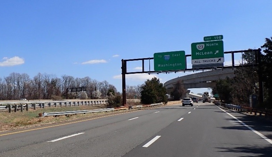
The Dulles Toll Road bridge that officially separates Tysons from McLean is in need of some major upkeep.
At a public meeting tomorrow (Thursday), the Virginia Department of Transportation will share its plans to rehabilitate the toll road’s eastbound lanes over Route 123 (Dolley Madison Blvd). The proposed project will replace the bridge’s concrete deck, parapets and steel beams.
Repairs to the piers and abutments are also planned.
“The project aims to improve safety, increase vertical clearance under the bridge and extend the overall life of the bridge,” VDOT said in a press release announcing the meeting, which will be held as a virtual webinar starting at 7 p.m.
Built in 1963, the Dulles Toll Road bridge was rehabilitated once before in 1995, according to VDOT. An average of 28,000 vehicles drive across it in a day.
VDOT currently estimates that the project will cost $12.6 million. The design phase, which is now underway, is funded by $1.3 million from the state. The source of the $11.3 million needed for construction is still being determined, but that phase isn’t expected to start until late 2025.
After the meeting, which will be recorded and posted on the project webpage, VDOT will accept public feedback on the rehabilitation online, by email (meetingcomments@vdot.virginia.gov) and by mail to structural and bridge engineer Dipali Patel at its Northern Virginia office (4975 Alliance Drive).

The Fairfax County Department of Transportation is asking commuters for feedback on changes they would like to see along the Route 29 corridor.
The department recently launched a survey asking commuters how often they travel Route 29, the duration of their travel, and the mode of transportation they use.
The survey focuses on a 2.9-mile stretch of Route 29 near Fairfax City between Buckleys Gate Drive and Jermantown Road. The survey will help the county identify multi-modal solutions to support increased development in the area, according to Fairfax County Transportation Planning Section Chief Michael Garcia.
The county is seeking to shift away from the interchanges, road widenings and other auto-focused improvements currently recommended for the corridor.
“There have been development proposals in the corridor and trying to accommodate the Comprehensive Plan recommendations for interchanges may not be in harmony with how the area has developed and will continue to develop,” Garcia told FFXnow.
Instead, his team is working with Fairfax City and the Virginia Department of Transportation to study low-cost multi-modal solutions, such as bicycle and pedestrian upgrades, with the goal of preserving future mobility and accessibility in the corridor, as well as enhancing public spaces.
Garcia says the feedback collected from the survey will play a crucial role in shaping county staff’s recommendations for transportation improvements. Interested participants can fill out the survey online or leave a recorded message at 703-890-5898 (Project Code 3941) by Friday, March 1, 2024.
FCDOT will present the results at a virtual public meeting on Tuesday, March 12, at 7 p.m., per the study website.
Garcia noted that FCDOT’s study of this Route 29 section is “timely,” since the county is in the process of updating its plan for the Fairfax Center area, which spans about 5,500 acres between Centreville and Fairfax City bounded by Route 50 and 29.
As authorized by the Board of Supervisors last year, the county’s Department of Planning and Development is currently reevaluating its vision for the “core area” that includes Fair Oaks Mall and the Fairfax County Government Center.
Building on past reviews of the area-wide and low-density residential neighborhood goals, this third phase of the planning study will include a transportation analysis and consideration of additional housing on the Reserve at Fairfax Corner Apartments site. The property owner, Equity Residential, has requested more density at 11727 Fairfax Woods Way for a 405-unit residential building “to complement” the existing apartments.

Fairfax County is continuing talks on a proposal that could allow some residents to better access their homes in areas with certain traffic restrictions.
Cut-through mitigation restrictions prohibit turns into neighborhoods from major transit corridors during rush hour. While the restrictions aim to prevent local roads from getting jammed by drivers trying to evade traffic, it can make it challenging for residents to legally access their homes on those streets.
The Fairfax County Department of Transportation is proposing a residential cut-through permit zone that would exempt residents in affected neighborhoods from the restrictions by providing permits for their vehicle. Signs that restrict turns would be changed to say “resident permit required.”
After first proposing the permit program in early 2023, FCDOT presented an update to the Fairfax County Board of Supervisors at a transportation committee meeting on Tuesday (Feb. 15).
Currently, the county is considering introducing the program in three areas with existing cut-through restrictions.
- Carolyn Drive and Nicholson Street in Lake Barcroft
- Oxford Street and Downing Street in Annandale
- Thomas Avenue in Great Falls
“There are approximately 350 addresses that are impacted, and that could initially seek impairments if this program were implemented,” county transportation planner Henri Stein McCartney said.
Another seven communities are in the process of implementing cut-through restrictions.
“If all seven projects were implemented, we would expect to have approximately 1,300 addresses county-wide that could participate in the program,” McCartney said.
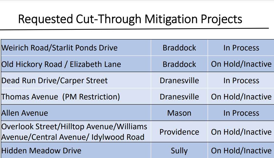
In January, the Board of Supervisors directed FCDOT to work with the Department of Tax Administration on revenue collection options for the program.
“In those conversations, tax administration recommended that we speak with the vendor that they currently have under contract for the county’s parking enforcement software,” McCartney said. “We are very early in our conversations with this vendor.”
FCDOT will return to the committee in June with additional information on using the vendor, she added.
The department is proposing a $25 permit fee for residents participating in the program. If the permits are implemented for all of the areas that have or are currently considering cut-through traffic restrictions, the county could collect an estimated $33,000 to $99,000 in gross revenue.
Chairman Jeff McKay questioned how the program would be enforced, saying it could put law enforcement in “awkward positions.”
“I don’t think we want our police checking every car that comes down the street during a certain period of time to verify residency,” he said. “I mean, to me…there’s a whole lot of problems with that.”
In its presentation, FCDOT noted that some neighboring jurisdictions, including Fairfax City, Vienna and Alexandria, have turn restrictions but don’t require permits for residents to legally access local roads. The only jurisdiction that does offer residents permits to get around turn restrictions is Falls Church City.
“Why did they decide to not offer permits and then how do they do enforcement? Because to me, that’s a really critical question here,” McKay said.
An officer with the Fairfax County Police Department conceded “it would probably be difficult to enforce,” adding that he couldn’t speak to what other localities are doing.
Hunter Mill District Supervisor Walter Alcorn asked county staff to look into automated enforcement as an option.
McCartney said she was unaware of any other jurisdictions currently using automated enforcement, but the vendor they’re working with offers it.

