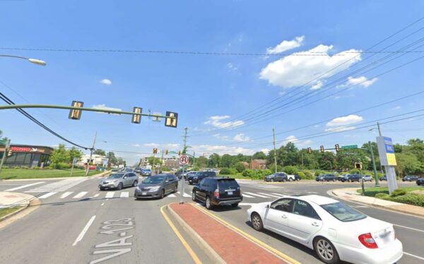
At a Vienna Town Council meeting this week it was revealed that, with any luck, work could start on overhauling one of the town’s most dangerous intersections before the year’s end.
The Vienna Town Council voted unanimously on Monday, Aug. 28, to approve construction services and management for improvements to the intersection of Maple Avenue and Nutley Street.
The Nutley Street intersection was one of three along Maple Avenue identified as a crash hotspot in Vienna.
According to the town’s website, plans for the intersection include enhanced signal technology that will let the town adjust and improve traffic flow in real-time.
“The Town is turning to enhanced signal technology to ensure that the wheels on vehicles along Maple Avenue and Nutley Street keep going round and round,” the website said.
The tech upgrade for Vienna’s signals system is estimated to cost $2.1 million, with some funding coming from a VDOT SmartScale grant and $170,000 in proffered contributions from the 444 Maple Avenue W project.
“The $2.1 million in adaptive technological upgrades, scheduled to be completed in 2024, will allow the Town to better manage congestion and enhance system efficiency,” the website said.
Transportation Engineer Andrew Jinks said the hope is to start physical construction later this year.
“We’re very excited about this,” said Mayor Linda Colbert said. “This is a long time coming, we’ve been talking about this for a long time.”
Image via Google Maps
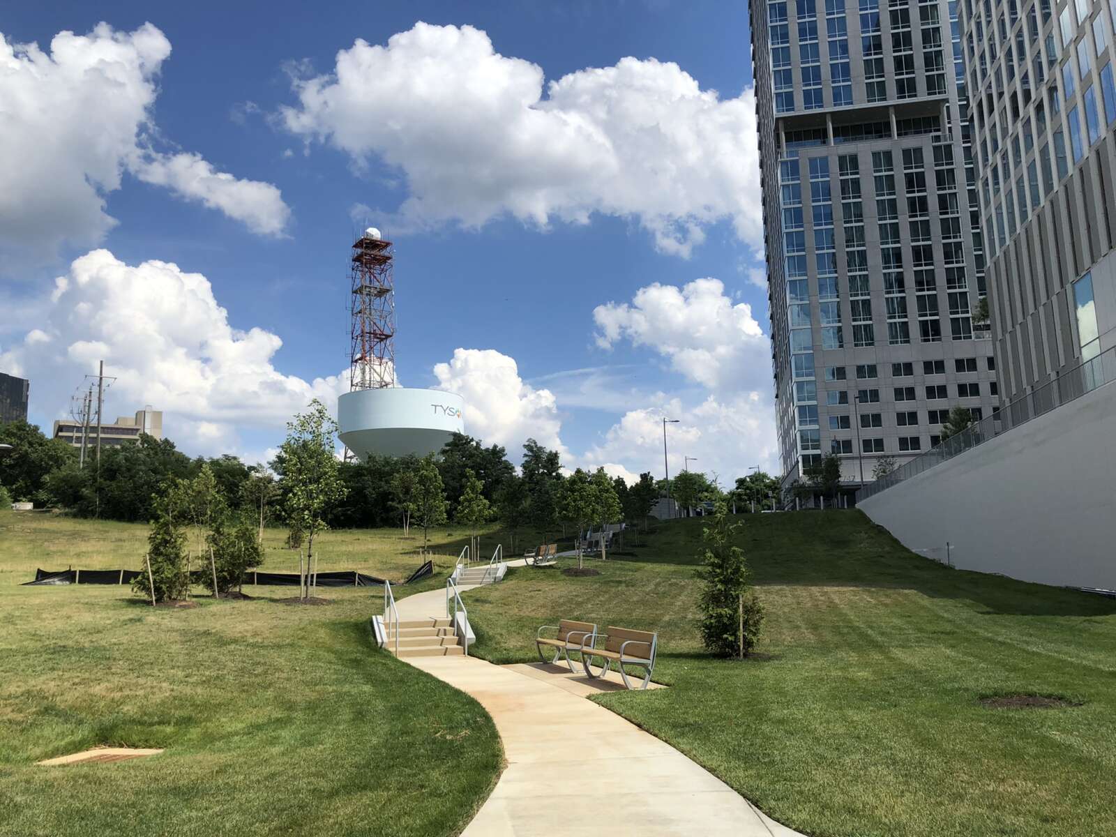
Tysons has seen some promising developments in its transportation network in recent years, but many obstacles remain to achieving Fairfax County’s vision of a truly accessible downtown, a market study released earlier this month suggests.
Commissioned by the Tysons Community Alliance, the 2023 Tysons Market Study characterizes the 2,100-acre urban center as “somewhat walkable” — meaning at least some errands can be accomplished on foot — based on its official average Walk Score of 57.
Calculated based on population density, the distance to amenities, block lengths and other factors, the walk score ticked up from the 54 that Tysons got in 2020 when the COVID-19 pandemic began. The area is more walkable than Reston, which has a score of 40, but it falls short of more urban areas in the region, including Crystal City in Arlington (71) and downtown D.C. (98), according to the study.
The most walkable properties are in central Tysons, particularly around the Greensboro Metro station, which is also where multifamily housing has concentrated, TCA CEO Katie Cristol notes.
“That increase in the walk score is a real validation…of how environmentally sustainable, how much better in terms of quality of life the new residential development has been in Tysons,” Cristol said. “It is in the right places, it is in places that are walkable, so more Tysonians live [in places] walkable to Metro and other amenities and can easily reach the necessities of their lives on foot than could before.”
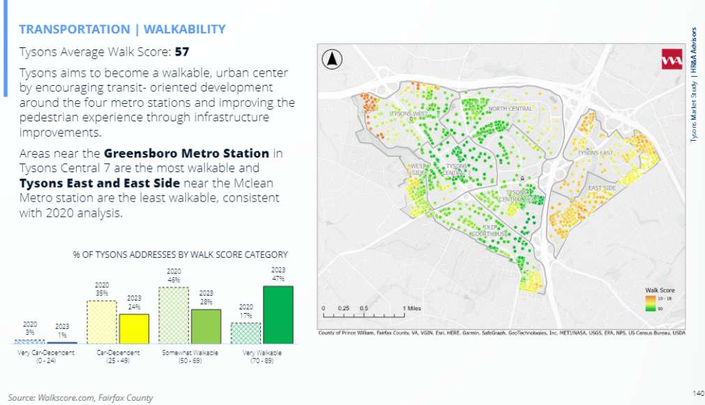
However, properties east of Route 123 — where most for-sale and single-family units are located — tend to be more car-dependent, per the study. Based on 2021 Census data, the percentage of car-free households in Tysons has jumped up to 5.1% — an over 50% increase from 2019 — but 47% of households still own two vehicles.
In addition, the TCA identified 4.6 miles of missing sidewalks, and most of the 24 miles of sidewalk that do exist are just 4 feet wide, which “is not ideal for a growing area seeking to promote walking,” the study says.
The improved Walk Score was also tempered by a lowered Bike Score, which dipped from 49 in 2020 to 43 this year. Categorized as “somewhat bikeable” with “minimal” infrastructure, Tysons trails Reston, which stayed flat at 54 over that time frame. Read More
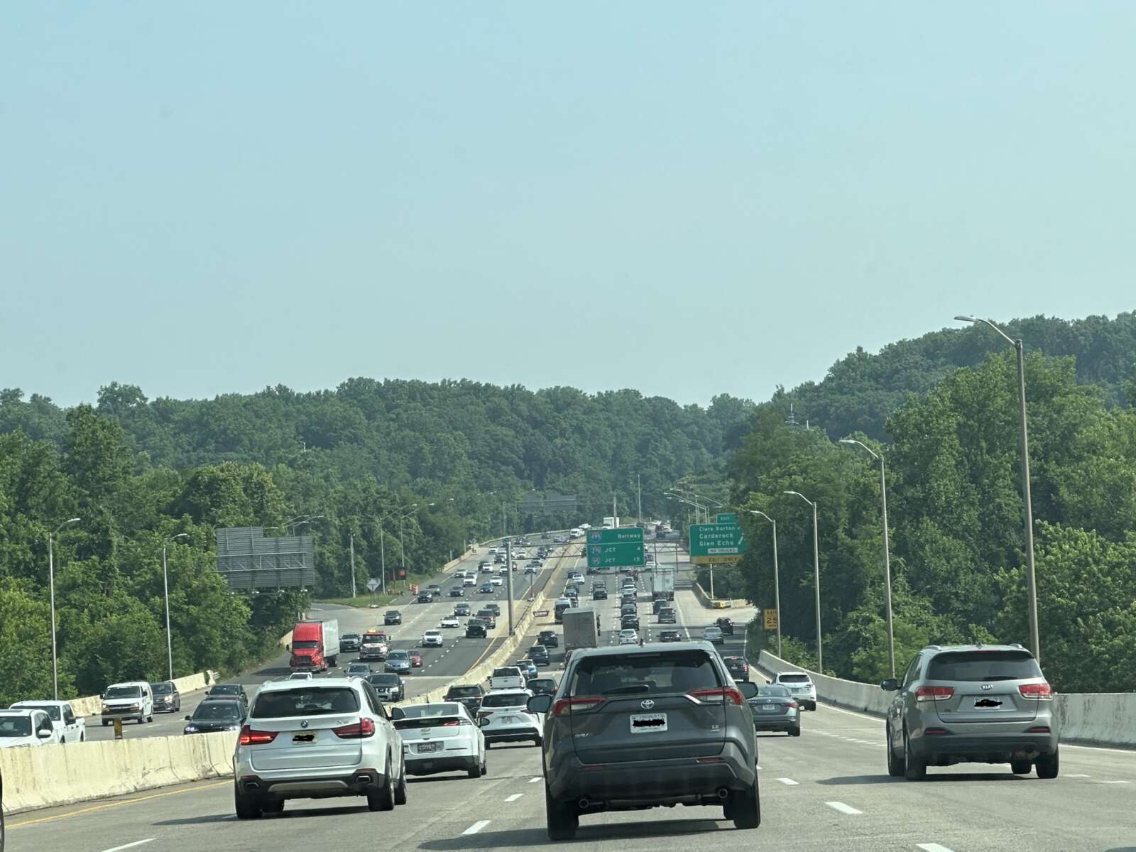
(Updated at 9:35 a.m. on 8/22/2023) Maryland has renewed its commitment to replacing the American Legion Bridge and adding express lanes on the Capital Beltway, much to the relief of Northern Virginia transportation officials.
The Maryland Department of Transportation has applied for a federal grant to fund the initial phase of its project to widen the Beltway (I-495/I-270) and reconstruct the aging bridge, which provides the only road connection between Fairfax County and Montgomery County, Maryland Gov. Wes Moore announced today (Monday).
The announcement is the first indication of how Maryland will proceed since private express lanes operator Transurban backed out in March over concerns about delayed environmental approvals, lawsuits and the change in leadership after Moore succeeded Larry Hogan in January.
Since Hogan and then-Virginia governor Ralph Northam announced an agreement in 2019 to replace the heavily used American Legion Bridge, Maryland’s cooperation has been seen as critical to the success of Virginia’s I-495 Northern Extension (495 NEXT) project, which is now under construction and will extend the Beltway’s toll lanes from the Dulles Toll Road in Tysons to the bridge north of McLean.
“Governor Moore’s plan ensures these long-awaited improvements will become a reality. This is great news for area travelers and the economic competitiveness of our entire region,” Northern Virginia Transportation Alliance President Jason Stanford said in a statement. “The Alliance applauds Governor Moore for finding a multimodal solution to address one of the region’s worst bottlenecks and move more people through one of our most congested corridors.”
The Virginia Department of Transportation has estimated that 495 NEXT will move 2,500 more people per hour in both directions when the express lanes open in 2025. However, it would move 5,400 more people an hour with Maryland’s project in place.
Skeptics of 495 NEXT, including Dranesville District Supervisor John Foust, have argued that widening I-495 in Virginia without a concurrent widening in Maryland will only push the existing congestion further north, leaving McLean residents to deal with the traffic, environmental and neighborhood impacts without getting any of the supposed benefits.
Noting that many details of Moore’s plan have yet to be shared, such as what kind of “managed lanes” will be involved, Foust called the announcement “great news” as a sign that Maryland is committed to helping address congestion on the American Legion Bridge.
However, assuming it secures the necessary approvals and funding, the Maryland project will still likely take years to complete, Foust said in a statement.
The estimate I have seen is that the project could be complete in eight years (by 2031) if all goes well. Unfortunately, that means commuters who cross the American Legion Bridge, and residents of the communities around the bridge, will continue to suffer from the impacts of severe congestion for at least that long unless something is done in the interim. Given the miserable traffic conditions around the bridge, eight years is too long to wait for any relief. That is why I believe VDOT needs to deliver interim solutions that mitigate the congestion impacts over the bridge and in the surrounding neighborhoods.
The 495 NEXT project was designed to seamlessly connect to a version of an American Legion Bridge project that we now know will not be built. In addition to very nasty congestion, established neighborhoods along the path of the 495 NEXT project are being severely impacted by construction activity. Given the dramatic change of plans and potentially major reduction of scope for the Maryland project, I believe VDOT should determine whether and by how much it can reduce the scope of disturbance of its project to help mitigate those construction-related impacts on the adjacent communities.
Shifting away from the public-private partnership that Hogan sought and that has built Virginia’s growing express lanes network, Moore emphasized in his announcement that Maryland’s project will incorporate transit and other multimodal improvements, including pedestrian and bicycle access. Read More
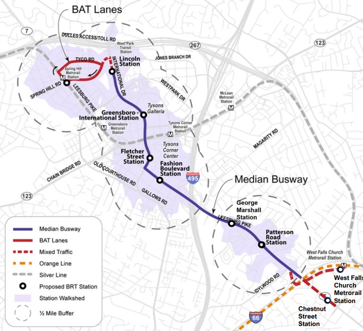
Whenever Route 7 (Leesburg Pike) gets widened, the new lanes from International Drive in Tysons down to the West Falls Church Metro station area will be reserved exclusively for a future bus rapid transit (BRT) system.
The Fairfax County Board of Supervisors approved a comprehensive plan amendment last Tuesday (July 25) incorporating the BRT into the county’s vision for Route 7 and International Drive, a move that enables county staff to pursue funding.
“I do think this is an important movement forward in this project,” Providence District Supervisor Dalia Palchik said after a public hearing.
The Tysons portion of the Route 7 BRT — which is intended to provide faster, more direct service than a traditional local bus route — is part of a regional system that the Northern Virginia Transportation Commission has been planning for a decade now. The finished route will extend into Falls Church City and Seven Corners, ending at the Mark Center in Alexandria.
For the initial Tysons phase, though, the Fairfax County Department of Transportation has settled on the West Falls Church Metro as the southern endpoint and the Spring Hill Metro station as the northern terminus.
Adhering to an alignment approved by the Board of Supervisors in 2021, the BRT will have nine stops:
- The West Falls Church Metro station
- Westbound Route 7 (Leesburg Pike) at Chestnut Street
- Patterson Road, near the Tysons Station and Idylwood Plaza shopping centers
- George C. Marshall Drive
- Fashion Blvd, serving Tysons Corner Center
- International Drive and Fletcher Street
- International and Greensboro Drive, next to Tysons Galleria
- International and Lincoln Circle, near the Rotunda Condominiums
- Spring Hill Metro station
Along with establishing the potential stations, the newly approved amendment designates two additional lanes planned for Route 7 from Haycock Road to International Drive as dedicated BRT lanes.
The comprehensive plan recommends expanding Leesburg Pike from four to six lanes between Haycock and the Capital Beltway (I-495) and from six to eight lanes between the Beltway and Route 123. Funds have already been secured to design the Beltway to Route 123 segment. Read More
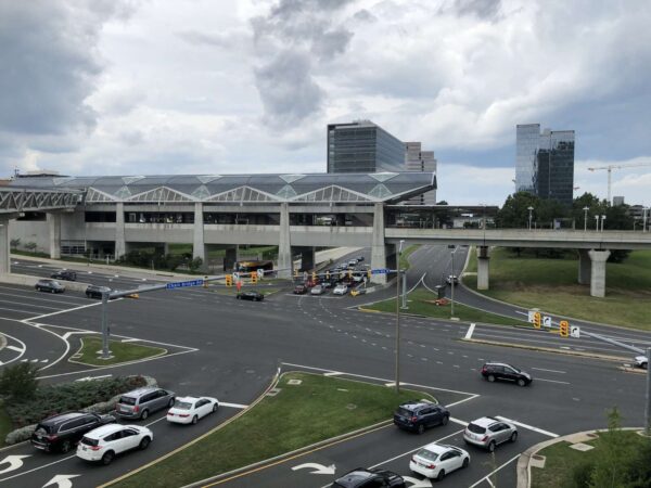
Local officials are in the midst of developing a data-driven way to prioritize and implement spot transportation improvements throughout Fairfax County.
The spot improvement screening program, which was discussed at a Fairfax County Board of Supervisors’ transportation committee meeting on July 18, lets the county identify priority locations for new transportation improvements, especially along intersections.
The program also intends to prioritize safety as a metric to evaluate transportation.
So far, the county has identified 287 projects as high priority out of a total of 3,966 reviewed locations. Roughly 46% of the spots already have a planned project nearby, according to the county.
The Dranesville District had the most spots, but the majority of them were categorized as “low priority.” The Franconia and Mason districts led the way in terms of high-priority spots.
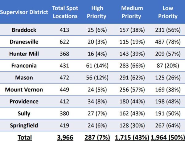
Underway since 2021, the county’s methodology prioritizes safety while also considering equity and the multimodal nature of the area, Fairfax County Department of Transportation staff said.
The county is in the midst of finalizing locations for each district. Evaluation and implementation is contingent on approval by the Board of Supervisors.
FCDOT staff recommend focusing on high priority locations and working with the Virginia Department of Transportation to strategize funding for projects. Staff also suggested further narrowing spots where there are no programmed safety-related projects.
If approved, the spot improvement program could get renewed every three to five years.
While the full list of possible spot improvements was not released at the meeting, Vanessa Holt from FCDOT’s traffic engineering section said that public input will be solicited on projects.
“Our program recommendations include focusing on the high priority spot locations,” Holt said.
At the meeting, supervisors asked staff to consider other elements in their evaluations. Hunter Mill District Supervisor Walter Alcorn suggested incorporating near-misses, camera data from VDOT, and other data points into the prioritization process.
“I really like the process, the drivers being data-driven,” Alcorn said.
The program, which is not yet funded, is different from the county’s active transportation program, which sets aside $100 million for improvements for pedestrians, bicyclists and other non-motorized travelers.
Board Chairman Jeff McKay also emphasized that not all traffic fatalities are linked to road safety issues.
“Unfortunately, we do have fatalities in some corridors of the county. It’s not a road design issue at all,” McKay said.
He also added that the proximity of other projects to prioritized spot improvement locations shouldn’t automatically downgrade a project from the list. Instead, the location may be a strategic area to kill two birds with the same stone.
Others like Springfield District Supervisor Pat Herrity noted that funding for these projects may not be available for several years, resulting in the need to manage public expectations about implementation.
Holt acknowledged that the public’s feedback is critical as the process moves forward.
“We recognize that data analysis is not perfect when we have that human element in transportation safety,” Holt said.
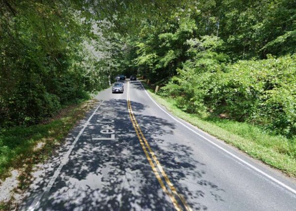
In the wake of a fatal crash earlier this year, Fairfax County intends to get rid of the hills that make Lee Chapel Road near Fairfax Station so harrowing to navigate.
Eliminating the two hills has emerged as “the most prudent” mid-term option for improving safety on the 1-mile stretch between Ox Road (Route 123) and Fairfax County Parkway, where two teens were killed and another seriously injured in a crash on Jan. 10, according to Springfield District Supervisor Pat Herrity.
To fund the project’s estimated $9 million cost, the Fairfax County Board of Supervisors directed staff today (Tuesday) to take away $5 million from the planned Shirley Gate Road extension, which is fully funded but not expected to start construction until 2026.
“They are both very important projects…but I think it’s critical we move forward with Lee Chapel safety improvements, and this allows that to happen,” Herrity said, noting that county staff have said the shift in funding won’t delay the Shirley Gate project.
The county is working with the Virginia Department of Transportation, Del. Kathy Tran, state Sen. George Barker and other partners to fund the remainder of the Lee Chapel project and “restore full funding to Shirley Gate as quickly as possible,” Herrity’s joint board matter with Board Chairman Jeff McKay and Mount Vernon District Supervisor Dan Storck says.
January’s fatal crash was the third on the scrutinized segment of Lee Chapel Road in less than 20 years, following deadly crashes in 2005 and 2015. The victims in all three crashes were teenagers.
Seeking to improve visibility for drivers, Herrity first proposed eliminating the hills in 2017 as part of a plan to widen the two-lane road to four lanes. The project was included in the county’s Transportation Priorities Plan (TPP) but got dropped after Virginia redirected regional transportation funds to Metro.
After January’s crash renewed calls for safety improvements from the community, VDOT and the Fairfax County Department of Transportation evaluated three options: remove both hills, remove just the larger hill or build the first leg of the Lee Chapel Road widening.
Removing both hills and constructing two 11-foot-wide travel lanes and a 6-foot-wide shoulder on each side of the road was “the alternative that appears to be the most prudent from a funding, timeline, and community support standpoint,” Herrity said.
“Only very preliminary design work has been done, so we are not at the level of design where we can say to what extent private and public property would be impacted, including trees,” Herrity’s office told FFXnow, noting that the $9 million cost estimate assumes VDOT will allow Lee Chapel to be fully closed during construction.
The proposal will be presented to the public at a town hall meeting with Tran and Barker in September, though the exact date hasn’t yet been settled. Read More
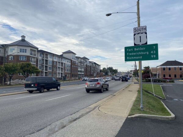
(Updated 10:55 a.m. on 7/26/2023) The ongoing redevelopment of Richmond Highway (Route 1) in Fairfax County has sparked a larger discussion over whether the benefits of road widening projects outweigh their potential harm.
The Virginia Department of Transportation plans to bring improvements to a three-mile stretch in the Richmond Highway corridor in two phases: first from Jeff Todd Way to just north of Frye Road, then from just north of Frye Road to Sherwood Hall Lane.
Notably, the changes will widen Richmond Highway from four to six lanes, which will pave the way for bus rapid transit in the corridor but has garnered some pushback from local community members.
The Coalition for Smarter Growth, which advocates for more “sustainable” transportation methods such as walking, biking and transit in the D.C. region, claimed in a recent press release that “wider roads fail, and the public knows this.”
CSG’s Northern Virginia Advocacy Manager Sonya Breehey says road widening projects create induced demand, arguing that adding more travel lanes incentivizes more people to drive and increases congestion in the long run, despite offering short-term relief.
“The idea is, we get stuck in traffic, so we add travel lanes,” Breehey said. “It’s easy for a few years, but then those travel lanes fill back up and then everybody’s clamoring again for more road widening. It’s a cyclical problem.”
Rep. Don Beyer, who represents the county’s Route 1 area in Congress, told FFXnow in an exclusive interview that he supports road widening projects.
“I think [road widening projects] are an important part of congestion relief,” Beyer said. “There’s an alternative argument…that they will fill up as fast as you build them. That’s certainly been largely true in the metro D.C. area for a long time…but at the same time, I don’t know if it’s still true today.”
In addition to adding travel lanes, the Richmond Highway project reserves median space for future lanes dedicated to The One, a bus rapid transit system that aims to outpace traditional bus services with dedicated lanes and fewer stops.
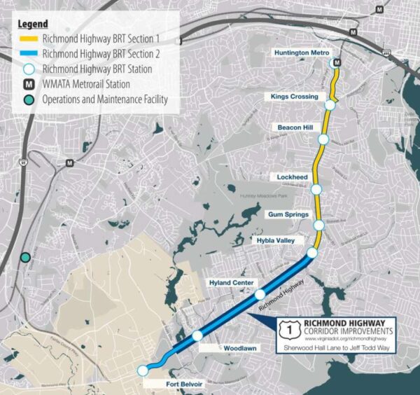
With the BRT expected to be operational in 2030, the Northern Virginia Transportation Commission announced last month that the Commonwealth Transportation Board approved $10 million to help implement the bus system from Fort Belvoir to the Huntington Metro station.
“This billion-dollar investment in a new state-of-the-art transportation system and in the communities along Richmond Highway will revitalize the area and provide more safe, convenient and dependable transportation options for the people who live here,” Mount Vernon District Supervisor Dan Storck wrote in a statement.
Storck says road widening can only be “done right” if it is “in coordination” with “walkable, bikeable communities and mass transit.” Read More
A Fairfax County proposal to overhaul parking regulations has attracted opposition from a local citizens group.
In a letter to the county, the Reston Citizens Association, a nonprofit citizen advocacy group founded in 1967, said the Parking Reimagined proposal does not fully consider the impact of the changes on Reston and the county overall.
“The RCA strongly urges that this proposal be withdrawn until at least such time as its conformity with the letter and the spirit of the One Fairfax Policy, the ADA, and other guiding principles can be achieved,” the letter states.
Specifically, two-page letter asserts that the changes will “significantly and adversely impact low-income, blue-collar workers, minorities, the elderly and disabled citizens.”
The effort kicked off in August 2021 when county staff began exploring ways to update an article of the zoning ordinance that regulates off-street parking and loading. Overall rates and regulations haven’t been comprehensively reviewed since 1988.
The initiative is intended to modernize those requirements and generally analyze parking and loading supply, demand factors, and loading trends.
On July 12, the county released a staff report on the issue ahead of Fairfax County Planning Commission hearings planned on July 26 and a Board of Supervisors hearing on Sept. 26.
“Significantly reducing unnecessary parking requirements in Metrorail station areas creates a return on the County’s investment in rail transit by aligning non-auto transportation options with transit access,” the staff report reads. “Reducing unnecessary parking supports placemaking as identified in the strategic plan and fosters a built environment where members of the community want to gather and where businesses can grow.”
If approved, the changes would go into effect on Jan 1.
The most significant change is a tiered framework that sets parking requirements based on factors like the availability and type of transit and the allowable density of development. County staff say it’s the “most critical new component” of Parking Reimagined.
Suburban centers have a proposed rate of 90% of the base parking requirement for nonresidential uses and multifamily units, while revitalization areas have a proposed rate of 80% of the base rate. Transit Station Areas and the Tysons Urban Center have a by-right rate of 70%, while transit-oriented development areas have a 60% rate. Some areas within those categories vary.
The proposal also allows the county to approve shared parking reductions and transit-based reductions of up to 30%.
In response, RCA asserts that the proposal doesn’t take into account a full range of transportation factors, including planning for future road, bus and rail routes and changes in employment and retail configurations.
RCA also calls the premise of the proposal — lower resident vehicle usage — “unrealistic” for the next 20 to 25 years, along with the minimum parking rates for multifamily units in revitalization areas, transit station areas, and transit oriented developments.
The organization also disputes the county’s rationale that reducing off-street parking will improve the environment, noting that the proposal doesn’t require developers to add green space and trees in exchange for off-street minimum parking.
The letter also flags the Reston Town Center area as not having enough access for cars, pedestrians and bicyclists.
“The RCA appreciates the significant work staff has put into this proposal and the outreach they conducted, and we stand ready to continue to work with staff to develop a proposal that will serve the citizens of Reston and Fairfax County in the years ahead,” the memo states.
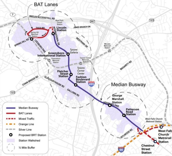
Fairfax County’s plan for bus rapid transit (BRT) service on Route 7 in Tysons sailed through the planning commission last week.
The commissioners recommended on Wednesday (June 21) that the Fairfax County Board of Supervisors approve a comprehensive plan amendment establishing guidelines for the future public transportation system, including the route and station locations.
If the amendment is approved at the board’s scheduled public hearing on July 25, the project will become eligible for funding through the county’s Transportation Priorities Plan and state and regional grants, Fairfax County Department of Transportation senior planner Sean Schweitzer told the planning commission.
“This is for future planning. This is not an immediately funded initiative. It’s also very timely,” Planning Commission Vice Chairman Timothy Sargeant noted, referencing FCDOT’s collaboration with the Northern Virginia Transportation Commission on a larger study that could eventually extend the Route 7 BRT to Alexandria.
Known as Envision Route 7, that study has been underway since 2013 and shifted its focus last fall to a portion of the system that will run through Falls Church City down to Seven Corners.
Because the Tysons section is at a more advanced stage of planning, with an overall route alignment in place since 2021, Fairfax County hopes to initially implement service within Tysons down to the West Falls Church Metro station as a temporary southern terminus.
As shared with the planning commission at a committee meeting on May 11 and with the public at virtual community meetings on June 7 and 8, the Route 7 BRT will serve nine stops in the Tysons area:
- West Falls Church Metro
- Route 7 (Leesburg Pike) at Chestnut Street
- Patterson Road, near the Tysons Station and Idylwood Plaza shopping centers
- George C. Marshall Drive
- Fashion Blvd, serving Tysons Corner Center
- International Drive and Fletcher Street
- International and Greensboro Drive, next to Tysons Galleria
- International and Lincoln Circle
- Spring Hill Metro station
To give the buses a clear path, since BRT is intended to be faster than a regular local bus service, the county has proposed designating two future lanes on Route 7 (Leesburg Pike) as BRT-exclusive lanes. The service will also repurpose two existing lanes on International Drive to Lincoln Circle.
The buses will occasionally enter mixed traffic at the West Falls Church station and when turning left from International Drive onto Spring Hill Road, where they will use Business Access and Transit (BAT) lanes to reach the Metro station.
“We know that the middle of Tysons doesn’t really have too much in the way of transit options,” Schweitzer said. “So, this preferred alignment helps to kind of expand the overall transit network within Tysons and gives people…different modes to use in order to get around Tysons and, ultimately, in the future, to Alexandria.”
FCDOT staff is studying how to incorporate improvements for bicyclists and pedestrians into the project, Schweitzer told the commission. Also to be determined is whether the BRT will keep stopping at the West Falls Church Metro station or stay on Route 7 after service is extended into Falls Church.
Franconia District Commissioner Dan Lagana suggested the county could learn from the existing BRT systems in Arlington and Alexandria when designing bicycle and pedestrian facilities, such as wider or raised crosswalks.
“I use and drive by, for example, the Metroway in Alexandria frequently, and…the city has done an outstanding job, Arlington and Alexandria,” Lagana said. “But there are some clear gaps now that we’ve seen it in action and we know crosswalks in the area are insufficient.”
Schweitzer said the county has been collaborating with its neighbors in Arlington, Alexandria and Falls Church, including through the Envision Route 7 study.
“We’re making sure all our transit projects and studies are kind of lining up so it can create, in the future, an expansive BRT system and also connect to the West End Metroway as well in Alexandria,” he said.
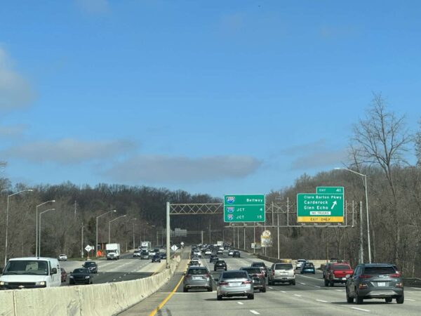
If you find trips on the Capital Beltway into Maryland nightmarish now, imagine what they would be like without any transit options.
That’s the scenario posed by the Northern Virginia Transportation Commission (NVTC) in a new study on the value of the region’s transit network, including Metro, local bus services like Fairfax Connector and the Virginia Railway Express (VRE).
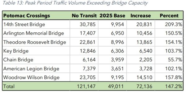
Released today (Thursday), the study found that the American Legion Bridge — the only direct link between Fairfax County and Maryland — would need to carry 24,653 or 8.2% more vehicles per day in 2025 if there was no transit (325,619 vehicles) compared to the projected traffic volume with transit (300,965 vehicles).
The other bridges across the Potomac River would see even bigger differences, led by a 39.2% increase on the Arlington Memorial Bridge.
“These bridges are congested today, and congestion will increase in the future. Without transit, however, the capacity constraint on the bridges would be substantially greater,” the study report says.
The report notes that rush-hour traffic on all of the Potomac crossings is projected to exceed capacity in 2025 regardless of transit availability. The American Legion Bridge would exceed capacity by 3,651 vehicles under the “base” conditions and by 7,379 vehicles under the “no transit” scenario — a 102% difference.
Construction is underway to widen the Capital Beltway (I-495) by adding two toll lanes in each direction from the Dulles Toll Road to just south of the American Legion Bridge. The Virginia Department of Transportation has forecast that the 495 NEXT project will move approximately 2,500 more people per hour in both directions, starting in 2025.
However, Maryland’s plans to replace and expand the bridge remain in limbo following the exit of its private partner. Replacing the American Legion Bridge would allow the Beltway to move 5,400 more people an hour, VDOT has said, but the endeavor will cost an estimated $1 billion.
According to an NVTC spokesperson, the study’s calculations incorporated the 495 NEXT project, but it didn’t include the possibility of future bus service between Tysons and Bethesda, as proposed by both Fairfax Connector and Metro.
“Our study evaluated the difference between what’s currently planned for 2025 and a scenario in which all transit in Northern Virginia is removed,” NVTC said. “That means the proposed future route from Tysons to Bethesda, using the American Legion Bridge, was not included since it won’t be in service by then.” Read More

