

The hottest parts of Fairfax County identified by this summer’s “Urban Heat Island Mapping Project” likely won’t come as a huge surprise to local residents.
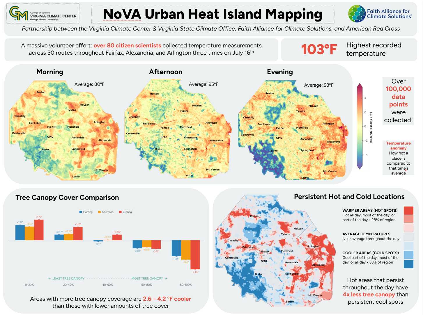
Tysons, Reston, Fair Lakes, Chantilly and Springfield were among the hot spots recorded by 80 volunteers who fanned out across Northern Virginia on July 16 for the project, which was organized by the nonprofit Faith Alliance for Climate Solutions (FACS) in conjunction with the new Virginia Climate Center at George Mason University and the American Red Cross-National Capital Chapter.
The highest temperature recorded anywhere in the region that day was 103 degrees Fahrenheit in Franconia, according to preliminary results released by the Virginia Climate Center last Thursday (Oct. 22).
Much of Arlington County and Alexandria City are also consistently hot throughout the day.
“Extreme heat is gaining speed in our region and worldwide,” FACS Executive Director Chris Topoleski said yesterday (Monday) in a press release sharing an overview of the initial data. “Once the mapping project data is fully analyzed, we’ll know where to concentrate efforts that will have the greatest impact.”
According to the initial data, about 10% of Fairfax, Arlington and Alexandria remain hot throughout the day with little to no cooling relief provided by dusk.
In addition, areas with limited tree canopy could be anywhere from 2.5 to 4.2 degrees hotter than areas with substantial canopy, depending on the extent of the tree canopy and the time of day.
“In Franconia and other hot areas, among the biggest contributors to high heat is the prevalence of large expanses of flat asphalt, including highway interchanges, parking lot strip malls, and other exposed concrete surfaces,” Luis E. Ortiz, co-director of the GMU Climate Center and acting state climatologist for Virginia, said in a statement to FFXnow.
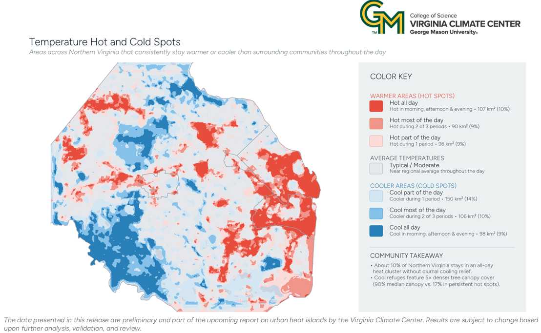
The difference is stark on a map of hot and cold spots, where major corridors like I-66, the Dulles Toll Road and the Springfield Interchange stand out so clearly in red that the roads don’t need to be marked. Cool refuges boast median tree canopy coverage of 90% compared to just 17% in areas that stay hot all day, according to the project team.
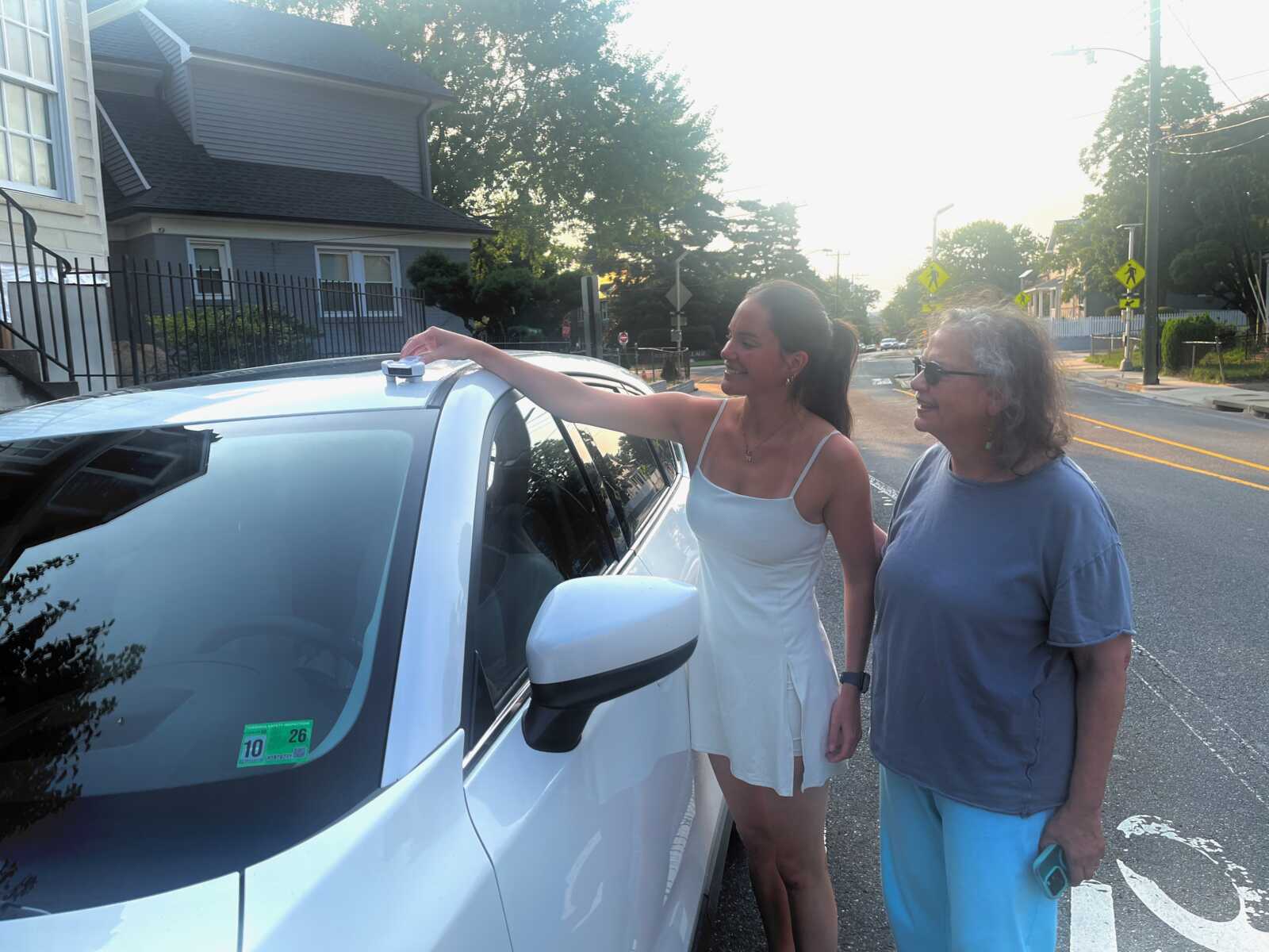
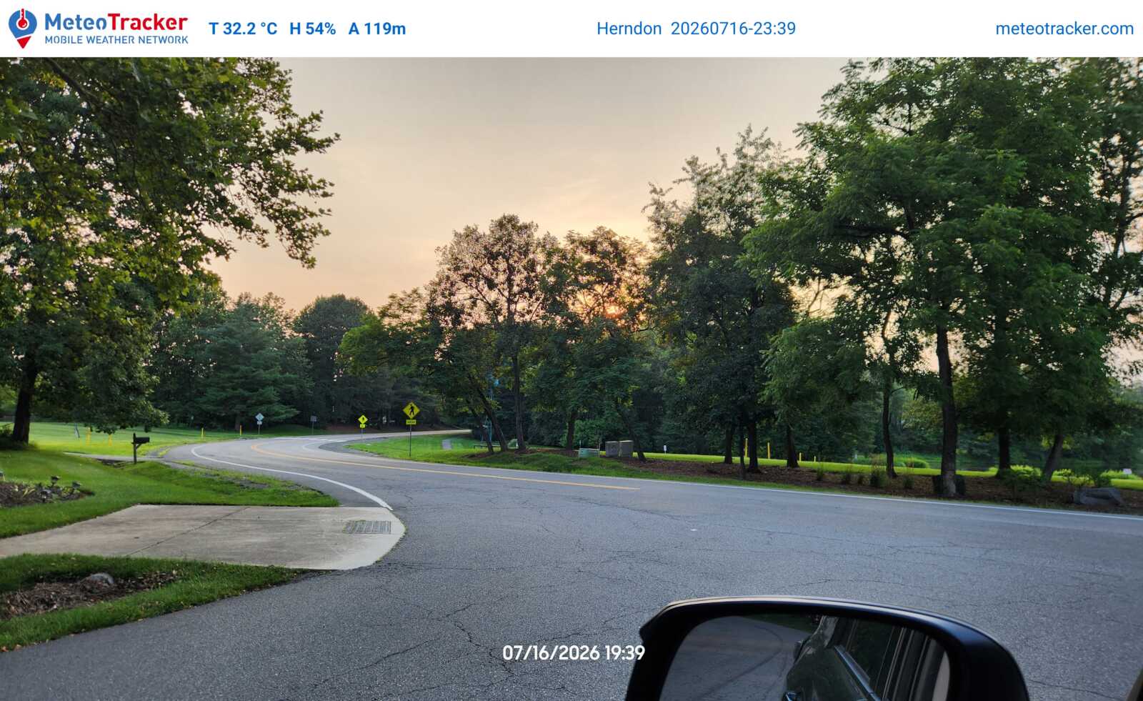
Temperature and humidity data were collected by recruited volunteers who drove along 30 assigned routes in Fairfax, Arlington and Alexandria three times throughout the day — at 6-8 a.m., 2-4 p.m. and 6-8 p.m. The volunteers’ vehicles were equipped with rooftop sensors.
July 16 was chosen as the measurement day because the Virginia Climate Center forecasted that it would be among the hottest days this year. According to National Weather Service data, temperatures ultimately hit a high of 98 degrees at Reagan National Airport that day, the hottest in July outside of an early-month heat wave that included three straight days of triple digits, peaking at 103 degrees on the Fourth of July.
The FACS and GMU heat mapping project aims to collect more granular data at the neighborhood and street level, providing more detailed, up-to-date information that could guide local government policies and decision-making about issues from tree plantings to land use and development projects.
“A lot of very useful information is coming out from the observations, and it can help inform how we can intervene to protect people’s health,” Ortiz said.
According to American Red Cross-National Capital Region CEO Dale Kunce, young people, seniors and people on certain medications are especially vulnerable to extreme heat.
“When the body does not get the option to cool down at night, bad things happen,” he said. “You can be hot during the day. But when you’re trying to sleep at night, and can’t cool down, bad things happen.”
Extreme heat also adds stress to the power grid, transportation networks and other infrastructure.
The full findings of the study will be compiled in a report that the Virginia Climate Center is expected to release by the end of this year.
