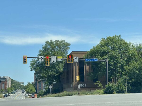
Email signup
A memorial at Columbia Pike and Tyler Street for Lesly Diaz-Bonilla, who was killed by a driver on Nov. 16, 2022 (photo by Ellie Ashford, courtesy Bailey’s Crossroads and Culmore PBI Coalition)

To the relief of Bailey’s Crossroads residents, some traffic safety improvements are in the works for the often harrowing area where Columbia Pike and Route 7 (Leesburg Pike) meet.

Perhaps the most urgent change will be the addition of a pedestrian hybrid beacon at the crosswalk across Columbia Pike at Tyler Street — the intersection where a driver hit and killed Justice High School student Lesly Diaz-Bonilla in November.

The Fairfax County Board of Supervisors approved an allocation of $920,000 to fund improvements at the intersection on April 11 as part of a $25 million slate of pedestrian safety projects planned throughout the county.

In the wake of Diaz-Bonilla’s death, over 1,000 residents signed an in-person and online petition calling for a reduction of the speed limit on Columbia Pike from 35 to 25 mph and other changes to the intersection, according to the Bailey’s Crossroads & Culmore Place-Based Initiative (PBI) Coalition, a community initiative led by George Mason University.

“This is a daily route to school for many children, including my own, and a route to work for many of us in Culmore,” resident Laura Doughty said in a press release from the coalition. “The lack of safety features for pedestrians coupled with the high-speed traffic makes it extremely dangerous for those of us who walk in the community everyday.”

Just 17 years old, Diaz-Bonilla had dropped off a younger sibling at a bus stop in front of the Barcroft View Apartments when a sedan crashed into her shortly before 9 a.m. on Nov. 16. After the crash, community members said they’d raised concerns about the intersection’s safety for years.

A report released last summer found that high vehicle speeds, incomplete sidewalks and limited crossings make Bailey’s Crossroads dangerous for pedestrians, particularly along the major corridors of Columbia Pike and Route 7.

A pedestrian hybrid beacon requires vehicles to stop if a pedestrian is present and pushes an activation button. A rapid flashing beacon with a pedestrian refuge island could be considered at the Tyler Street crosswalk instead if a hybrid beacon “is not feasible or warranted,” county staff said in a list of the safety projects that the board approved.

The April 11 vote also designated $1.9 million for a sidewalk on westbound Route 7 in front of the Liberty Gas station at 5930 Leesburg Pike in Culmore. A pedestrian was killed there in December 2021.

By press time, the Fairfax County Department of Transportation hadn’t returned a request for comment on when the projects will be implemented.

So far, the county has allocated about $30 million out of the $100 million that the Board of Supervisors pledged to spend on active transportation safety projects over six years, starting in 2022.

The inclusion of the Bailey’s Crossroads improvements in the latest package is the result of advocacy by residents, businesses, nonprofits and other organizations that have united around the need for safer streets, PBI Coalition program manager and Fairfax Families for Safe Streets Board of Directors member Katie Wilson said.

“The PBI Coalition will continue building these pipelines between local residents, organizations, and county leadership to amplify resident voices and ultimately work in partnership to build a community where all thrive,” Wilson said.

In a separate project, the county is planning to build a sidewalk and make other improvements in the Annandale section of Columbia Pike.

0 Comments
Crosswalk upgrades are proposed at Monroe Manor Drive and Monroe Street in Herndon (via Google Maps)

It’s repaving and restriping season once again, with public meetings coming later this month on proposed projects that would add bicycle lanes and improve crosswalks.

April marks the beginning of an annual process that ends in November with hundreds of miles of roadway being repaved and restriped by the Virginia Department of Transportation (VDOT).

In Fairfax County, more than 1,700 miles of roadway are expected to be repaved this year. The work often leads to new bike lanes, shoulders, crosswalks, signage, and street markings.

The program is “an opportunity to increase driver, bicyclist and pedestrian safety with road and crosswalk improvements while minimizing the financial investment in restriping work,” the Fairfax County Department of Transportation says on its website.

The first virtual public meeting hosted by VDOT and FCDOT will come on April 17 at 7 p.m. and cover proposals in the Hunter Mill and Providence districts.

One plan would add bicycle lanes on Glade Drive between Sunrise Valley Drive and Reston Parkway in Reston by narrowing the driver travel lanes.

In addition, upgrades are proposed at Monroe Street and Monroe Manor Drive in Herndon. This could include “marked crosswalks, high-visibility crosswalks and/or crosswalk signage,” the county says.

After a proposal for Ellenwood Drive was discussed at a separate meeting in February, the Providence District could get more bicycle lanes at four spots in the Merrifield and Annandale area:

The lanes would be added by narrowing travel lanes or “repurposing underutilized parking lanes.”

Upgrades are also being considered for the intersection of Willow Oaks Corporate Drive and Professional Center Access Road in Merrifield. This could include marked crosswalks, high-visibility crosswalks, and additional signage.

Comments on projects in both districts will be accepted through the close of business on May 1.

Virtual public meetings will be held to discuss projects in Sully District on April 18, Franconia and Mount Vernon on April 19, Braddock and Mason on April 20, and Springfield on April 26.

Most of the proposed projects in those districts would also add bike lanes and improve crosswalks.

While all repaving and restriping work is set to begin soon and conclude by November, exact work dates for each project will be available “approximately ten days prior to work beginning.”

If the repaving requires parking to be limited, signs will be posted at least three business days in advance. Parked cars, basketball hoops, and garbage cans may need to be moved to accommodate the work.

In general, work hours will be limited to “outside of rush hours” with crews typically on-site in neighborhood streets on weekdays between 9 a.m. to 3 p.m. However, on interstates and some primary roads, work might happen overnight to limit the impact.

Residents should expect construction vehicles in their neighborhood during the project, and the county is asking motorists to “be alert to temporary traffic patterns.”

0 Comments
A rain garden, also known as a bioretention area, at an elementary school (via Fairfax County)

A stormwater retention project in Vienna that officials say will help contain runoff and slow down traffic is set to get another infusion of Fairfax County funds.

The county’s Board of Supervisors authorized staff last week to provide an additional $54,000 for the Town of Vienna’s Tapawingo and Kingsley road urban bioretention project. The vote took place without discussion at the board’s Feb. 21 meeting.

The money will come in addition to $200,000 that the county already allocated to the project under a funding agreement originally signed in October 2018.

“The increased Project cost is attributable to rising construction costs and larger bioretention cells needed to maximize water quality benefits,” county staff said in a memo explaining their recommendation that the agreement be amended.

The project will add two bioretention areas — or rain gardens — along Meadow Lane SW: one at the Tapawingo Road intersection and another further south at the Kingsley Road intersection.

Vienna is planning bioretention areas with curb extensions and crosswalks on Meadow Lane at Tapawingo Road on the left and Kingsley Road on the right (via Town of Vienna)

To accommodate the cells, the existing corner pavement will be demolished and replaced with extended curbs, according to Vienna plans. The cells will be covered with a combination of perennial plants, such as switchgrass and bee balm, as well as grass sod.

According to county staff, the cells will treat stormwater runoff as it goes into Hunter’s Branch of the Accotink Creek watershed, providing “nutrient reduction and improved water quality.”

“Green stormwater controls are not only an aesthetic benefit provided by integrating nature into the urban built environment, but also planted cells are effective at removing nitrogen, phosphorous and in remediating metals that pose health impacts to aquatic life,” staff said. “For this reason, alternatives such as underground storage basins that offer limited infiltration and water quality improvement were not preferred.”

In addition to the stormwater benefits, town officials anticipate the curb extensions will help calm traffic on Meadow Lane, a 30-foot-wide street in a residential neighborhood, county staff said.

The road’s travel lanes at the Tapawingo and Kingsley intersections will be restricted to 20 feet wide, according to Vienna project manager Alan Chen.

The design, which was developed by Urban Ltd., also proposes 10-foot-wide crosswalks on all four sides of the Tapawingo intersection and on the north and east sides of the Kingsley intersection. The final design was presented at a community meeting on Nov. 3, 2021.

Under the 2018 agreement, Fairfax County agreed to cover the design and construction cost of the stormwater facilities. The additional funds authorized last week will cover the increased construction costs for the bioretention areas — but not for the curb extensions, Chen said.

The curb extensions and other remaining costs are Vienna’s responsibility, Chen told FFXnow. The town council will vote on whether to approve $84,564 for the project and the amended funding agreement on April 10.

In all, the project will cost just under $338,565. Assuming the town council approves Vienna’s portion and the new agreement, the town anticipates construction will begin in May.

Photo via Fairfax County

0 Comments
Ellenwood Drive at the Jersey Drive intersection in Merrifield (via Google Maps)

(Updated at 3:40 p.m.) Fairfax County hopes to get a head start on its annual street paving and restriping efforts this year, thanks to the D.C. area’s warmer-than-usual winter weather.

The county and Virginia departments of transportation program will kick off next month in Merrifield with the proposed addition of bicycle lanes on Ellenwood Drive from Route 29 to Route 50, along with crosswalks at two intersections.

“Because of the warmer winter weather, VDOT recently began repaving some streets during the winter on short notice,” an FCDOT spokesperson said. “The Ellenwood Drive project was selected for this accelerated schedule, which also helps reduce the repaving backlog.”

The street’s two travel lanes will narrow to 10 feet to make room for the 5-foot-wide bicycle lanes, which would be separated from the curb by 7-foot-wide parking lanes, according to a presentation from the Fairfax County Department of Transportation.

Ellenwood Drive proposed bicycle lanes cross-section (via FCDOT)

In addition to linking two key thoroughfares, Ellenwood Drive is a good candidate for on-road bicycle lanes, because it has wide travel lanes, on-street parking and sidewalks on both sides, and the lanes can connect to trails on both ends, FCDOT says.

The Arlington Blvd service road at the southern end of Ellenwood has a trail connection to Armistead Park. In addition, the upcoming Fairfax Landing neighborhood’s developer is constructing a 6-foot-wide asphalt trail that will extend the Armistead Park Trail north to the Route 29 service road.

Per the presentation, parking reductions will be limited to the loss of two spaces at Ellenwood and the Route 29 service road.

However, the Fairfax Alliance for Better Bicycling (FABB) says more parking likely needs to be sacrificed to build bicycle lanes that are actually safe and comfortable to use.

“If you keep on-street parking, your options are very limited to add safe bicycling routes,” FABB board member Shawn Newman said. “Our preferred option would be to remove the parking on one side of that street and to add in buffered bike lanes, so a bike lane with adequate space next to it in order to provide bicyclists space between them and the vehicle.” Read More

0 Comments

A new county-supported study is recommending pedestrian and bike-friendly improvements in the Huntington Metro corridor, including more crosswalks, wider sidewalks, additional lighting, and increasing shared-use paths.

At a virtual meeting tomorrow (Sept. 14) night, a Fairfax County Department of Transportation (FCDOT) study – “Huntington Metrorail Active Transportation Study” – will be presented to the public that looked into the pedestrian and biking conditions within the Huntington Transit Station Area (TSA).

The Huntington TSA covers an area bordered by North Kings Highway to the south, Huntington Avenue to the north, Telegraph Road and Jefferson Manor Park to the west, and Richmond Highway to the east.

As the study points out, the area is continuing to grow in density.

“The Huntington TSA has been transitioning from low density to mid density for decades and will continue to become denser,” it reads while providing a list of new developments and projects that will contribute to the growing population in the years to come.

Along with that, the Richmond Highway Bus Rapid Transit is expected to create a “greater need” for pedestrian access and safety in the corridor when the system opens within the next decade.

While considering all future conditions and projects up to 2045, the study concluded generally that the corridor is “uncomfortable” for pedestrians and bicyclists. That’s due to a prevalence of narrow sidewalks, lack of bike lanes, high speed of traffic, and the far distance pedestrians have to go to cross major roads.

“Almost all of the analyzed roads were deemed highly uncomfortable for pedestrians… due to narrow sidewalks, large crossing distances, and high speeds,” reads the study. “It is also worth noting that areas around community resources such as Mt. Eagle Elementary School and the Huntington Community Center are also highly uncomfortable due to sidewalk quality and a lack of pedestrian scaled lighting.”

Three intersections are particularly worrisome due to the crossing length exceeding 400 feet.

These include Huntington Avenue between Biscayne Drive and Foley Street, North Kings Highway between Telegraph Road and Jefferson Drive, and North Kings Highway between Fort Drive and Fairhaven Avenue.

There are also no official bike lanes in the Huntington TSA.

To rectify these issues, the study recommends a number of fixes and solutions.

At the intersections with long crossing lengths, it’s suggested that “high visibility” crosswalks be added with crossing warning signs and pedestrian refuge islands.

Where pedestrian crossings currently exist in the Huntington Transit Station Area (via Fairfax County)

There are also suggestions for implementing for a number of roads the concept of “Slow Streets,” where traffic speeds are lowered and entry points are closed to traffic to create a safer space for pedestrians.

In terms of costs, the study notes that “improving sidewalk quality” is a lower-cost option than adding new or widening sidewalks. The highest cost options are changing road diets, adding new bike and pedestrian facilities, like shared use paths, or subtracting traffic lanes.

Overall, the study recommends potential options for individual streets with a focus on lower and medium-cost options.

For example, on Monticello Road in the Jefferson Manor neighborhood, the recommendation is to fix the “cracked and failing” sidewalk and widen it to 8 feet in some places plus adding more lighting. On North Kings Highway, the recommendations include new traffic signs telling traffic to stop for pedestrians, restricting truck traffic with signs, a new crossing location at Fairhaven Avenue, and a high-cost option of removing traffic lanes on Jefferson Drive.

Besides this study, a number of other planned infrastructure improvements are found in other county-supported plans, including a 10-foot wide path along N. Kings Highway and Huntington Avenue, narrowing travel lanes on N. Kings Highway to allow for wider sidewalks, installing more barriers, lights, and crosswalks, and installing a beacon crossing signal in front of Mount Eagle Elementry School.

Throughout the county – and region – car crashes involving pedestrians and cyclists have continued to be a major and tragic problem. In July, a woman was killed by the driver of a car who hit her while she was crossing an eight-lane section of Richmond Highway included in this study.

There have been 10 fatal crashes involving pedestrians on Richmond Highway since 2017.

0 Comments
×

Subscribe to our mailing list