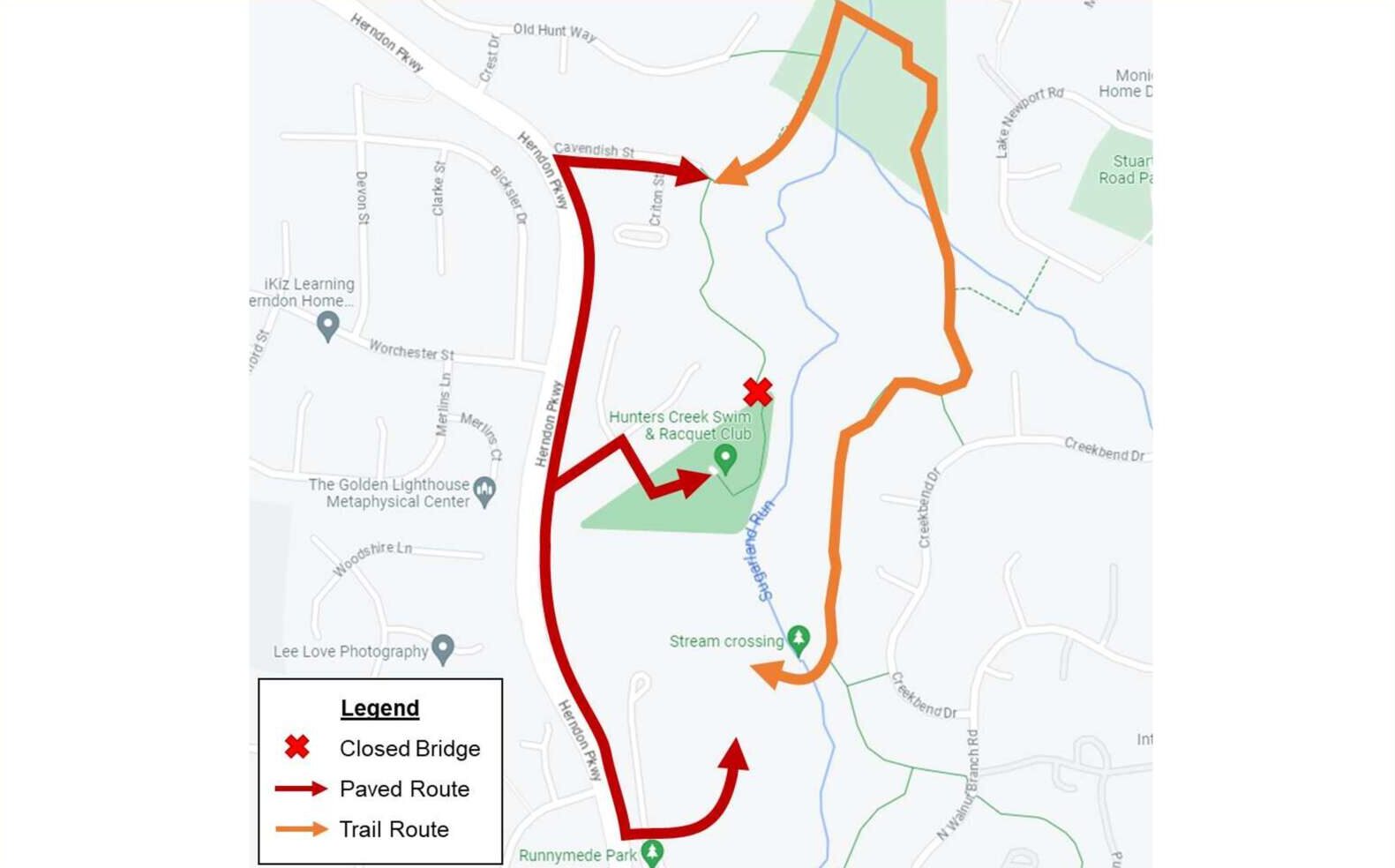
Construction to replace the Hunters Creek Pedestrian Bridge is slated to begin in October, according to the Town of Herndon.
An assessment by the town found that the bridge — which connects to the Sugarland Run trails from behind the Hunters Creek Swim & Racquet Club (417 Queens Row Street) — needs to be replaced and that erosion of the stream needs to be addressed.
Final designs for the replacement bridge and stream restoration are expected this month. It will include a new fiberglass structure set on a new foundation.
But the town announced on Friday (March 15) that the project will take longer to get going than anticipated.
“Schedules have been extended because of the sensitivities of working in a wetland area and in a floodplain,” the project page says. “Working in the wetland area will require an Army Corp of Engineers permit, which typically takes up to 9 months. The Town will work with the Army Corp of Engineers in an effort to expedite the permit process.”
Construction is expected to wrap up by the spring of 2025.
The bridge will remain closed until the work is complete. Residents will need to use the Cavendish Street entrance or Runnymede Park entrance to access trails.
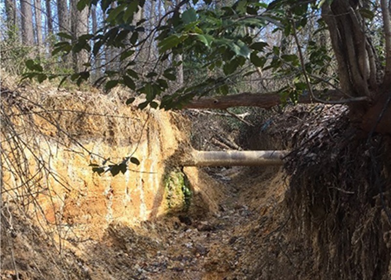
Fairfax County is making progress on a stream restoration project at Lamplighter Way in Reston after receiving the needed land rights to move ahead with designing the project.
The project was identified by the county’s management plan for the Difficult Run watershed and a nomination by Reston Association, which owns the land.
With the project, the county will restore about 1,200 linear feet of natural stream channel between Lamplighter Way and Woodbrook Lane, extending downstream to Piney Run.
The stream channels are severely eroded and over-widened bank, leading to further bed and bank instability, according to the Fairfax County Department of Public Works and Environmental Services.
“Two sanitary sewer lines have been exposed by the erosion,” the department says on its project page. “This project is part of larger efforts to restore many of Fairfax County’s degraded streams while improving overall water quality and the condition of the Chesapeake Bay.”
The county will hold two public meetings on the project next month. A virtual meeting is set for Thursday, Jan 4 at 7 p.m. and an in-person meeting is scheduled for Saturday, Jan. 6 at 10 a.m. Participants should meet at the park trail entrance at Center Harbor Road.
The project design is 65% complete, and plans are under review. Once the review is completed, the final design phase will begin. Construction is expected to begin in the winter of 2024.
The project costs $464,000.
Work is underway to restore the waterways around the Fairfax County Government Center.
To support the Difficult Run stream restoration project, which began in October, the Fairfax County Department of Public Works and Environmental Services (DPWES) worked with a consultant to relocate over 200 fish and eels to the pond outside the Herrity Building (12055 Government Center Parkway).
In an approach that DPWES says is “unprecedented” for the county, the aquatic creatures were corralled using an electro-fishing boat provided by the consultant, Prince William County-based Solitude Lake Management.
A total of three eels, 49 bluegill and 145 golden shiners were moved on Dec. 5, making way for dredgings of the government center’s two amenity ponds.
“The American eel is actually an endangered species, so it’s especially good that we got them out,” Caleb Yankee, a fisheries biologist for Solitude Lake Management, said in a brief video shared by DPWES to showcase the relocation process.
According to Jonathan Witt, an ecologist in the department’s stormwater management division, electro-fishing involves electrifying the water “in the immediate vicinity” of the boat, stunning the fish and bringing them to the surface so they can be picked up in nets.
They were then put in a storage tank and transported to their new home less than a mile away.
DPWES emphasized that electro-shocking is a “sophisticated and humane technique that allows for efficient, safe fish relocation.” The county has utilized electro-shocking before, but on a smaller scale, using handheld devices instead of a full boat.
“The successful transfer of these aquatic residents to Herrity Pond signifies not only the protection of these species during the restoration project, but also the enrichment of the pond’s biodiversity,” DPWES said. “The fish have been carefully introduced into their revitalized habitat, marking a significant step towards ecological balance.”
In addition to dredging the ponds, the Difficult Run Tributary and Basins project entails restoring about 1,600 linear feet of stream, which will reduce soil erosion, shore up natural habitats on land and in the water and improve water quality, according to DPWES.
The northwestern portion of a trail on the government center campus recently reopened with the completion of the project’s first phase. Additional trail closures for the second and third phases are expected to start next week, according to DPWES spokesperson Sharon North.
“With the updated schedule, it could last [until] about May 2024,” North told FFXnow.
That would push back the end date for the fourth phase — which focuses on the streams and ponds along the property’s southeastern border — from September to November or December 2024.
After the project, the amenity ponds will be restocked with new native fish, DPWES says.
“Fairfax County residents are encouraged to participate in the final phase of the project, where they can witness the restocking of the amenity ponds,” the department said. “This event will offer a unique opportunity to observe the tangible impacts of such environmental initiatives.”
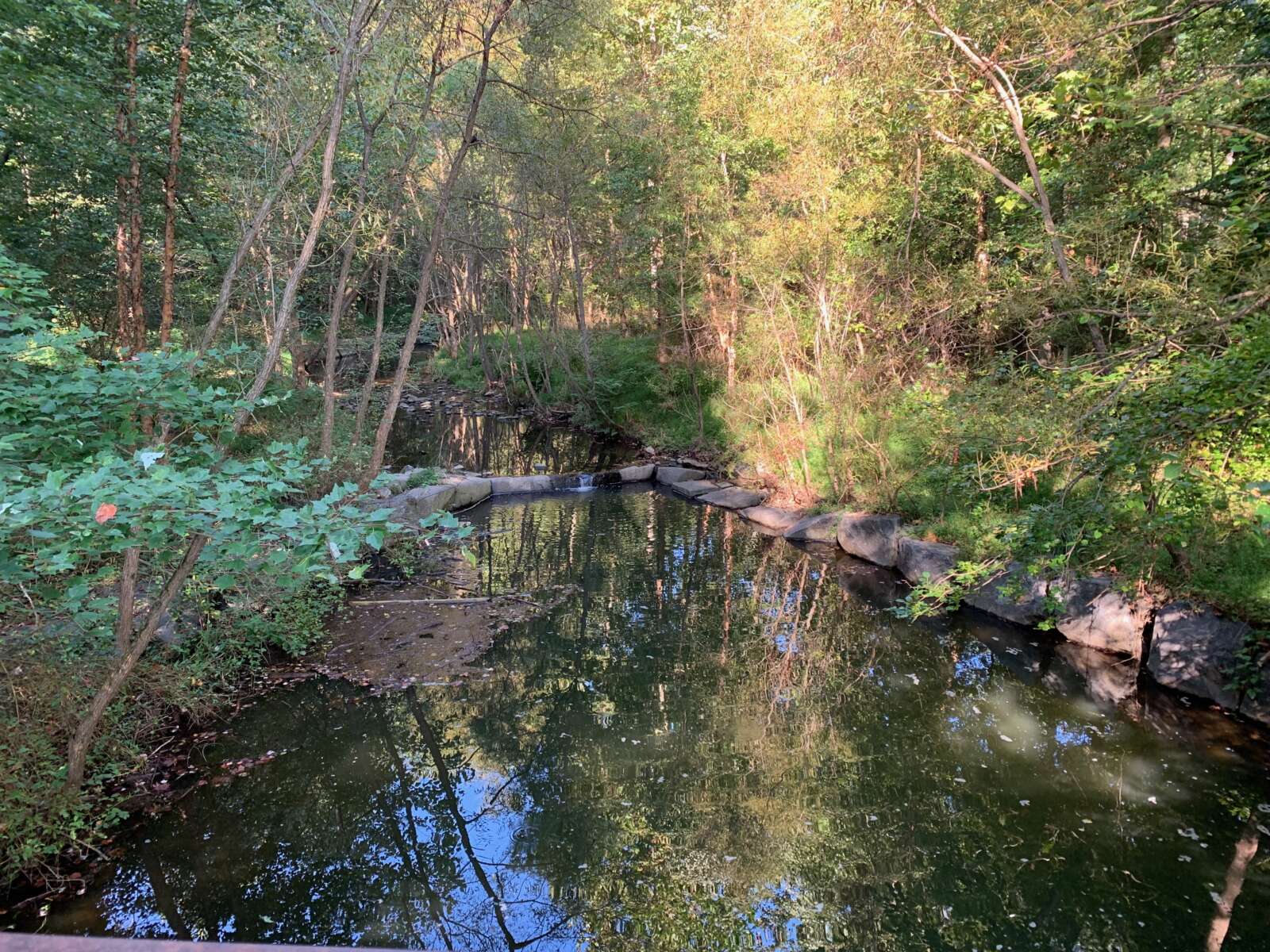
Updated at 5:45 p.m. — The fish deaths reported at Snakeden Branch stream this morning have been traced to a water main break behind Hunters Woods Plaza, Reston Association says.
“Potable water was discharged and included chlorine, causing the fish kill,” RA Chief Operating Officer Peter Lusk said. “The water main break has been repaired, and the stream is considered safe, and not harmful to humans or animals.”
Earlier: Dead fish were found earlier this morning (Friday) at Snakeden Branch stream, according to a report confirmed by Reston Association.
A foul smell also protruded from the stream.
RA staff are working with the Virginia Department of Environment Quality (DEQ) and the Fairfax County Stormwater Planning Division to confirm the cause of the incident.
Residents are encouraged to avoid using the stream. Signage has been posted at the stream, which flows from Hunters Woods Village Center to Lake Audubon.
RA is also urging residents to be cautious when using Lake Audubon until the source of the issue is confirmed.
Preliminarily, there is no evidence that the issue was caused by sewage, according to RA COO Peter Lusk.
“These events typically occur when there are malfunctions within wastewater systems, water mains, or occasionally illicit dumping. RA staff will confirm the source of the issue, once identified,” RA said.
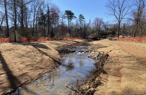
Planning is underway for stream restoration at Sugarland Run North.
At a Fairfax County Board of Supervisors meeting on July 11, the board unanimously approved an agreement between the county and the Town of Herndon to design and construct the project.
The $3.9 million project would restore roughly 2,350 linear feet of Sugarland Run, which is located in the Sugarland Run watershed. The project will begin roughly 1,200 linear feet north of the Washington & Old Dominion Trail crossing with Sugarland Run.
Sugarland Run South runs from Elden Street to the previously finished southern end of the project.
The town has asked the county to fund the design and construction of the project over four fiscal years.
“In addition to improving the environment and water quality, this partnership with the Town of Herndon is an example of implementation of effective and efficient government practices consistent with the County’s Strategic Plan,” county staff said a July 11 memo.
Staff noted that the partnership with Herndon will save the county time and administrative costs that would have piled up if the project was administered under the county’s own stormwater program.
The agreement is possible because the Town of Vienna, the Town of Herndon and Fairfax County have agreed to share some stormwater service district fees in order to meet stormwater management requirements for the Chesapeake Bay.
At a recent Herndon Town Council meeting, John Irish, the town’s deputy director of public works, noted that the primary goal of the project is to absorb and direct energy in a way that protects the geology of the stream. The project will improve the aquatic habitat of the area, address local flooding, and improve the safety and instability of eroded banks.
Channel erosion from the increased volume and velocity has led to significant nutrient and sediment pollution, along with the loss of habitats.
Construction on the northern project is expected to start in fiscal year 2026, which would start on July 1, 2025. Design work will begin in fiscal year 2024, according to the town’s website.
Photo via Town of Herndon newsletter
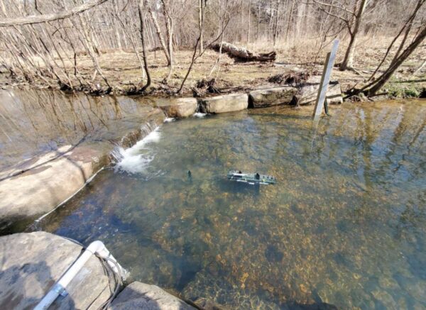
Several groups are working together to embark on a one-of-a-kind urban mussel restoration project for the Snakeden and Glade stream valleys in Reston.
The project is part of a partnership with Virginia Tech, the U.S Geological Survey and other institutions. The team will work to install mussel beds into restored streams and evaluate their ability to remove nutrient and sediment pollution.
“Freshwater mussels have the ability to filter stream water at a prodigious rate, improving water quality, and thereby potentially keeping local streams, rivers, and receiving estuaries cleaner,” the Resource Protection Group, a nonprofit funding the effort, said on the project page. “Within urbanized settings such as Reston, the possibility of utilizing mussels to improve both local water quality and that of larger receiving systems is quite intriguing.”
According to the organization, Virginia Commonwealth University and the U.S. Fish and Wildlife Service completed a study last year on whether freshwater mussels could survive in the streams before the current, larger-scale project to reintroduce the animals launched.
Other initiatives are also planned at both stream valleys.
A team of researchers from William and Mary and George Mason University will investigate the best ways to reduce the colonialization of stream restoration by grass and other invasive and non-native vegetation.
“We are excited to do our part to contribute to the science of stream management in our region by hosting these projects,” Reston Association said in an announcement on Friday (June 9).
Scientists are also working on studying water quality and vegetation management at both areas, which are part of the Northern Virginia Stream Restoration Bank Initiative.
RA COO Larry Butler noted that it’s not clear when the work related to invasive species will be completed, but it could take three to three-and-a-half years. The stream monitoring and mussel programs are expected to cost $2 million.
“The stream monitoring and mussel programs are five years with approximately four years remaining, with the work split between Snakeden Branch and the Glade watersheds,” Butler wrote in a statement to FFXnow.
Photo via Resource Protection Group
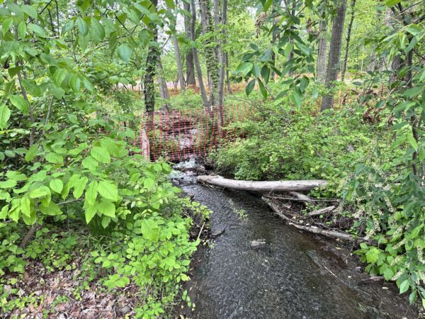
Some stability has been restored to Sugarland Run.
The Town of Herndon has nearly completed a project to restore roughly 1,200 linear feet of natural stream and stabilize stream banks of Sugarland Run South from the Washington & Old Dominion Trail crossing to the pedestrian bridge crossing, according to town manager Bill Ashton II.
At a recent Herndon Town Council meeting, Ashton said the first phase of the project is “quickly coming to a close.”
“We are preparing to repave the pathway,” he said, adding that the work will officially wrap up in the fall after conditions because safe and reliable for the installation of new plans.
The project aimed to reduce sediment and improve water quality along the stream, whose steep banks had become eroded. Bioengineering methods like vegetation planting plans, in-stream structures and brush mattress installations were used to shore up the stream.
Although the trail will remain open during the remaining construction, the entrance at the Herndon Police Department remains blocked.
A $964,000 contract was awarded to KBS Earthworks, Inc. late last year. The project has been in the works for years.
Stream restoration creates a stable channel using natural materials to restore the function, dynamics and structure of the stream to the maximum extent possible, according to the town.
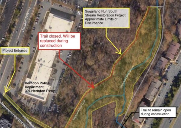
The Town of Herndon is moving forward with a multi-million-dollar contract to restore more than 1,000 feet of Sugarland Run Stream.
At a Herndon Town Council meeting tomorrow (Tuesday), the council is expected to vote on awarding a nearly $964,000 contract to KBS Earthworks, Inc. to complete the project.
Public bidding on the project closed on Sept. 9. The lowest bidder — Geomorphic Restoration — did not respond to the town’s request for additional documentation.
“The next lowest bidder KBC Earthworks, Inc., has been found to be responsive and responsible,” John Irish, deputy director of the town’s public works department, said in a statement.
The project includes restoring 1,100 linear feet of the stream, along with 250 linear feet of three tributaries on the town’s property. The design also includes pedestrian access to the east side of the project.
The trail will remain open during restoration, but the portion of the trail central to the site will be replaced during the construction project.
“Stream restoration will include but are not limited to constructed riffles, rock cross vanes, rock toe revetments, plunge pools and rock outfall channels,” a staff memo says.
The project has been in the works for years. Stream restoration creates a stable channel using natural materials to restore the function, dynamics and structure of the stream to the maximum extent possible, according to the town.
A project timeline was not immediately available.
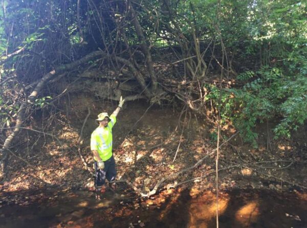
The Vienna Town Council dedicated over half a million dollars on Monday (Aug. 29) to an ongoing project to restore Bear Branch tributary, a stream that runs through Southside Park to I-66.
With no discussion, the council awarded a $543,258 design contract to A. Morton Thomas and Associates, Inc. (AMT), one of five engineering firms that submitted proposals for this second phase of a two-part project this past spring.
This phase of the restoration will address approximately 2,300 linear feet of stream that flows through the park, parallel to Walker Street SW and Ross Drive SW, by stabilizing “the steep, eroded stream banks,” according to town staff.
“The completed project will reduce sedimentation and improve the stream’s water quality using natural channel design techniques,” the project page says.
In addition to shoring up the stream banks, the project will involve the replacement of a pedestrian bridge and the development of a “functional” pedestrian trail from the bridge to an existing sidewalk.
As part of its proposal, AMT said it would provide two recommendations for a possible bridge design and work with the town and park staff to develop the trail. The firm’s contract consists of a base fee of $497,744 with $45,514 added for the bridge and trail.
Carrying an estimated total cost of $2.5 million, the project is being funded by both Fairfax County and the town, which obtained a grant from the Virginia Department of Environmental Quality in November 2019.
The project’s first phase, which focused on the stream segment parallel to Patrick Street SW and Yeonas Park, got funding approved in 2019 and a design contract awarded in July 2020.
The first phase’s design plan is nearly complete and will be presented at a community meeting next Thursday (Sept. 8).
Photo via Town of Vienna
(Updated at 2:45 p.m.) Fairfax County has sealed the deal on a plan to restore a portion of Scotts Run stream parallel to the Capital Beltway.
The county’s Board of Supervisors approved an agreement today (Tuesday) with the Virginia Department of Transportation, which will contribute almost $1.4 million to the project’s design and construction.
The project will restore approximately 4,900 linear feet of stream between Old Dominion Drive and Lewinsville Road in McLean, “providing nutrient reduction and improved water quality in the Scotts Run watershed,” according to a staff report.
The county will fund the remaining $5.2 million needed for the project, which carries a total estimated cost of $6.6 million.
The agreement with VDOT had been in the works since 2020, as county officials called on the state to help address the anticipated environmental impact of extending the I-495 Express Lanes from the Dulles Toll Road in Tysons past the George Washington Memorial Parkway. Construction on the 2.5-mile 495 NEXT road project began in late May.
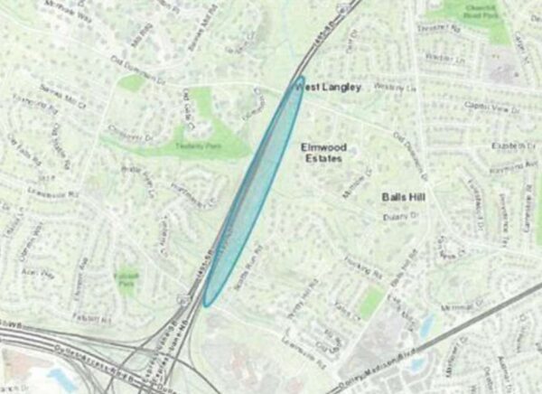
The agreement deals with just one part of a larger effort to restore Scotts Run stream, which flows north from the I-495 and Route 123 interchange and extends all the way through McLean to the Potomac River.
In a Middle Potomac Watersheds Management Plan finalized in 2008, the Fairfax County Department of Public Works and Environmental Services (DPWES) recommended evaluating approximately 7,800 linear feet of Scotts Run and a tributary between the toll road and Old Dominion for restoration sites.
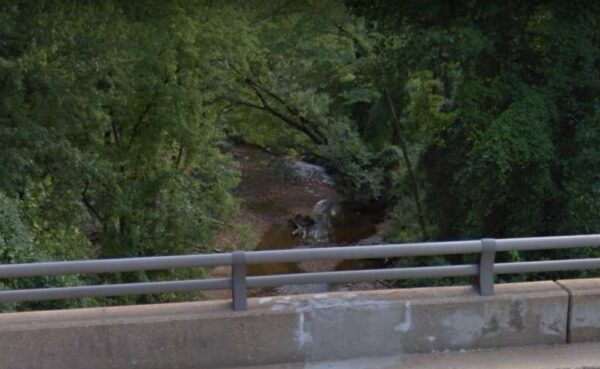
The stream banks in the upstream portion of the restoration area are undercut and eroded with many trees along the bank falling into the stream. Woody debris accumulation in the stream has inhibited any defined riffle and pool development. Irregular point bars of sand and gravel are seen along this stream length and bank full flow (1.5 to 2 year storm) is predicted to be at the top of the streams banks.
Proposed restoration activities included removing woody debris and trash, reconfiguring the stream bank and channel, planting vegetation, and placing in-stream structures to support the stream’s habitat.
According to a stormwater management projects map, about 600 feet of a tributary at Windy Hill Road in McLean was restored in 2019. The county also secured a commitment from developer Cityline Partner to improve the stream where it passes through the Scotts Run development in Tysons East.
It will take some time for the new Scotts Run restoration project to come to fruition. DPWES staff had an initial scoping walk to look at the site last month, according to a spokesperson.
The funds for the design will be available starting this year through fiscal year 2025, which will be from July 1, 2024 to June 30, 2025, but construction funding isn’t expected to be available until fiscal year 2026.
Photo via Google Maps

