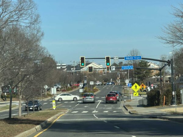
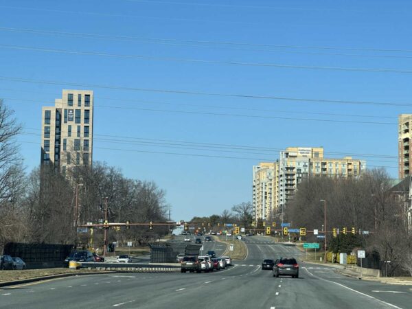
Email signup
Reston Station from the Wiehle Avenue bridge (staff photo by Angela Woolsey)

Updated at 8:40 p.m. on 11/8/2023 — The community workshop has been relocated to the cafeteria of Langston Hughes Middle School (11401 Ridge Heights Road).

Earlier: Fairfax County is formally launching a new study on how to shift Wiehle Avenue from a car-dominated, suburban road to a multimodal, urban street.

The Wiehle Avenue study kicks off with an in-person community workshop on Nov. 13.

After diving into the background and purpose of the study, the county will open the floor for attendees to brainstorm ideas on how to improve the road between Sunrise Valley Drive and the Washington & Old Dominion Trail in Reston.

The ideas proposed by the community will later be refined into three concepts “to test in future (year 2030) scenarios” by the Fairfax County Department of Transporation and its consultant, Fehr & Peers, FCDOT spokesperson Freddy Serrano says.

“[The scenarios] will give us an overview of how potential changes may affect traffic operations and accessibility and comfort for pedestrians, bicyclists, and transit users,” Serrano told FFXnow. “We will take these concepts and the resulting future analysis back to the public early next year and will solicit their feedback to arrive at a preferred concept for Wiehle Avenue.”

The Fairfax County Board of Supervisors initiated the Wiehle Avenue study as a follow-on motion after approving TF Cornerstone’s Campus Commons redevelopment plan in 2019.

The project prompted vigorous debate on the safety of a proposed pedestrian crossing at the intersection Dulles Toll Road ramps and Wiehle Avenue. An alternative is being explored after the developer offered $1.65 million instead of developing a solution.

The county previously convened a study group to evaluate options for that crossing, but the group didn’t support any of the developer’s proposals.

FCDOT says this new study will take a broader look at the corridor and how it may have been affected by the opening of Metro’s Silver Line extension last year.

“This effort is expected to identify new and improved bicycle/pedestrian facilities and intersection treatments, as well as evaluate the potential reconfiguration of vehicular lanes and/or widths for current and future land use scenarios,” the department said in a news release.

The community meeting takes place from 5:30-9 p.m. in the second floor conference room of 1900 Reston Metro Plaza. A light dinner will be provided. RSVPs are encouraged through an online feedback form.

0 Comments
University Drive in Fairfax City (staff photo by Angela Woolsey)

Fairfax City is starting to refine its plans to add bicycle facilities on University Drive.

The project will “implement bicycle facilities on University Drive between Layton Hall Drive and South Street, with shared lane markings through the center of Old Town and bicycle lanes to the north,” according to the city’s website.

It will serve as a link to other multimodal projects currently underway in the area, such as the partially built George Snyder Trail, Chloe Ritter, the city’s multimodal transportation planner, told the Fairfax City Council at a meeting on Oct. 24.

“It connects to the bike lanes that are already existing on University Drive, south of Old Town. It connects to The Flats — the apartments that recently opened,” Ritter explained. “It really brings together a lot of the multimodal projects that we’ve been working on in connecting everything together.”

In addition to the bicycle facilities, the city hired consulting firm Kimley-Horn to evaluate possible changes to the University Drive and Layton Hall Drive intersection.

“The measures of evaluation that we looked at were bicycle and pedestrian safety, vehicle safety traffic operations, transit operations, property impacts implementation, and cost,” Megan Waring, a transportation engineer for the consultant, said at the council meeting.

She said ultimately, the firm recommends a two-way stop and a removal of the northbound, right-turn lane at the intersection, which will be condensed. Waring said that change allows for a pedestrian island that will improve safety.

“It allows us to have bike lanes as we’re coming up and down University, as we have kind of that steep incline or decline, depending on which way you’re traveling,” she said.

The recommended concept for the University Drive and Layton Hall Drive intersection creates a two-way stop and eliminates a right-turn lane (via City of Fairfax)

Tightening the intersection would also enable it to accommodate an added crosswalk, giving it a total of four. The crosswalks will also be closer to the intersection.

“So, we’re moving the people, the bikes, and the cars all to a location that’s more centralized, so that all users are able to see each other and make safe passage through the intersection itself,” Waring said.

The recommendations also call for adding a median refuge island, a protected space in the center of the street that facilitates bicycle and pedestrian crossings.

Waring said, together, the recommendations would reduce bicycle and vehicle conflicts, improve pedestrian crossings and maintain transit and vehicle operations. Read More

0 Comments
A shared-use path from the Innovation Center Metro station is intended to improve connectively (via FCDOT)

Fairfax County is gearing up to secure land rights to proceed with the development of a new shared-use path from the Innovation Center Metro station to surrounding neighborhoods.

At a meeting on Tuesday (Oct. 24), the Fairfax County Board of Supervisors unanimously agreed to set a public hearing for the project on Nov. 21.

Presented to the community in January, the project includes a 10-foot-wide, approximately 1,920-foot-long shared-use path. It would connect the kiss-and-ride parking lot to the residential communities at Farougi Court and Apgar Place.

“The connection will significantly reduce the trip length between the station and surrounding neighborhoods,” the Fairfax County Department of Transportation said on its webpage for the project.

Two pedestrian bridges over Horsepen Creek and lighting along the new path are also planned.

To move forward with the project, the county must secure land rights on six properties.

“Negotiations are in progress with the affected property owners,” county staff said in the board meeting agenda. “However, because resolution of these acquisitions is not imminent, it may be necessary for the Board to utilize quick-take eminent domain powers to commence construction of this project on schedule.”

Construction on the project is expected to begin in summer 2024, followed by completion in the summer of 2025.

0 Comments
Prosperity Avenue outside a Dunn Loring Metro station parking lot (via Google Maps)

Fairfax County is designing a new layout for Prosperity Avenue near the Dunn Loring Metro station.

The new configuration will reduce the roadway from four to two lanes by adding a road diet and protected bicycle lanes between Gallows Road and Prosperity Metro Plaza, the two-building office center whose tenants include U.S. Customs and Immigration Services’ D.C. field office.

The project will also convert existing on-street bicycle lanes that start to the west and continue until Hilltop Road into protected bike lanes.

Design funding will come from the Metropolitan Washington Council of Governments (COG), whose Transportation Planning Board awarded $80,000 to the project last week as part of its Transit Within Reach program.

COG is “excited” about the county’s proposed improvements to Prosperity Avenue, which currently has a “very wide” design that “encourages drivers to speed and discourages people from walking and biking,” according to John Swanson, the principal transportation planner for the regional nonprofit.

The affected section of Prosperity Avenue has a 35 mph speed limit. A 19-year-old man from Chantilly was killed in a crash on the road last December, but that occurred to the south between Route 29 and Arlington Blvd.

“This part of Fairfax is undergoing a lot of change and the county is really committed to making the Dunn Loring station the center of a vibrant, walkable community,” Swanson said. “…This kind of project will make a real difference at the local level and will serve as a model for the region.”

The idea for the Prosperity Avenue safety project emerged out of discussions that started in April between representatives of businesses along the roadway and Providence District Supervisor Dalia Palchik’s office.

Since then, the district office has been working with county and state transportation staff to develop their proposal.

“I am delighted to see that this project design was approved for funding!” Palchik said in a statement. “After hearing from local businesses about safety concerns for their staff and visitors, my office worked diligently with FCDOT and VDOT on a proposal for a road diet for Prosperity Avenue. This design work will help improve safety for our pedestrians, especially for staff and community members visiting the USCIS offices or attending naturalization ceremonies.”

The Transit Within Reach funds will cover the project design up to 30% completion, according to the Fairfax County Department of Transportation. That will encompass the bicycle lanes from west of the Metro station to Hilltop Avenue, which is expected to be completed around the end of 2024.

The COG funding will also give the county an estimate for how much it’ll cost to implement the project.

“Once complete, FCDOT will identify funding to complete the design and construct the project,” a department spokesperson said.

Launched in 2021, the Transit Within Reach program provides consulting services for the design and preliminary engineering of “small, high-impact bicycle and pedestrian projects,” per COG.

The Transportation Planning Board approved a total of $250,000 in funding from the program at its meeting last Wednesday (Oct. 18). The other projects were a shared-use path in Gaithersburg and a sidewalk in D.C.

FCDOT is also working on a separate study to identify potential improvements on Gallows Road. Staff told community members at a meeting last month that traffic congestion, crashes, a lack of sidewalks and general pedestrian, bicycle and transit safety are all issues on the 7-mile corridor, Annandale Today reported.

While that study won’t assess or make recommendations for Prosperity Avenue, it could “be informed” by the road diet and bicycle lanes project, according to FCDOT.

Image via Google Maps

0 Comments
A shared-use trail is planned through Fairfax City’s Shiloh Street Park (via City of Fairfax)

(Updated at 3:45 p.m.) A years-long effort to build a pedestrian and bicycle trail along Fairfax Blvd (Route 50) is facing a roadblock.

At a public hearing last Tuesday (Sept. 26), the Fairfax City Council deferred action on a special use permit for nearly 12,000 square feet of trail in Shiloh Street Park (10400 Shiloh Street). The affected area requires the permit because it is zoned for residential development.

The Shiloh Street Park passageway, which would include asphalt pavement, a boardwalk and a bridge over the Accotink Creek, would join the partially-constructed George Snyder Trail. Plans for the Snyder trail have been in the works for more than a decade.

Per a July presentation from city staff, the final version of the trail will be 1.78 miles long and offer a route for pedestrians and cyclists parallel to Fairfax Blvd from Chain Bridge Road (Route 123) to Draper Drive, connecting to the Wilcoxon Park trail.

The special use permit request for Shiloh Street Park now appears on the agenda for the council’s Oct. 10 meeting, where it will not require a public hearing. The vote to defer action was unanimous.

Councilmember D. Thomas Ross said he supported the deferral to give the council time to gather additional information and reflect on concerns raised by community members.

Councilmember Kate Doyle Feingold said the proposal was developed to use funding, rather than to serve residents.

Much of the Snyder trail’s $18.8 million estimated cost will be covered by money from the state’s I-66 Outside the Beltway project, which funds 16 projects approved by the Commonwealth Transportation Board with the recommendation of the Northern Virginia Transportation Authority.

“What we need to do is design things that the community and residents want, design things that protect our natural spaces, that make our residents feel safe and comfortable, places people love to go, like Daniels Run Trail,” Doyle Feingold said.

Among other concerns, she said the project would “take down an unnecessary hundreds of trees”

City staff estimate the Shiloh Street Park portion of the project would require removing 59 trees, while the overall project would require removing 568 trees — a prospect that has fueled opposition to the trail from some community members.

A mitigation plan to offset the prospective tree losses would plant 858 trees and 815 shrubs — all native species — in the project area, including 518 trees and 353 shrubs in the resource protection area, a city spokesperson says.

During the public hearing, four individuals who said they live in the Mosby Woods neighborhood near Shiloh Street Park spoke against having an access point to the trail near their homes, citing crime.

Ross said he recognized those concerns, and the city is taking action to address them. Ultimately, though, he remained supportive of the trail.

“From a trail perspective, and from our parks and our open space, opening them up to public access can be a good thing. It adds visibility. It adds public use,” he said.

Ross also said there has been “strong community support” for the trail over the years of its development.

The Fairfax Alliance for Better Bicycling called on riders to support trail construction ahead of a city council work session in July.

The vote on the Shiloh Street Park special use permit is not the last action the city council will take on the trail project this year. If the permit is approved, the body will vote this winter to award a contract for construction, which is scheduled for spring 2024, per city staff’s July presentation.

0 Comments
Gallows Road approaching the Dunn Loring Metro station area (staff photo by Angela Woolsey)

The Fairfax County Department of Transportation is ready to take a hard look at the future of Gallows Road.

The department will introduce a Gallows Road Multimodal Study with two public meetings next week, seeking feedback on enhancing mobility and safety along the major road between Tysons and Annandale. It will also give an update on the current travel conditions.

According to FCDOT communications head Freddy Serrano, the study is needed to address various transportation and connectivity challenges in the Gallows Road corridor.

“[Those include] pedestrian and bicycle facilities, limited mobility options, traffic conditions, and barriers created by I-495,” he said. “It aims to explore opportunities to mitigate these barriers and improve multimodal mobility between the planned land uses on the east and west sides of the interstate.”

Serrano says the goal is to find solutions and improve accessibility for everyone who uses the corridor, while supporting planned development.

Merrifield in particular is poised for growth. This spring, the county designated proposals to redevelop aging buildings in the area as top priorities for review, and plans to convert former Inova office buildings into live/work units recently raised concerns about traffic backups at the Gallows and Gatehouse Road intersection.

“Additionally, the study is essential for securing funding and planning for transportation infrastructure projects that align with the goals of the comprehensive plan and accommodate future development,” Serrano said.

The study stems from a comprehensive plan amendment that the Fairfax County Board of Supervisors approved in 2019, opening up the Merrifield Suburban Center to more mixed-use development. With the vote, the board also directed staff to:

  • Conduct a comprehensive study of multimodal transportation opportunities
  • Study the barriers to connectivity in the Merrifield suburban center created by I-495, and opportunities to mitigate the barriers
  • Develop a funding plan for the transportation infrastructure improvements recommended in the Merrifield suburban center comprehensive plan.

The study started late last year, and it’s expected to wrap up by 2024.

“Overall, the study aims to improve transportation infrastructure and connectivity within the Merrifield suburban center and along Gallows Road to support sustainable development and enhance mobility for residents and stakeholders in the area,” Serrano said.

The first meeting is scheduled for Tuesday, Sept. 19. at 7 p.m. and will be virtual. A second meeting will be held in person at Luther Jackson Middle School (3020 Gallows Road) on Wednesday, Sept. 20 at 7 p.m.

Comments will be accepted until the end of the business day on Friday, Oct. 6.

0 Comments
The Route 7 bus rapid transit service from Tysons to Alexandria (via NVTC/Twitter)

A new bus rapid transit (BRT) route could connect Alexandria and Tysons, and the golden spike in that project could be Falls Church.

The Northern Virginia Transportation Commission (NVTC) is reviewing a study of Envision Route 7’s impact on Falls Church. The study doesn’t make recommendations but provides analysis on how BRT might impact bus and car traffic in Falls Church.

According to the NVTC agenda:

The Commission will be asked to accept the findings of the Envision Route 7 Phase 4-1 Mobility Study, a key element of the fourth phase of planning for a Bus Rapid Transit (BRT) system designed to connect the Mark Center in Alexandria to Tysons via Bailey’s Crossroads, Seven Corners and Falls Church along the Route 7 corridor.

The study included a variety of scenarios for how the BRT route could run through Falls Church, from a “no-build” option to full transit lanes, along with various “hybrids” inbetween.

Unsurprisingly, the scenarios with the higher number of dedicated bus lanes having the largest travel time decrease for buses, though travel times would also increase for cars and other vehicles.

The study also included feedback from public engagement, which determined 60% of respondents agreed improving bus speed and reliability was a high priority, though there was also concern about how the changes might impact bicyclist safety.

The full report is available online.

NVTC is working with Falls Church throughout this fall to develop a preferred scenario, with the project going to various boards and commissions in Falls Church, Fairfax, Alexandria and Arlington this winter.

Image via NVTC/Twitter

0 Comments
Nutley Street and Maple Avenue (image via Google Maps)

At a Vienna Town Council meeting this week it was revealed that, with any luck, work could start on overhauling one of the town’s most dangerous intersections before the year’s end.

The Vienna Town Council voted unanimously on Monday, Aug. 28, to approve construction services and management for improvements to the intersection of Maple Avenue and Nutley Street.

The Nutley Street intersection was one of three along Maple Avenue identified as a crash hotspot in Vienna.

According to the town’s website, plans for the intersection include enhanced signal technology that will let the town adjust and improve traffic flow in real-time.

“The Town is turning to enhanced signal technology to ensure that the wheels on vehicles along Maple Avenue and Nutley Street keep going round and round,” the website said.

The tech upgrade for Vienna’s signals system is estimated to cost $2.1 million, with some funding coming from a VDOT SmartScale grant and $170,000 in proffered contributions from the 444 Maple Avenue W project.

“The $2.1 million in adaptive technological upgrades, scheduled to be completed in 2024, will allow the Town to better manage congestion and enhance system efficiency,” the website said.

Transportation Engineer Andrew Jinks said the hope is to start physical construction later this year.

“We’re very excited about this,” said Mayor Linda Colbert said. “This is a long time coming, we’ve been talking about this for a long time.”

Image via Google Maps

0 Comments
A walking path from the Greensboro Metro station toward the Tysons Central office building (staff photo by Angela Woolsey)

Tysons has seen some promising developments in its transportation network in recent years, but many obstacles remain to achieving Fairfax County’s vision of a truly accessible downtown, a market study released earlier this month suggests.

Commissioned by the Tysons Community Alliance, the 2023 Tysons Market Study characterizes the 2,100-acre urban center as “somewhat walkable” — meaning at least some errands can be accomplished on foot — based on its official average Walk Score of 57.

Calculated based on population density, the distance to amenities, block lengths and other factors, the walk score ticked up from the 54 that Tysons got in 2020 when the COVID-19 pandemic began. The area is more walkable than Reston, which has a score of 40, but it falls short of more urban areas in the region, including Crystal City in Arlington (71) and downtown D.C. (98), according to the study.

The most walkable properties are in central Tysons, particularly around the Greensboro Metro station, which is also where multifamily housing has concentrated, TCA CEO Katie Cristol notes.

“That increase in the walk score is a real validation…of how environmentally sustainable, how much better in terms of quality of life the new residential development has been in Tysons,” Cristol said. “It is in the right places, it is in places that are walkable, so more Tysonians live [in places] walkable to Metro and other amenities and can easily reach the necessities of their lives on foot than could before.”

The central districts of Tysons are the most walkable, according to calculations by Walk Score (via Tysons Market Study)

However, properties east of Route 123 — where most for-sale and single-family units are located — tend to be more car-dependent, per the study. Based on 2021 Census data, the percentage of car-free households in Tysons has jumped up to 5.1% — an over 50% increase from 2019 — but 47% of households still own two vehicles.

In addition, the TCA identified 4.6 miles of missing sidewalks, and most of the 24 miles of sidewalk that do exist are just 4 feet wide, which “is not ideal for a growing area seeking to promote walking,” the study says.

The improved Walk Score was also tempered by a lowered Bike Score, which dipped from 49 in 2020 to 43 this year. Categorized as “somewhat bikeable” with “minimal” infrastructure, Tysons trails Reston, which stayed flat at 54 over that time frame. Read More

0 Comments
Traffic on the American Legion Bridge headed north into Maryland (staff photo by Angela Woolsey)

(Updated at 9:35 a.m. on 8/22/2023) Maryland has renewed its commitment to replacing the American Legion Bridge and adding express lanes on the Capital Beltway, much to the relief of Northern Virginia transportation officials.

The Maryland Department of Transportation has applied for a federal grant to fund the initial phase of its project to widen the Beltway (I-495/I-270) and reconstruct the aging bridge, which provides the only road connection between Fairfax County and Montgomery County, Maryland Gov. Wes Moore announced today (Monday).

The announcement is the first indication of how Maryland will proceed since private express lanes operator Transurban backed out in March over concerns about delayed environmental approvals, lawsuits and the change in leadership after Moore succeeded Larry Hogan in January.

Since Hogan and then-Virginia governor Ralph Northam announced an agreement in 2019 to replace the heavily used American Legion Bridge, Maryland’s cooperation has been seen as critical to the success of Virginia’s I-495 Northern Extension (495 NEXT) project, which is now under construction and will extend the Beltway’s toll lanes from the Dulles Toll Road in Tysons to the bridge north of McLean.

“Governor Moore’s plan ensures these long-awaited improvements will become a reality. This is great news for area travelers and the economic competitiveness of our entire region,” Northern Virginia Transportation Alliance President Jason Stanford said in a statement. “The Alliance applauds Governor Moore for finding a multimodal solution to address one of the region’s worst bottlenecks and move more people through one of our most congested corridors.”

The Virginia Department of Transportation has estimated that 495 NEXT will move 2,500 more people per hour in both directions when the express lanes open in 2025. However, it would move 5,400 more people an hour with Maryland’s project in place.

Skeptics of 495 NEXT, including Dranesville District Supervisor John Foust, have argued that widening I-495 in Virginia without a concurrent widening in Maryland will only push the existing congestion further north, leaving McLean residents to deal with the traffic, environmental and neighborhood impacts without getting any of the supposed benefits.

Noting that many details of Moore’s plan have yet to be shared, such as what kind of “managed lanes” will be involved, Foust called the announcement “great news” as a sign that Maryland is committed to helping address congestion on the American Legion Bridge.

However, assuming it secures the necessary approvals and funding, the Maryland project will still likely take years to complete, Foust said in a statement.

The estimate I have seen is that the project could be complete in eight years (by 2031) if all goes well. Unfortunately, that means commuters who cross the American Legion Bridge, and residents of the communities around the bridge, will continue to suffer from the impacts of severe congestion for at least that long unless something is done in the interim. Given the miserable traffic conditions around the bridge, eight years is too long to wait for any relief. That is why I believe VDOT needs to deliver interim solutions that mitigate the congestion impacts over the bridge and in the surrounding neighborhoods.

The 495 NEXT project was designed to seamlessly connect to a version of an American Legion Bridge project that we now know will not be built. In addition to very nasty congestion, established neighborhoods along the path of the 495 NEXT project are being severely impacted by construction activity. Given the dramatic change of plans and potentially major reduction of scope for the Maryland project, I believe VDOT should determine whether and by how much it can reduce the scope of disturbance of its project to help mitigate those construction-related impacts on the adjacent communities.

Shifting away from the public-private partnership that Hogan sought and that has built Virginia’s growing express lanes network, Moore emphasized in his announcement that Maryland’s project will incorporate transit and other multimodal improvements, including pedestrian and bicycle access. Read More

0 Comments
×

Subscribe to our mailing list