Email signup
Cunningham Park Elementary School grounds after a previous snowstorm (staff photo by Angela Woolsey)

(updated at 6:40 p.m.) The National Weather Service has issued winter weather and wind advisories for Fairfax County tomorrow (Saturday).

NWS warns that there may be snow accumulations of between 2 to 4 inches. The winter weather advisory is between 7 a.m. and 3 p.m. Saturday, coinciding with a wind advisory that will take effect between 6 a.m. to 1 a.m. on Sunday.

Fairfax County Public Schools has canceled all activities that were set to take place on school grounds Saturday, including SAT testing, extracurriculars and recreation and community uses.

The county sent out a news release warning that they expect the incoming weather “will bring heavy winds, with gusts up to 55 mph.”

See the full NWS winter weather advisory is below.

…WINTER WEATHER ADVISORY IN EFFECT FROM 7 AM TO 3 PM EST SATURDAY…

* WHAT…Snow expected. Total snow accumulations of 2 to 4 inches. Northwest winds will gust around 45 to 55 mph.

* WHERE…Portions of central and northeastern Maryland, northern and central Virginia, and the District of Columbia, including most of the DC and Baltimore metros.

* WHEN…From 7 AM to 3 PM EST Saturday. Rain will change to snow between 7 and 9 AM early Saturday. The steadiest snow will be through Saturday morning.

* IMPACTS…Plan on slippery road conditions. Gusty winds could bring down tree branches.

* ADDITIONAL DETAILS…Visibility may be reduced to below one- quarter mile at times. Brief near blizzard conditions are possible between 8 and 11 AM.

PRECAUTIONARY/PREPAREDNESS ACTIONS…

Slow down and use caution while traveling.

When venturing outside, watch your first few steps taken on steps, sidewalks, and driveways, which could be icy and slippery, increasing your risk of a fall and injury.

0 Comments

More snow is on the way to Fairfax County, though Northern Virginia isn’t expected to see the worst of this storm.

The National Weather Service has issued a Winter Weather Advisory for the D.C. area, starting at 4 p.m. today (Friday) and continuing until 4 a.m. tomorrow (Saturday).

The full alert is below:

…WINTER WEATHER ADVISORY IN EFFECT FROM 4 PM THIS AFTERNOON TO 4 AM EST SATURDAY…

* WHAT…Snow. Total snow accumulations of 1 to 3 inches.

* WHERE…The District of Columbia, and portions of central Maryland and central and northern Virginia.

* WHEN…From 4 PM this afternoon to 4 AM EST Saturday.

* IMPACTS…Plan on slippery road conditions. The hazardous conditions could impact the evening commute.

PRECAUTIONARY/PREPAREDNESS ACTIONS…

Slow down and use caution while traveling.

When venturing outside, watch your first few steps taken on steps, sidewalks, and driveways, which could be icy and slippery, increasing your risk of a fall and injury.

Fairfax County Public Schools has canceled extracurricular programs, athletic team practices, and all other activities scheduled to take place on school grounds this afternoon and evening, as well as tomorrow morning until noon.

Expected snowfall for D.C. area on Jan. 28, 2022 (via National Weather Service)

The Virginia Department of Transportation says its crews pretreated roads in Northern Virginia yesterday (Thursday), and approximately 2,400 trucks will start deploying around midday to treat roads as needed.

The snowstorm is expected to hit around this afternoon’s rush hour, so the department advises planning ahead to avoid non-essential travel at that time.

“Temperatures are expected to stay below freezing over the next several days, causing potential icy conditions,” VDOT said in a news release. “Treat anything that looks wet as if it could be icy, especially bridges, ramps, overpasses, and elevated surfaces. If there is snow or ice on roadways, travel is hazardous.”

In anticipation of the coming snow, Gov. Glenn Youngkin declared a state of emergency for Virginia yesterday, noting that areas along the state’s coastline are expected to see the biggest impact.

0 Comments

White brine lines are a familiar sight on Fairfax County roads before snowstorms, such as the one that passed through the D.C. area last weekend.

Not too long ago, though, winter weather preparations involved scattering tons of dry salt and sand on streets, sidewalks, and other outdoor surfaces.

The adoption of brine to prevent snow and ice from sticking to pavement is part of a regional effort to limit the use of salt, which is effective — and cheap — as a de-icing material but pollutes the environment and corrodes infrastructure.

“What we’re trying to do is walk that fine line between protecting the natural resources, but at the same time, providing the need for public safety,” said Normand Goulet, a senior environmental planner for the Northern Virginia Regional Commission (NVRC).

The Salt Management Strategy

NVRC is overseeing the implementation of a Virginia Salt Management Strategy (SaMS) that the state Department of Environmental Quality released last year as a guide to minimizing the dangers of salt.

In the works since 2018, the strategy was developed by a committee that included Fairfax County staff after a water quality report identified de-icing salt as a primary contributor to excessive levels of chloride in Accotink Creek, affecting wildlife in the 51 square-mile watershed.

According to the Fairfax County Department of Public Works and Environmental Services (DPWES), one teaspoon of salt can permanently pollute five gallons of water.

The department advises residents to shovel snow early and often, apply salt only where needed, and sweep up extra material for reuse. Viable alternatives to salt include sand, wood ash, and native bird seed.

“One 12oz coffee mug holds enough salt to treat a 20-foot driveway or 10 sidewalk squares,” DPWES said by email.

Why Brine?

The SaMS toolkit encourages local and state government agencies to pay closer attention to the salt they use for anti-icing, which comes before snow to prevent accumulation, and de-icing, which removes snow and ice during or after a storm. Read More

0 Comments

Updated at 1:50 p.m.Winter Weather Advisory for Fairfax County, with the National Weather Service predicting up to 2 inches of snow from 6 a.m. to 1 p.m. tomorrow.

Earlier: All Fairfax County Public Schools students will participate in classes online tomorrow (Thursday) for the first time since February 2021.

The district announced the move shortly after noon today, citing weather forecasts that indicate some snowfall early in the morning.

Middle and high schools will have a two-hour delayed start, and elementary schools will begin the day at 10:30 a.m. FCPS advises all students to bring their laptops home and ensure their devices are charged.

Students were already scheduled to go home two hours early to mark the end of the second quarter. The early dismissal will remain in effect, and there will be no classes on Friday and Monday, which have been designated as a teacher work day and a professional development day, respectively.

FCPS is implementing virtual learning tomorrow after using up its five “traditional” snow days in response to winter weather that hit the D.C. area during the week of Jan. 3-7.

As of 10 a.m., the National Weather Service is projecting that Fairfax County could see 1 to 3 inches of snow between 1 p.m. today and 7 p.m. tomorrow. The D.C. area has a 64% chance of getting at least an inch of snow.

More details from the FCPS announcement are below:

Division operations are open on time and school and central office building work spaces are open. Employees are expected to report to work on time.

All employees (exempt and non-exempt) who are able to telework, meaning their job duties can be completed remotely and have access to the appropriate technology, may do so. Individuals who are unable to telework and those employees designated as essential are expected to report to their work site. Unscheduled leave is in effect. If you have questions, please contact your direct supervisor.

School age child care (SACC) centers are closed.

ACE students should check their email for communications from ACE staff and instructors.

We will reassess the weather conditions tomorrow to determine any potential impact on activities that are scheduled on school grounds.

Grab & Go breakfast and lunch will be available from 10 a.m.- 12 p.m. Please pick them up at our weekly meal kit distribution locations, listed on our website.

0 Comments
Reston Parkway and Sunset Hills with snow on the roadway (via VDOT)

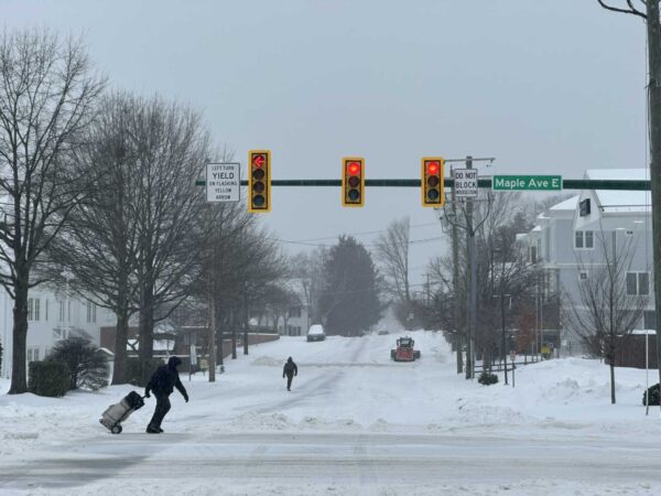
Roadways in Fairfax County are covered in snow after flurries first started to fall around 1 p.m. and local officials are warning drivers to continue to stay home.

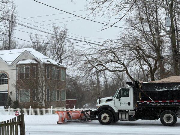
The Virginia Department of Transportation has trucks working on major roadways, according to its snow plow map.

As previously advised, Virginia State Police spokesperson Shelby Crouch said to avoid travel today through tomorrow to allow VDOT crews to safely and effectively work.

“During the current winter storm impacting the Commonwealth, Virginia State Police troopers have responded to 369 traffic crashes and 282 disabled vehicles since 12:01 a.m. Sunday (Jan. 16) through 4:30 p.m. Sunday (Jan. 16),” Crouch said. “The majority of those crashes have involved only damage to vehicles. There have been no reported traffic fatalities during this time period.”

State police have responded to 36 disabled vehicles & 41 traffic crashes in Fairfax today.

Dominion Energy has not seen any power outages in Fairfax County as of publication, according to its outage map, but the company said it was monitoring the storm in Virginia and had crews ready to respond to any damage or power outages.

The Washington Post’s Capital Weather Gang estimated there was about an inch of snow in the area as of 4:30 p.m.

By 5 p.m., Reston Parkway and Sunset Hills Road near Reston were blanketed with snow as it continued to fall. The National Weather Service predicts freezing rain will begin around 9 p.m., with a chance of 1 to 2 inches of new snow accumulation after that.

Here’s what the NWS says to expect through the evening:

Snow should overspread all of our region by 21Z with light to moderate snow likely for most of the region through the early parts of the evening. A warm layer aloft should start moving into our region at 850 mb this evening leading to transition from snow to a wintry mix of snow, sleet and freezing rain for areas east of I-81. Areas along the I-95 corridor should start transitioning first between 5 and 8 pm this evening, with the warm layer continuing to push westward with the transition shifting over the shenadoah Valley by the 6 to 9pm period. The I-95 corridor should become all rain by the 7 to 9pm period as temperatures rise above freezing with the all rain layer likely reaching as far west as areas just east of I-81. Our high temperatures for Monday may very well occur around midnight or early Monday morning due to the warming on-shore flow. I believe the Allegheny front should remain mainly snow with periods of sleet and freezing rain mixing in at times this evening and into early Monday morning. Precipitation is expected to start tapering off early Monday morning between midnight and 2am with snow likely to continue along the Allegheny front into Monday.

A strong low level easterly jet is expected to form late this evening and into Monday evening. Winds of 35 to 45 mph`s will be possible over our higher elevations with 25 to 35 knots possible else where. Continued light to moderate snow showers along the Allegheny front will combine with the strong winds to produce some near Blizzard like conditions along and west of the Allegheny Mtns. We have highlighted this threat in our WSW product. The overnight
gusty winds should taper off by daybreak but gusts of 20 to 25 mph should continue into Monday morning.

0 Comments
Expected snowfall for D.C. area on Jan. 16-17 (via National Weather Service/Twitter)

(Updated at 11:55 a.m.) A Winter Weather Advisory has been issued for Fairfax County, as the D.C. area prepares for its second snowstorm of the year.

In effect from 1 p.m. today (Sunday) to 1 a.m. tomorrow (Monday), the alert warns of mixed precipitation that will create slippery, hazardous road conditions.

The National Weather Service anticipates snow accumulations of 1 to 3 inches and one-tenth of an inch of ice, along with wind gusts that could reach speeds of 45 miles per hour. With temperatures expected to drop below freezing tonight, travel could be affected through tomorrow morning.

The Virginia Department of Transportation began pretreating roads with brine on Friday (Jan. 14) and mobilized snow plow crews this morning, deploying more than 3,800 pieces of equipment throughout Northern Virginia, according to a 10 a.m. snow update.

“Plan your trips now to avoid all nonessential travel on Sunday into Monday, especially during the height of the storm, to avoid deteriorating conditions and to allow crews room to work,” VDOT said.

Fairfax County Public Schools has canceled all activities on school grounds after 1 p.m.

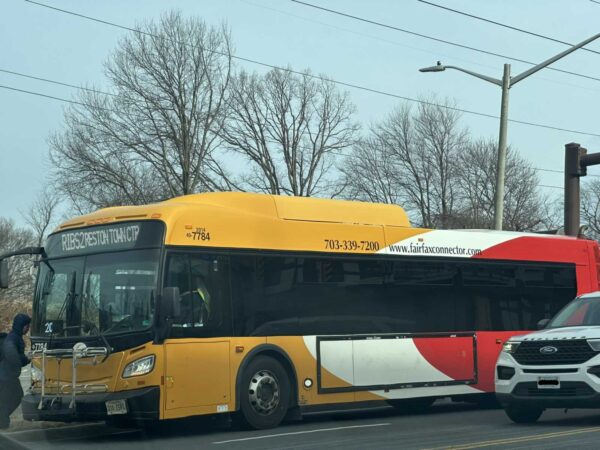
Fairfax Connector plans to continue operating regular Sunday service, but detours could be implemented along some routes starting at 3 p.m.

After the Jan. 3 snowstorm took out power for about 500,000 households across the state, including tens of thousands of people in Fairfax County, Dominion Energy says crews and contractors from as far away as Louisiana and Oklahoma will be on hand to assist with its emergency response.

“Our crews are ready to once again rise to any challenge this storm will bring,” Charlene Whitfield, Dominion’s senior vice president of power delivery, said in a news release. “Customers should prepare, as well, so they can remain safe until our work is done.”

Dominion advises avoiding downed power lines and reporting outages through its website or to 1-866-DOM-HELP (1-866-366-4357) to ensure the fastest possible response.

Map via National Weather Service/Twitter

0 Comments

Another winter storm is brewing, potentially bringing 3 to 4 inches of snow to Fairfax County on Sunday and Monday (Jan. 16-17).

The National Weather Service has issued a Winter Storm Watch for the D.C. area, including Fairfax County. The alert will take effect at 1 p.m. on Sunday and last through 7 a.m. Monday, when the snow is  expected to turn into a wintry mix with sleet and freezing rain.

The NWS projects total snow accumulations of 1 to 3 inches as the most likely scenario, though up to 5 inches could be possible. The forecast also includes up to an one-tenth of an inch of ice accumulation and wind gusts that could reach 45 miles per hour.

“Snow may fall at 1 to 3 inches per hour late Sunday afternoon and early Sunday evening, resulting in
nearly impassable roads,” the alert says, warning that slippery and hazardous road conditions could affect Monday’s commute.

Preparations for the coming storm are underway, with the Virginia Department of Transportation treating roads throughout Northern Virginia today.

“Since dry conditions are expected, we are able to brine throughout Fairfax, Loudoun and Prince William counties,” VDOT spokesperson Kathleen Leonard told FFXnow. “Drivers will start to see those white brine lines, which really just gives us a little bit of time at the beginning of the storm, preventing ice from bonding to the pavement.”

Leonard says snow trucks will be staged tomorrow (Saturday) so that plowing operations can begin once the area gets about two inches of snow.

Gov. Ralph Northam, who will be officially succeeded by Glenn Youngkin tomorrow, declared a state of emergency today in anticipation of the storm.

“Declaring a state of emergency now allows our emergency responders to prepare, and to move supplies and equipment where they expect to need them the most,” Northam said. “This also gives Governor-elect Youngkin the ability to respond to any storm needs swiftly. I urge Virginians to take this storm seriously and make preparations now.”

VDOT and the Virginia State Police are both advising people to avoid traveling during the storm, though the police agency says all available troopers will be on patrol to respond to crashes and disabled drivers.

While schools will be closed on Monday for Martin Luther King Jr. Day, Fairfax County Public Schools says students and staff should bring their computers home today in case a snow day is needed next week.

Any snow days will include virtual learning, because the school system already used its five designated “traditional” snow days after a snowstorm slammed the D.C. region last week, disrupting transportation and power networks.

Dropping up to 3 inches of snow per hour, Winter Storm Frida affected 58,000 miles of roadway across Virginia and took out electricity for approximately 500,000 households, according to VDOT, which is part of a multi-agency review of the state’s response after hundreds of motorists were stranded for hours on I-95.

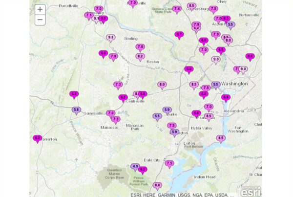
In Fairfax County, snowfall totals on Jan. 3 ranged from 4.5 inches in Herndon to 11.8 inches in Franconia.

Photo via National Weather Service

0 Comments

(Updated at 5:25 p.m.) Up to 5 more inches of snow could come to Fairfax County and nearby areas.

The National Weather Service has issued a Winter Weather Advisory, warning that an additional 2 to 4 inches of snow is forecast to come between 9 p.m. tomorrow (Thursday) and 5 a.m. Friday (Jan. 7). It said drivers should expect slippery road conditions.

A winter weather advisory means that hazardous weather is “occurring, imminent or likely.”

The chaotic weather comes after over more than a half foot of snow fell across the county on Monday (Jan. 3), causing crashes and shutting down services, roads and power.

Per the alert:

…WINTER WEATHER ADVISORY IN EFFECT FROM 9 PM THURSDAY TO 5 AM
EST FRIDAY…

* WHAT…Snow. Total snow accumulations 2 to 4 inches. Isolated high amounts of around 5 inches are possible.

* WHERE…The District of Columbia, portions of northern and central Maryland, and northern Virginia.

* WHEN…From 9 PM Thursday to 5 AM EST Friday.

* IMPACTS…Plan on slippery road conditions. The hazardous conditions could impact the Friday morning commute.

* ADDITIONAL DETAILS…The heaviest snow is expected between 10 PM and 2 AM when snowfall rates of 1 inch per hour are possible.

PRECAUTIONARY/PREPAREDNESS ACTIONS…

Slow down and use caution while traveling.

When venturing outside, watch your first few steps taken on steps, sidewalks, and driveways, which could be icy and slippery, increasing your risk of a fall and injury.

Fairfax County Public Schools announced just after 5 p.m. that classes will be canceled again. Students were scheduled to return from winter break on Monday, but it has now been extended four extra days.

“Across Fairfax County, we continue to receive reports of roadways, sidewalks and pathways that remain unsafe for our students, and so we are closing schools out of an abundance of caution, and the concern for safety of our students,” FCPS said on social media.

Unlike with previous cancellations, the school system says its COVID-19 testing sites will all be open for students and staff experiencing symptoms. Plans to resume meal kit distributions are also move forward.

0 Comments

Fairfax County Public Schools won’t hold classes for a third consecutive day this week, citing inclement weather in an announcement released just before 5 p.m.

The region could see freezing rain between 4 a.m. and 9 a.m. tomorrow (Wednesday), according to the National Weather Service, following Monday’s snowstorm that pummeled the region with over half a foot of snow in areas.

The NWS has issued a “Potential Winter Commuting Hazard” for Fairfax County, warning that there is a 30-50% chance of light freezing rain after 4 a.m. “that could turn into a glaze of ice on area roads.”

“Plan ahead by staying off the roads if possible,” the county said in a blog post. “If you do need to travel, allow for additional time and be extra cautious and alert while driving.”

FCPS said in a Facebook post that meal distribution will return at regular locations on Thursday (Jan. 6), and school offices will open later in the day tomorrow (Wednesday).

The school system tentatively expects to open its COVID-19 testing sites to staff and students who are experiencing symptoms, though a final decision won’t be made until tomorrow morning. Pre-registration is required, and only PCR tests will be available.

Testing is not required for students to be able to return to schools, whenever they reopen.

FCPS’ announcement comes after Monday’s snowstorm caused tens of thousands of Fairfax County homes to lose power and hundreds of crashes. As of this evening (Tuesday), Dominion’s power outage map showed over 7,000 customers in the county with electric issues.

The storm disrupted travel, but Fairfax Connector buses were slated to resume tomorrow (Wednesday). County officials asked commuters to use its BusTracker system in case any detours were still in effect.

0 Comments
A snowplow on Legato Road at the intersection of West Ox Road near the Fair Oaks Mall (Photo by Benita Mwali)

(Updated at 2:35 p.m.) Local students will get another day of winter break, thanks to the snow that has inundated Fairfax County and the rest of the D.C. region.

Fairfax County Public Schools announced at 1:17 p.m. that classes have been canceled tomorrow (Tuesday), delaying the return of students for a second consecutive day. There will be no virtual or in-person learning, and all activities on school grounds have been canceled.

In the meantime, the snow has wreaked havoc on people’s travel plans and the county’s power grid.

Drivers faced delays, both by choice and by nature, where even some pickup trucks and emergency vehicles struggled as a snowstorm forced widespread shutdowns from schools to offices and roadways.

At least nine roads in the county were closed due to snow and ice or downed trees and wires, as of 1:50 p.m., according to the Fairfax County Police Department. Major roads affected include Richmond Highway near Huntley Meadows Park and Prosperity Avenue in Mantua.

As of 12:30 p.m., the Virginia State Police had responded to 559 traffic crashes and 522 disabled vehicles across the state since midnight.

Fairfax Connector bus service has been suspended since 11:45 a.m. with no updates on when it might resume.

The Fairfax County Fire and Rescue Department reported that firefighters and paramedics have spent all morning responding to reports of downed wires and trees, which have created potentially dangerous conditions while taking out power for around 40,000 Dominion Energy customers.

Downed power lines and trees can be reported to 9-1-1, Dominion Energy and NOVEC, or the Virginia Department of Transportation, depending on the severity of the situation and where the incident occurs.

The snow storm, transforming much of the region even before morning commutes, caught some people off guard after temperatures reached the low 60s yesterday (Sunday).

0 Comments
×

Subscribe to our mailing list