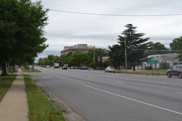
Commuters who use Route 29 in the Fairfax Corner area harbor concerns about poor pedestrian and bicycle infrastructure, safety and traffic congestion, the results from a recent Route 29 survey suggest.
The Fairfax Department of Transportation conducted the survey from Feb. 12 to March 1 as part of an ongoing effort to make the 2.9-mile stretch between Buckleys Gate Drive and Jermantown Road more pedestrian and cyclist-friendly.
Nearly 400 people responded to the survey, about half of them saying they commute along the corridor regularly for errands, work or school. Three-quarters of those respondents drive, seven bike, two carpool, one walks, and 64 use various modes of travel.
While many respondents were content with the current state of the corridor, a majority expressed a desire for wider sidewalks and bicycle lanes, along with greater separation for those facilities from the road. The survey also identified frustrations with the roadway’s short turn lanes, which some said create long left-turn delays.
During a virtual public meeting last Tuesday (March 12), FCDOT’s Arpita Chatterjee said the newly unveiled survey findings support the department’s plans to shift away from interchanges, road widenings, and other auto-focused improvements and “explore ways to increase walking and biking along the corridor.”
“The easiest way to describe Route 29 through this corridor is kind of a mess,” Braddock District Supervisor James Walkinshaw said at the meeting. “And this study is our opportunity to develop a much better vision for this stretch of Route 29.”
Almost 20 people who attended the virtual meeting, but just one person spoke. Their comments centered on safety at the Jermantown Road intersection, and they recommended improving sidewalk lighting.
Though staff won’t present its final recommendations until summer 2024, Chatterjee said FCDOT plans to implement mitigation measures for intersections experiencing significant congestion, including Waples Mill and Shirley Gate Road.
“Overall intersection delays were over 100 seconds and side streets delays are even higher,” Chatterjee said. “But that said, we will investigate what mitigation would be possible to get the intersection of Waples Mill and Shirley Gate roads to operate more efficiently, similar or at least close to Legato Road and Monument Drive.”
The online survey will stay open until March 29, and participants can leave a recorded voicemail at 703-890-5898 using the code 3941.
There will be a second virtual meeting in the early part of this summer before staff present their final recommendations to the Board of Supervisors.
The Fairfax County Department of Transportation is asking commuters for feedback on changes they would like to see along the Route 29 corridor.
The department recently launched a survey asking commuters how often they travel Route 29, the duration of their travel, and the mode of transportation they use.
The survey focuses on a 2.9-mile stretch of Route 29 near Fairfax City between Buckleys Gate Drive and Jermantown Road. The survey will help the county identify multi-modal solutions to support increased development in the area, according to Fairfax County Transportation Planning Section Chief Michael Garcia.
The county is seeking to shift away from the interchanges, road widenings and other auto-focused improvements currently recommended for the corridor.
“There have been development proposals in the corridor and trying to accommodate the Comprehensive Plan recommendations for interchanges may not be in harmony with how the area has developed and will continue to develop,” Garcia told FFXnow.
Instead, his team is working with Fairfax City and the Virginia Department of Transportation to study low-cost multi-modal solutions, such as bicycle and pedestrian upgrades, with the goal of preserving future mobility and accessibility in the corridor, as well as enhancing public spaces.
Garcia says the feedback collected from the survey will play a crucial role in shaping county staff’s recommendations for transportation improvements. Interested participants can fill out the survey online or leave a recorded message at 703-890-5898 (Project Code 3941) by Friday, March 1, 2024.
FCDOT will present the results at a virtual public meeting on Tuesday, March 12, at 7 p.m., per the study website.
Garcia noted that FCDOT’s study of this Route 29 section is “timely,” since the county is in the process of updating its plan for the Fairfax Center area, which spans about 5,500 acres between Centreville and Fairfax City bounded by Route 50 and 29.
As authorized by the Board of Supervisors last year, the county’s Department of Planning and Development is currently reevaluating its vision for the “core area” that includes Fair Oaks Mall and the Fairfax County Government Center.
Building on past reviews of the area-wide and low-density residential neighborhood goals, this third phase of the planning study will include a transportation analysis and consideration of additional housing on the Reserve at Fairfax Corner Apartments site. The property owner, Equity Residential, has requested more density at 11727 Fairfax Woods Way for a 405-unit residential building “to complement” the existing apartments.
Public art and social spaces will be key to transforming southern Richmond Highway into a community, a panel of local land use experts says.
Last week, the consulting nonprofit Urban Land Institute (ULI) presented recommendations at the Hybla Valley Community Center for how to foster economic growth in the corridor, while preserving its cultural identity through “placemaking.”
Placemaking highlights the unique aspects of a community, including its people and history, which encourages activity and “helps to make the space vibrant,” Southeast Fairfax Development Corporation (SFDC) Executive Director Evan Kaufman told FFXnow in an interview.
“Obviously, you can go to any corporate strip mall across the country, and you’re not really going to find a sense of place,” Kaufman said. “You’ll probably find an Applebee’s, Wendy’s, and Home Depot, which are great. Those provide services, but they’re not really telling a story of the community.”
After spending two days studying four miles of the corridor from Jeff Todd Way to Lockheed Blvd, the assembled panelists proposed creating community spaces for socializing — like parks and event venues — and enhancing the area with public art and more greenery.
The full findings will be detailed in a report that’s expected in the next six to eight weeks, according to the SFDC, which worked with the Fairfax County Department of Planning and Development to finance the study.
ULI will also conduct follow-up surveys to track the implementation of the panel’s recommendations.
Designated as a focus area for commercial revitalization since 1986, the Richmond Highway corridor has seen those efforts intensify in recent years, as the county and Virginia Department of Transportation prepare to widen the road and add bus rapid transit service.
With some community members fearing negative impacts from the road widening project in particular on traffic, pedestrian safety and local businesses, the ULI study aims to identify strategies that can stimulate economic growth and improve the area’s quality of life.
In the short term, the consultant’s panelists recommended establishing a visitors center and using signage to guide visitors and residents to businesses affected by construction. Panelists also proposed using landscaping, pop-up activities and murals to beautify shopping plazas and make commercial areas more inviting. Read More
Updated at 8:40 p.m. on 11/8/2023 — The community workshop has been relocated to the cafeteria of Langston Hughes Middle School (11401 Ridge Heights Road).
Earlier: Fairfax County is formally launching a new study on how to shift Wiehle Avenue from a car-dominated, suburban road to a multimodal, urban street.
The Wiehle Avenue study kicks off with an in-person community workshop on Nov. 13.
After diving into the background and purpose of the study, the county will open the floor for attendees to brainstorm ideas on how to improve the road between Sunrise Valley Drive and the Washington & Old Dominion Trail in Reston.
The ideas proposed by the community will later be refined into three concepts “to test in future (year 2030) scenarios” by the Fairfax County Department of Transporation and its consultant, Fehr & Peers, FCDOT spokesperson Freddy Serrano says.
“[The scenarios] will give us an overview of how potential changes may affect traffic operations and accessibility and comfort for pedestrians, bicyclists, and transit users,” Serrano told FFXnow. “We will take these concepts and the resulting future analysis back to the public early next year and will solicit their feedback to arrive at a preferred concept for Wiehle Avenue.”
The Fairfax County Board of Supervisors initiated the Wiehle Avenue study as a follow-on motion after approving TF Cornerstone’s Campus Commons redevelopment plan in 2019.
The project prompted vigorous debate on the safety of a proposed pedestrian crossing at the intersection Dulles Toll Road ramps and Wiehle Avenue. An alternative is being explored after the developer offered $1.65 million instead of developing a solution.
The county previously convened a study group to evaluate options for that crossing, but the group didn’t support any of the developer’s proposals.
FCDOT says this new study will take a broader look at the corridor and how it may have been affected by the opening of Metro’s Silver Line extension last year.
“This effort is expected to identify new and improved bicycle/pedestrian facilities and intersection treatments, as well as evaluate the potential reconfiguration of vehicular lanes and/or widths for current and future land use scenarios,” the department said in a news release.
The community meeting takes place from 5:30-9 p.m. in the second floor conference room of 1900 Reston Metro Plaza. A light dinner will be provided. RSVPs are encouraged through an online feedback form.
The mental health crisis is costing the Northern Virginia region $8 billion a year in unrealized economic output, according to a new report from the Community Foundation for Northern Virginia.
The report from the foundation’s research arm, Insight Region, found that the economic loss caused by mental health has quadrupled since 2019, exacerbated by the COVID-19 pandemic that began in early 2020.
In 2019, worker mental health issues cost the region about 1% in productivity – the equivalent of $2.1 billion – in potential gross regional product (GRP). About 11% of working adults were experiencing mild anxiety or depression in that timeframe.
However, during the pandemic, more than half of all workers reported levels of anxiety or depression. As of May 2023, that statistic held with 53% of the workforce struggling.
The elevated levels of mental health needs caused productivity losses to increase by 2.1 percentage points – or over $8 billion in potential GRP each year, according to the report.
Millions of Americans exited the workforce over the last three years, and one in four blamed their departure on mental health, the report says. That lost employment negatively impacts more than just the worker and their family.
“It also affects team members who must compensate for the lost output; employers who bear the cost of recruiting, hiring, and onboarding new staff; and the local economy in unrealized gross regional product,” the report said.
Most workers with anxiety and depression stay on the job, meaning some of the lost productivity can be attributed to absenteeism and presenteeism – or an employee who is technically on the job but not engaged. This lack of engagement can often result in procrastination and missed deadlines.
Overall, for every worker with a mental health need, their team can expect total productivity to decline by 5% to 13%, or two to five lost hours in a 40-hour work week, according to the report.
“These behaviors can lead to a precipitous decline in productivity, at rates far higher than other conditions,” the report said.
The Community Foundation collaborated on the research with George Mason University. Keith Waters, assistant director at the university’s Center for Regional Analysis, presented the findings [earlier this month] during an event at the foundation’s headquarters in Fairfax.
Waters said the research showed that as mental health issues become more severe, so do productivity losses.
“As you go from sort of no mental health issues to more severe mental health issues, your productivity losses become more severe, you miss work more and then your presenteeism issues become more severe,” he added. Read More
The Fairfax County Department of Transportation is ready to take a hard look at the future of Gallows Road.
The department will introduce a Gallows Road Multimodal Study with two public meetings next week, seeking feedback on enhancing mobility and safety along the major road between Tysons and Annandale. It will also give an update on the current travel conditions.
According to FCDOT communications head Freddy Serrano, the study is needed to address various transportation and connectivity challenges in the Gallows Road corridor.
“[Those include] pedestrian and bicycle facilities, limited mobility options, traffic conditions, and barriers created by I-495,” he said. “It aims to explore opportunities to mitigate these barriers and improve multimodal mobility between the planned land uses on the east and west sides of the interstate.”
Serrano says the goal is to find solutions and improve accessibility for everyone who uses the corridor, while supporting planned development.
Merrifield in particular is poised for growth. This spring, the county designated proposals to redevelop aging buildings in the area as top priorities for review, and plans to convert former Inova office buildings into live/work units recently raised concerns about traffic backups at the Gallows and Gatehouse Road intersection.
“Additionally, the study is essential for securing funding and planning for transportation infrastructure projects that align with the goals of the comprehensive plan and accommodate future development,” Serrano said.
The study stems from a comprehensive plan amendment that the Fairfax County Board of Supervisors approved in 2019, opening up the Merrifield Suburban Center to more mixed-use development. With the vote, the board also directed staff to:
- Conduct a comprehensive study of multimodal transportation opportunities
- Study the barriers to connectivity in the Merrifield suburban center created by I-495, and opportunities to mitigate the barriers
- Develop a funding plan for the transportation infrastructure improvements recommended in the Merrifield suburban center comprehensive plan.
The study started late last year, and it’s expected to wrap up by 2024.
“Overall, the study aims to improve transportation infrastructure and connectivity within the Merrifield suburban center and along Gallows Road to support sustainable development and enhance mobility for residents and stakeholders in the area,” Serrano said.
The first meeting is scheduled for Tuesday, Sept. 19. at 7 p.m. and will be virtual. A second meeting will be held in person at Luther Jackson Middle School (3020 Gallows Road) on Wednesday, Sept. 20 at 7 p.m.
Comments will be accepted until the end of the business day on Friday, Oct. 6.
Tysons has seen some promising developments in its transportation network in recent years, but many obstacles remain to achieving Fairfax County’s vision of a truly accessible downtown, a market study released earlier this month suggests.
Commissioned by the Tysons Community Alliance, the 2023 Tysons Market Study characterizes the 2,100-acre urban center as “somewhat walkable” — meaning at least some errands can be accomplished on foot — based on its official average Walk Score of 57.
Calculated based on population density, the distance to amenities, block lengths and other factors, the walk score ticked up from the 54 that Tysons got in 2020 when the COVID-19 pandemic began. The area is more walkable than Reston, which has a score of 40, but it falls short of more urban areas in the region, including Crystal City in Arlington (71) and downtown D.C. (98), according to the study.
The most walkable properties are in central Tysons, particularly around the Greensboro Metro station, which is also where multifamily housing has concentrated, TCA CEO Katie Cristol notes.
“That increase in the walk score is a real validation…of how environmentally sustainable, how much better in terms of quality of life the new residential development has been in Tysons,” Cristol said. “It is in the right places, it is in places that are walkable, so more Tysonians live [in places] walkable to Metro and other amenities and can easily reach the necessities of their lives on foot than could before.”
However, properties east of Route 123 — where most for-sale and single-family units are located — tend to be more car-dependent, per the study. Based on 2021 Census data, the percentage of car-free households in Tysons has jumped up to 5.1% — an over 50% increase from 2019 — but 47% of households still own two vehicles.
In addition, the TCA identified 4.6 miles of missing sidewalks, and most of the 24 miles of sidewalk that do exist are just 4 feet wide, which “is not ideal for a growing area seeking to promote walking,” the study says.
The improved Walk Score was also tempered by a lowered Bike Score, which dipped from 49 in 2020 to 43 this year. Categorized as “somewhat bikeable” with “minimal” infrastructure, Tysons trails Reston, which stayed flat at 54 over that time frame. Read More
Tysons is increasingly becoming a place where people live, but a recent market study from the Tysons Community Alliance raised some questions about its future as a place where people work.
Released on Aug. 4, the study paints divergent pictures of the two commercial sectors that have defined Tysons since the 1960s — office and retail — as they navigate a post-pandemic world of remote work and online shopping.
While retail visits in Tysons have returned to 92% of the 2019 average, foot traffic at office buildings is at 77% of pre-pandemic levels, according to the study, which was conducted by consultants HR&A, Toole Design and Wells & Associates.
That’s still better than D.C., where office visitation is at just 70% of pre-pandemic levels, but the study found that Tysons is seeing “somewhat slower employment growth” both in general and among office users than Fairfax County and the overall D.C. region — a lag expected to continue through 2028.
“Tysons grew more slowly than surrounding Fairfax County and the D.C. [metropolitan area] in the last three years and is projected to continue growing more slowly in the next five years,” a workforce growth analysis summary said, identifying health care as the industry projected to add the most jobs in Tysons over the next five years.
Even though over 85% of Tysons workers are in industries that traditionally use offices, led by 47,100 workers in the broad category of “professional services,” the area’s office vacancy rate has climbed from 14.8% in 2019 to 20% so far this year.
That exceeds the county’s 16.7% vacancy rate, which is a 10-year high, Fairfax County Economic Development Authority leaders told the Board of Supervisors at an economic advisory committee meeting on July 18.
Constituting 5.6 million of the area’s 27.6 million square feet of office space, the vacancies have particularly affected lower class, older offices built before 1990, suggesting a “preference for newer and nicer properties,” the study report says.
Despite the “historically high” vacancy rates, average rents have grown 24% since 2015 to match the D.C. area’s average of $39 per square foot, driven in part by the $65-per-square-foot asking price at the Tysons Central office building that was completed last year.
Tysons also has an additional 1.9 million square feet of office under construction or planned, though the majority of upcoming development is residential.
“If vacancies remain high, future deliveries could result in stagnant rents and continued high vacancy,” the report says. “For developers to fill pipeline office space, office-using jobs in Tysons need to grow at 1.4 times the projected growth of 3,300 jobs between 2023 and 2033.” Read More
Tysons is going to need more housing.
Home to 17,000 people in 2010, the urban center saw its population grow to 29,620 people by 2021, according to a market study released Friday (Aug. 4) by the Tysons Community Alliance. Fairfax County staff reported earlier this year that there are now 30,124 residents.
Much of that influx came just in the past five years. Tysons added 13,000 households at a growth rate of 19% from 2018 to 2021 — tripling the 6% seen from 2015 to 2018, the market study found.
Its residential growth has easily exceeded that of Fairfax County as a whole (4% from 2018-2021) as well as the overall D.C. region (7% over that time period).
“Tysons is no longer just a place to shop and go to work,” said Providence District Supervisor Dalia Palchik, who represents most of Tysons. “The addition of Metro and now the completion of the Silver Line, investment in parks and public amenities, as well as the construction of bike trails, is creating connections within Tysons, to the region and beyond. People recognize Tysons as the type of community that they want to call home.”
While the county’s population has started to stagnate, Tysons is projected to reach more than 42,000 residents by 2030, though that pace would still fall short of the county’s goal of 100,000 residents by 2050.
To accommodate that growth, the area will need to add 4,400 more housing units, including an additional 1,900 affordable units, by 2032, the report estimates.
Tysons has made progress on building up its housing stock, which totals 8,600 units with 1,200 coming online since 2020 — a 16% increase. Another 1,600 units are under construction, and 624 have been approved but are still in planning, including about 516 units in the all-affordable Dominion Square West project.
Of the roughly 2,500 existing affordable units, 1,800 are “naturally occurring” because their market rate is affordable to households earning up to 80% of the area median income (AMI), which is $152,000 for a household of four people in the D.C. area.
However, the vast majority of the 700 committed affordable housing units in Tysons is aimed at people making 60% or more of the AMI. Only 7% are available to people earning under $76,000 a year, and there are no units affordable to people making under $45,000. Read More
Vienna’s tree canopy may be shrinking, but the trees still standing are actually doing quite well, a recently released town-wide inventory found.
About 88% of the 7,224 trees on public land examined by PlanIT Geo are in “fair” or “good” condition, the consultant told the Vienna Town Council when presenting its findings on June 20.
“I’ve looked at a lot of data across a lot of projects, and I don’t think I’ve seen one as good of health as Vienna’s trees are in,” PlanIT Geo Director of Field Operations TJ Wood said, decreeing the town’s tree population to be in “very good health” overall.
That does still leave roughly 722 trees that were found to be in poor condition or dead, according to the inventory, which was initiated based on a recommendation by an urban tree canopy assessment that the town received last October.
Focused on trees on public property, including any within the street right-of-way and parks, the inventory identified tulip poplars as the species with the highest mortality rate at 12 dead trees. The species with the biggest showing in the “poor” category was red maple, which isn’t surprising when it constitutes 16.6% of the total inventory, Wood said.
He reported that, while Vienna has “a very diverse urban forest overall” with 162 unique species, the top 10 most common species make up almost 51% of the population, led by the 1,200 red maples recorded by PlanIT Geo.
“There’s a lot of room to diversify tree plantings and try new species out,” Wood said.
In another sign that Vienna could use some more trees, less than 30% of its trees have a diameter of 1 to 6 inches, suggesting the town is “lacking in new plantings.” Wood added that the town could get close to the ideal rate of 40% if it puts a tree in all 1,222 sites that the inventory identified as suitable for plantings.
Despite the overall healthiness of Vienna’s urban forest, the inventory says 3,968 trees, or 65% are in need of some maintenance. The majority are recommended for some kind of pruning to remove dead wood and hanging limbs or prevent them from growing into utility lines, signs and other infrastructure.
However, 290 trees were deemed to be at moderate risk, meaning they should be revisited at least once a year, and there are 25 high-risk trees.
“I would recommend anyone visit immediately and get another set of eyes on them, decide whether those need to be removed, or if there is a mitigating factor that can be done to reduce that risk to public safety,” Wood said, pointing to a red maple with a split trunk that could fall on a street or sidewalk as an example of a high-risk tree.
Vienna Park Maintenance Superintendent Jeremy Edwards noted that there are still some trees in parks, including Northside and Wildwood, that haven’t been examined and added to the inventory yet. The survey didn’t include trees on private property and along the Washington & Old Dominion Trail, which isn’t town-owned.
All of the data collected is now publicly available through a TreePlotter database that town staff will be able to update in real time.
Last year’s tree canopy assessment found that the town’s canopy has declined by 163 acres, or 13%, since 2011. In January, the town council designated improving the canopy as a top priority for 2023, and Vienna is currently considering an ordinance that would require developers to preserve trees, instead of just replacing ones they cut down.