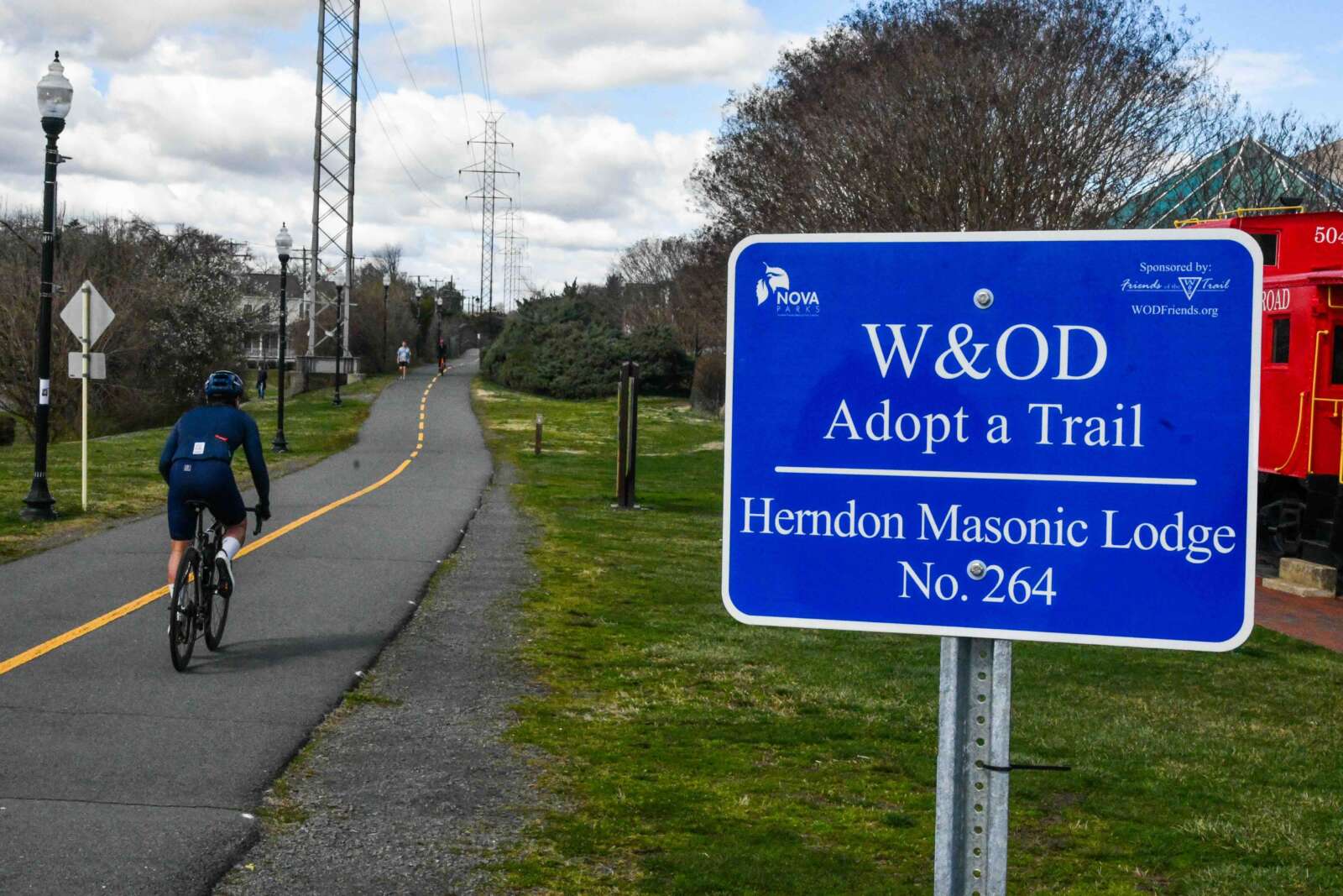
The Washington & Old Dominion (W&OD) Trail has reached the half-century mark.
The Northern Virginia Regional Park Authority (NOVA Parks) is marking the facility’s 50th anniversary with various activities from April to September, starting this Saturday (April 27) with a trail-wide cleanup event from 8:30 to 11:30 a.m.
Coinciding with the Rails to Trails Conservancy’s Celebrate Trails Day, the cleanup effort encourages volunteers to participate along the entire 45-mile trail, which stretches from Shirlington to Purcellville.
According to a press release, the trail was named after the former Washington & Old Dominion Railroad and played a vital role in the economic development of Northern Virginia. It linked Alexandria’s seaport to communities westward, including Arlington, Falls Church and Fairfax and Loudoun counties.
When the railroad was abandoned in 1968, Dominion Power installed transmission lines along the corridor. NOVA Parks immediately started studying the feasibility of converting the former railroad to a trail.
Nearly 50 years ago, on Sept. 7, 1974, the “first ride” was documented on the first stretch of the W&OD Trail — a 1.5-mile-long, 6-foot-wide asphalt path in Falls Church City, per the release. It made the amenity among the first rails-to-trails conversions in the U.S.
Over 14 years, NOVA Parks expanded the trail into a continuous 45-mile pathway from Arlington to the Town of Purcellville, serving over 2 million people annually.
To improve safety, several ‘grade-separated’ intersections have been installed along the trail’s 70 road crossings, allowing trail users and vehicles to travel at different levels. Recent upgrades include a bridge over Route 29 in Arlington, completed in 2021, and one over Wiehle Avenue in Reston that’s expected to open this June.
NOVA Parks has also been remaking parts of the trail into separate, parallel tracks for pedestrians and cyclists. A section in Falls Church became operational in 2021, and there are plans for expansion into other urban areas, including in Arlington and the Vienna, Herndon and Reston segments, per the release.
Additional events for the W&OD Trail’s 50th anniversary can be found on the NOVA Park’s website, which lists several scheduled through July.
APRIL 27: CELEBRATE TRAILS DAY
Make Earth Day everyday and show your appreciation of the trail by participating in the first ever 45-mile trail cleanup of the W&OD Trail. Celebrate Trails Day is presented by the Rails to Trails Conservancy. Sign up to volunteer anywhere along the 45-mile trail from Shirlington to Purcellville, Virginia.MAY 17: BIKE TO WORK DAY
Bike to Work Day celebrates the many benefits of using alternate transportation to work. The first 16,000 who register and attend at a pit stop receive a free Bike to Work Day t-shirt. Free giveaways, food, and beverages are available at participating locations, while supplies last. Register for and stop by one of the pit stops where NOVA Parks will be located:
- Falls Church, 6:30-9 a.m.
- Herndon, 5:30-10 a.m.
- Arlington, 7-9 a.m.
MAY 27: CITY OF FALLS CHURCH MEMORIAL DAY PARADE
Cheer on NOVA Parks’ W&OD-themed float at the City of Falls Church’s 42nd Annual Memorial Day Parade. The fun starts at 2 p.m. Learn more.JUNE 1: NATIONAL TRAILS DAY
Visit NOVA Parks at the W&OD Trail’s mile marker 0 in Shirlington, where EcoAction Arlington will coordinate volunteers for an invasive cleanup between the start of the W&OD Trail and George Mason Drive. National Trails Day is a day of service for hometown trails and the people who love them, presented by the American Hiking Society.JULY 4: CITY OF FAIRFAX INDEPENDENCE DAY PARADE
Cheer on NOVA Parks’ W&OD-themed float at the City of Fairfax’s Independence Day Parade and stay for the fireworks! The parade takes place 10am-noon in downtown Fairfax. The event is rain or shine. Learn more.
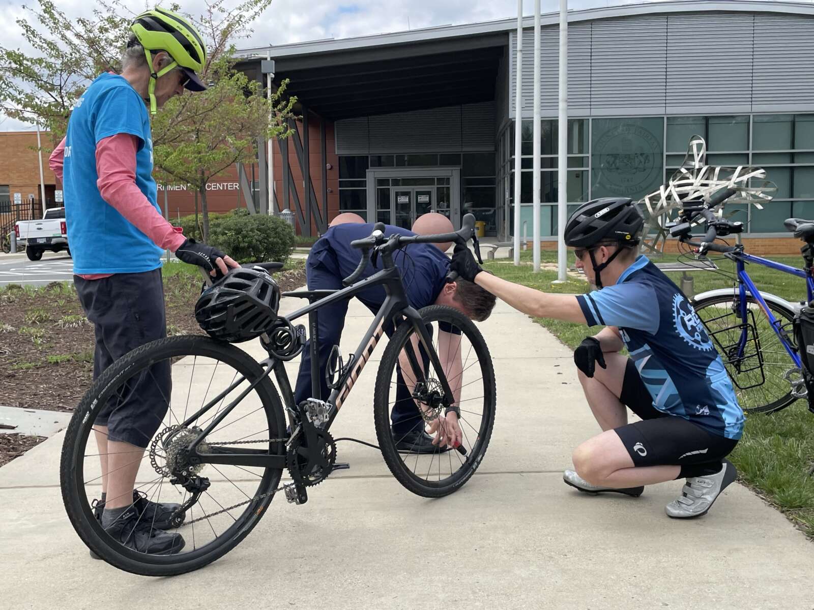
The annual Tour de Hunter Mill bicycle ride will kick into full gear early next month with new routes designed to show off sights and amenities throughout the district.
Registration is now open for the fourth iteration of the May 5 community bike ride, which was introduced in 2021 by Hunter Mill District Supervisor Walter Alcorn.
The event will feature two brand-new routes — one spanning 16 miles and the other covering 27 miles — that both begin and end at the North County Governmental Center (1801 Cameron Glen Drive) in Reston, with a rest stop at Meadowlark Botanical Gardens (9750 Meadowlark Gardens Court) in Wolf Trap.
This year’s routes will incorporate portions of the Washington & Old Dominion Trail and, for the first time, a new shared-use path along Route 7 (Leesburg Pike), according to Alcorn’s office.
The 10-foot-wide path is part of the Virginia Department of Transportation’s Route 7 widening, which is redesigning key intersections and adding a lane in each direction from Reston Avenue to Jarrett Valley Drive just outside of Tysons.
Though VDOT is targeting July 31 for completing the overall project, the trail is already functional enough for cyclists and pedestrians to use — at least between Reston Avenue and Towlston Road, according to Brian Worthy, a spokesperson for Alcorn’s office. A ribbon-cutting ceremony will be scheduled for late May.
“I’m excited that this year’s Tour de Hunter Mill will take advantage of the newest bike trail in the district — the new shared-used path along both sides of Leesburg Pike,” Alcorn said in a statement to FFXnow. “It will allow bikers to get from Reston all the way into Tysons safely, and it expands the transportation options for traveling safely along this busy corridor.”
Co-sponsored by the Fairfax Alliance for Better Bicycling (FABB), Reston Bike Club and Reston Community Center, the Tour de Hunter Mill costs $30 for adults, but children 15 and under can participate for free, as long as they’re accompanied by an adult.
The fee includes custom Tour de Hunter Mill socks for at least the first 165 registrants and a $5 donation to FABB, a volunteer, nonprofit organization that advocates for bicycling to be “safe, accessible and commonplace in Fairfax County for all ages, abilities and skill levels.”
The event will begin at 8 a.m. with riders checking in at a welcome table. After some opening remarks, the 27-mile ride will start at 8:30 a.m., and the shorter route will follow at 8:45 a.m. Once they finish, cyclists will be able to enjoy “food & fun” at the North County Governmental Center from 10 a.m. to noon, according to the registration page.
In a promotional video for the Tour de Hunter Mill, Reston Bike Club Vice Chairman Joel Kuester expressed hope that next year’s routes will utilize the new W&OD Trail bridge over Wiehle Avenue, which was installed earlier this month and is slated to open for use in June.
“Tour is a great way for folks to get out and experience the local roads, the trails and so on, so they know how to get around by bike,” FABB President Bruce Wright said in the video.
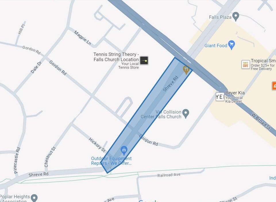
Design work is slated to begin this spring on a new shared-use path on Shreve Road just outside Falls Church City’s boundaries.
The Falls Church City Council approved an agreement on Monday (Feb. 12) to work with Fairfax County and provide funds for the project, which will add a 10-foot-wide path for bicyclists and pedestrians from the Route 7 (Leesburg Pike/West Broad Street) intersection to the Washington & Old Dominion Trail.
Other improvements will include a 6-foot-wide planting strip along Shreve Road, a crosswalk near the intersection of Shreve and Gordon Road intersection, benches near the W&OD Trail entrance, and stormwater management and drainage, Falls Church staff said in a report to the council.
Because the site is outside city limits, the county will be responsible for the project’s design and construction under the agreement.
“The concept is pretty simple and it’s pretty well-defined in the grant agreement, so we don’t think there’s going to be some curveball,” City Manager Wyatt Shields said at a Feb. 5 council work session. “…We’ve been working quite well with Fairfax County staff on this, so we feel very confident that we’re going to get what we want.”
The “West Falls Church Access to Transit and Multimodal Connectivity” project, as it’s formally known, is part of a larger effort by both the county and the city to add pedestrian and bicycle facilities connecting the W&OD Trail, the West Falls Church Metro station and Falls Church’s West End.
This component also “addresses a safety need” after a pedestrian was killed by a truck driver at the Shreve Road and Hickory Street intersection in 2019, according to a summary from the Northern Virginia Transportation Authority, which awarded $6.9 million to the city in 2020 to fund the project.
According to the staff report, Falls Church is also coordinating with the county and the Virginia Department of Transportation on the design of planned improvements around the Haycock Road side of the West Broad Street intersection.
Farther east on Haycock Road, a shared-use trail will be built over I-66 by developers in conjunction with a transformation of the West Falls Church Metro station’s parking lots into a mixed-use neighborhood.
Development has also been approved at Virginia Tech’s West Falls Church campus and is under construction on the city’s former high school site.
The Shreve Road project agreement still needs to be approved by the Fairfax County Board of Supervisors, which is scheduled to take action on April 16, according to Falls Church staff.
Per the staff report, the project is expected to be in design from this spring into fall 2025, putting it on track to begin construction in the fall of 2026 and finish in spring or summer 2027.
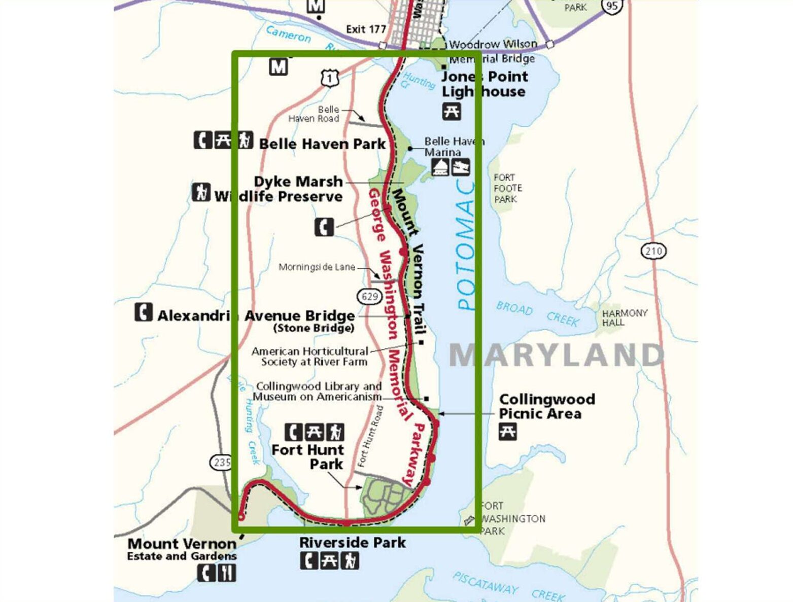
A stretch of the George Washington Memorial Parkway in southern Fairfax County is moving toward some major changes, as is the neighboring Mount Vernon Trail.
The National Park Service, which maintains the GW Parkway and much of the Mount Vernon Trail, plans to start “initial design work and planning for key aspects of the project” this year, per a Jan. 26 press release.
The announcement came after the Environmental Protection Agency released an assessment finding no significant environmental effects from the proposed changes, which will include a road diet and intersection and trail upgrades.
Once work is done, the parkway will be reduced to one southbound travel lane between Mount Vernon and Belle View Boulevard and one northbound lane between Mount Vernon and Tulane Drive. The Mount Vernon Trail, which is typically 8 or 9 feet wide right now, will be expanded to 10 or 12 feet wide in certain areas.
“The primary goal of the project is to enhance safety and reliability for users of the parkway and trail, while preserving the area’s scenic and historic character,” the NPS said. “As vital routes for both local and visiting cyclists, pedestrians, and drivers, these improvements are crucial for the continued enjoyment and safety of everyone who uses these routes.”
The affected portion of the GW Parkway covers about 8.5 miles from George Washington’s Mount Vernon estate (3200 Mount Vernon Memorial Highway) up to the Hunting Creek Bridge south of Alexandria City. According to the NPS, neither the south section of the Parkway nor its drainage systems has had a “comprehensive rehabilitation” since it was constructed in 1932.
Other changes will include a replacement of road surface that the NPS characterizes as “deteriorated” and improvements to drainage and stormwater management.
On the portion of the roadway with a road diet, the plan is to set up two right-hand shoulders or, at southbound intersections, right-turn lanes. Plus, the road will feature a new striped median or center turn lane.
A number of intersections will also see updates intended to make them safer, including the ones with Vernon View Drive, Waynewood Blvd and the access to Tulane Drive, Belle View Blvd and Morningside Lane. A study of crashes on GW Parkway in 2005-2015 and 2018-2019 revealed crashes were most severe at intersections with those roadways, mostly due to vehicle speeds.
Select intersections will also get crosswalks.
The NPS-administered portions of the Mount Vernon Trail will also see stormwater management improvements. Four trail bridges will be replaced, and repairs are planned for 29 more.
The planned trail widening comes nearly four years after NPS finished a study that determined the trail is “relatively narrow by modern standards.”
A full construction schedule and traffic management plan will come after initial design work and planning, but NPS documents indicate that the trail will remain usable to pedestrians and cyclists during construction. Closed sections will be serviced by alternate routes and temporary detours.
The affected section of the GW Parkway may see temporary lane closures, and access to its “recreational, natural, and cultural areas” may be restricted during construction, per the environmental assessment for the project.
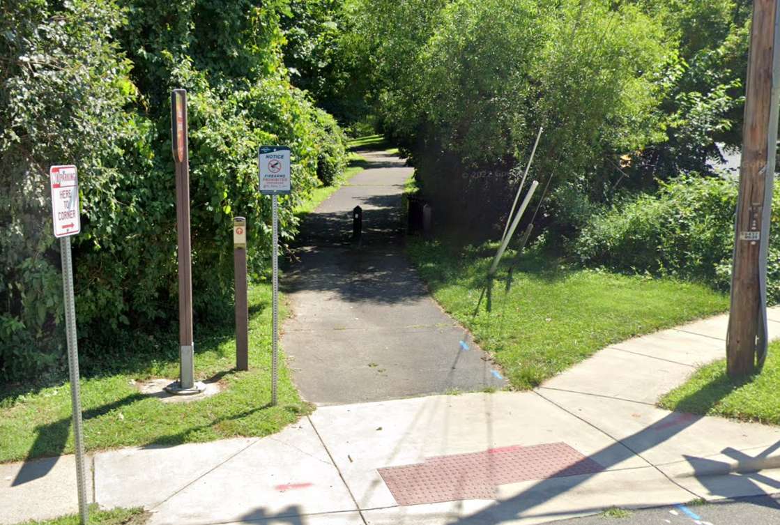
Fairfax City will complete the George Snyder Trail as planned after all.
In response to some community concerns, the Fairfax City Council discussed changing the pedestrian and bicycle project’s scope or even canceling it altogether during its meeting on Tuesday (Jan. 23). But council members failed to agree on any of the proposed alternatives, allowing the city to stay the course by default.
“None of the resolutions received enough support to change the current trail alignment,” City of Fairfax spokesperson Matthew Kaiser confirmed to FFXnow. “Staff will continue to acquire the needed land and come back to council in six months or so for [a construction] bid approval.”
The city has acquired rights-of-way for two of five needed parcels, Fairfax City Transportation Director Wendy Sanford told the council.
Over a decade in the making, the planned trail will run along the south side of Accotink Creek for about 1.8 miles from Chain Bridge Road (Route 123) to Fairfax Blvd (Route 50), connecting the existing George Snyder Trail to the I-66 shared-use path that’s slated to finish this spring.
However, some residents and environmental groups, including the Audubon Society of Northern Virginia, have objected to the proposed route for the 10-foot-wide trail, which will wind through a wooded area and require removing 553 trees. A segment in Shiloh Street Park that would’ve eliminated another 11 trees has been dropped from the plan, according to a city staff report.
The city has said 858 trees and 815 shrubs, all native species, will be planted to offset the lost trees.
Though the design is complete, Sanford said the council could cancel the project, realign the trail east of Fair Woods Parkway to use existing roads more, or construct only the segment west of Fair Woods Parkway.
Staff recommended either sticking with the existing plan or building only the western segment. If it cancels the project, the city would have to repay at least $395,000 in federal funding out of the $3 million it has spent so far, potentially putting it at a disadvantage for receiving future awards, Sanford said.
Most of the project’s $17.6 million budget comes from a concession fee that the I-66 Outside the Beltway toll lanes operator agreed to provide for transportation improvements in the corridor. Sanford said it’s unclear if any of that will need to be returned.
Revising the trail’s eastern segments would require restarting the design and engineering process, according to Sanford.
“This would delay the project, cause additional costs in engineering and potentially higher construction costs due to inflation when we do get to construction,” she told the council. “There’s also no assurance of feasibility for the new alignment or public support for any of the alternatives.”
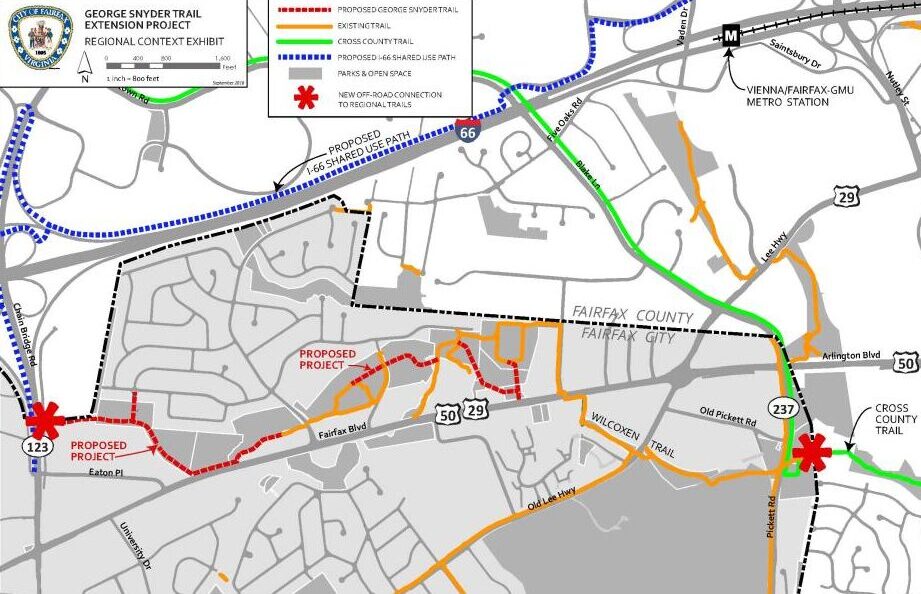
Councilmember Jeffrey Greenfield proposed building the western portion with two tweaks: merging it with the sidewalk on Route 50 where they run parallel and possibly rerouting it through WillowWood Plaza, an office complex on Eaton Place under review for redevelopment as housing. Read More
The Fairfax City Council will vote on the future of a much-debated trail planned in the heart of the city later this month.
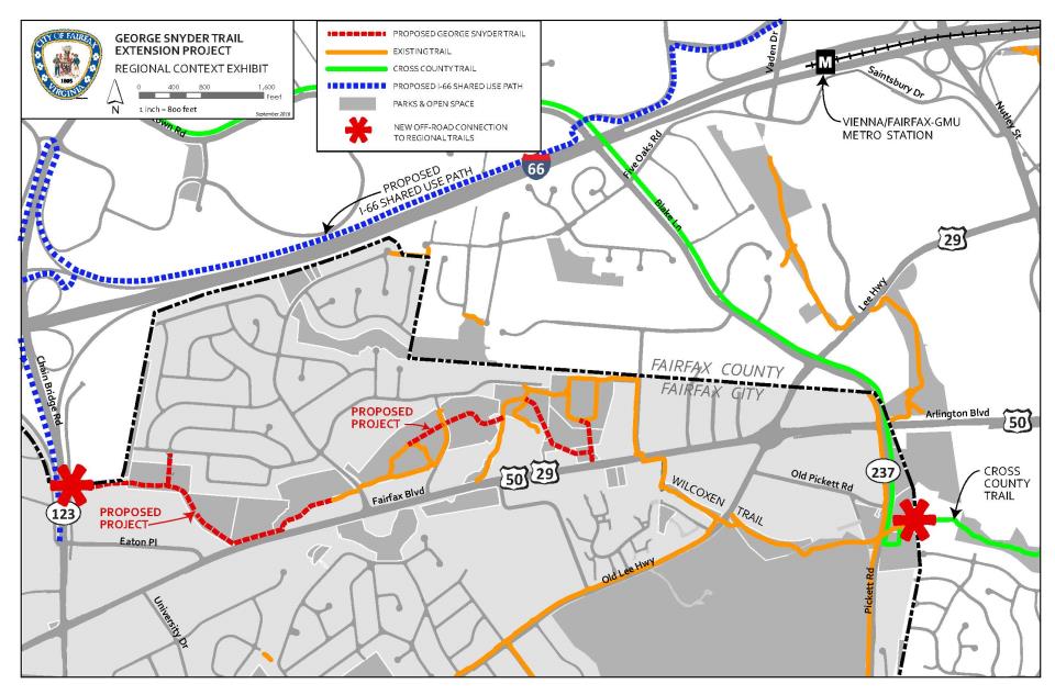
During a meeting on Tuesday (Jan. 9), the city’s transportation director, Wendy Sanford, presented the council with options for proceeding with the George Snyder Trail project, which will complete a 2-mile trail along the southern side of Accotink Creek between Chain Bridge Road (Route 123) and Fairfax Blvd (Route 50).
Plans for the Snyder trail have been underway for more than a decade, but the project has drawn some criticism from environmentalists who say it will eliminate hundreds of trees, negatively impacting the area’s woodlands.
A group of city residents sent an email to the city council and staff on Jan. 2 urging them to consider alternatives that would add a trail or bicycle lanes on existing streets, such as Fairfax Blvd, Cardinal Road or Eaton Place.
The planned route has gotten support from bicycling advocates, who say it’ll fill a missing link in the region’s bicycle network, particularly in the I-66 corridor.
In a presentation, staff recommended the council either continue with the proposed changes or modify it by only constructing the western portion from Chain Bridge Road to Fair Woods Parkway.
“To continue with the project as proposed, that would mean putting the project out to bid,” Sanford explained. “We have the 100% [design] plans to continue with the right-of-way acquisition.”
If the city cancels the project, Sanford said it would be required to repay some or all of the $3 million it has already spent, potentially affecting the city’s ability to be awarded funds for future projects.
Sanford noted that the suggested modification would reduce the overall cost, while still delivering some of the trail. However, Councilmember So Lim pushed for a cancellation, saying she thinks “it’s all or nothing.”
Councilmember D. Thomas Ross disagreed and said cancelling the project could have a negative impact on taxpayers.
“We’ve heard consistently the concerns about cost of operation and development and maintenance of the trail if it’s completed as proposed,” he said. “It’s going to be nothing compared to what we hear when we start talking about paying up to $3 million.”
Mayor Catherine Reed was also against canceling the project, but said she won’t participate in the scheduled vote on Jan. 23 unless there’s a tie.
“What what we understand about environmental impact is significant. No one is saying here that there’s no impact in building this trail, but we have heard it described as destroying a forest,” Reed said.
Anna Safford, the city’s urban forester, acknowledged the environmental concerns surrounding the trail, but said recreation helps to protect land.
“If you don’t use land, you lose land, but at the same time, recreation isn’t conservation,” Safford said. “And there is a very big difference in the land types along this corridor.” Read More
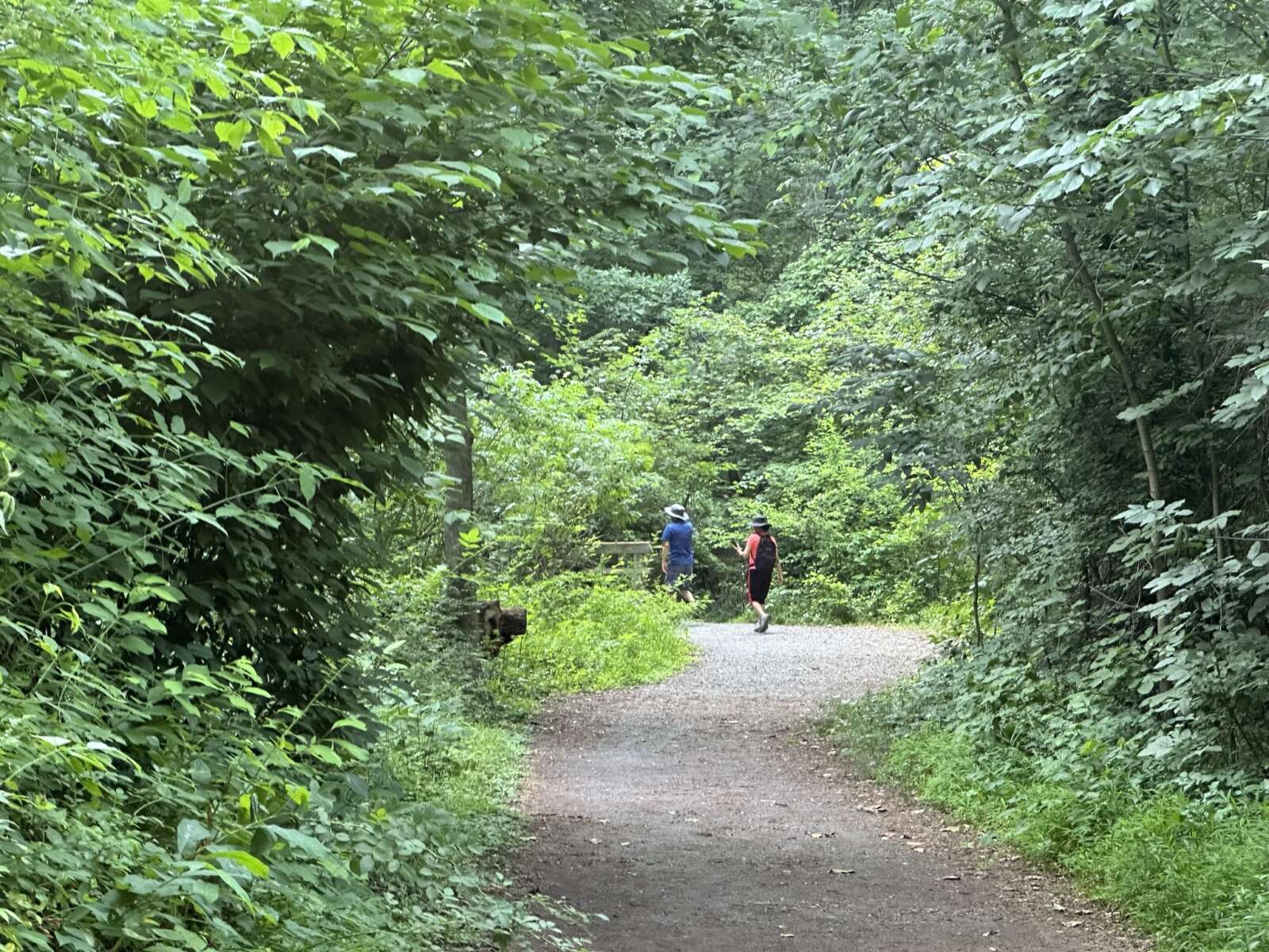
To kick off the new year, the Fairfax County Park Foundation is offering hikers gift cards ranging from $75 to $100 for their best photos of local trails.
This upcoming Monday, Jan. 1, hikers are invited to snap pictures while exploring any of the county’s 334 miles of trails.
Started in 2017, the First Hike Fairfax contest encourages professional and amateur photographers of all ages to capture a range of scenes on Fairfax County Park Authority-owned trails, including landscapes, wildlife and people.
The contest aims to highlight the county’s public spaces, foster community connections and encourage residents to explore its “hidden gems,” says the park authority’s public information officer, Ben Boxer.
“The effort is designed to encourage individuals and families to get a healthy start to the new year by enjoying time outdoors and taking a walk in the park,” he told FFXnow.
To win a park authority gift card, photographers must submit their best shots online before noon on Tuesday, Jan. 2. A link will be posted on the county’s website at 7 a.m. on Monday, according to a press release.
Participants with the best photos can win one of seven prizes.
- People’s Choice — $100 Park Authority Gift Card.
- Judges’ Choice — $100 Park Authority Gift Card.
- Director’s Choice — $100 Park Authority Gift Card
- Best in Show (Scenery/Landscapes) — $75 Park Authority Gift Card
- Best in Show (People) — $75 Park Authority Gift Card
- Best in Show (Wildlife) — $75 Park Authority Gift Card
- Best in Show (Pets) — $75 Park Authority Gift Card
The link to vote for the People’s Choice Award goes live on Friday, Jan. 5, and will stay open until Monday, Jan. 8 at 5 p.m. The winners of the contest will be announced by Thursday, Jan. 11, per the release.
Only one photo entry per person is allowed, and it should be in JPG format, no larger than 5 MB. The submissions must indicate the date and specific trail where the photo was taken, according to the contest rules.
While minor digital enhancements like cropping and red-eye removal are allowed, significant alterations or additions like borders, frames, watermarks, or signatures will lead to disqualification, the rules say.
First Hike Fairfax Photo Contest returns!
📸 Visit any FCPA trail on Jan. 1, 2024, take a photo and submit it before noon on Jan. 2, 2024! Photo Submission link will open at 7 a.m. on Jan. 1, 2024
Learn more: https://t.co/pJFP2q4PtA#firsthikefairfax #photocontest #fairfaxparks pic.twitter.com/hLKTZSvNwK— Fairfax County Parks (@fairfaxparks) December 4, 2023
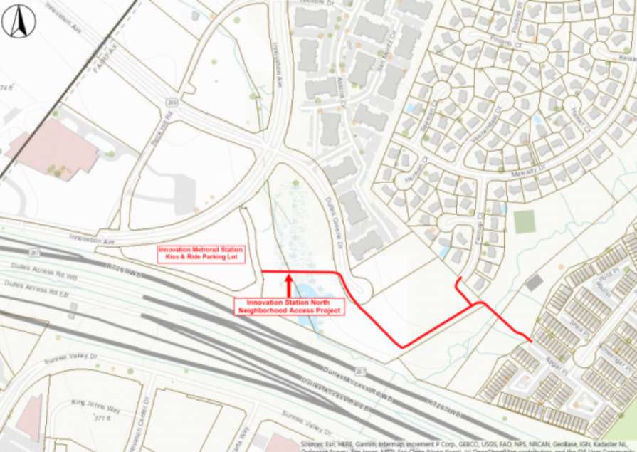
Fairfax County is gearing up to secure land rights to proceed with the development of a new shared-use path from the Innovation Center Metro station to surrounding neighborhoods.
At a meeting on Tuesday (Oct. 24), the Fairfax County Board of Supervisors unanimously agreed to set a public hearing for the project on Nov. 21.
Presented to the community in January, the project includes a 10-foot-wide, approximately 1,920-foot-long shared-use path. It would connect the kiss-and-ride parking lot to the residential communities at Farougi Court and Apgar Place.
“The connection will significantly reduce the trip length between the station and surrounding neighborhoods,” the Fairfax County Department of Transportation said on its webpage for the project.
Two pedestrian bridges over Horsepen Creek and lighting along the new path are also planned.
To move forward with the project, the county must secure land rights on six properties.
“Negotiations are in progress with the affected property owners,” county staff said in the board meeting agenda. “However, because resolution of these acquisitions is not imminent, it may be necessary for the Board to utilize quick-take eminent domain powers to commence construction of this project on schedule.”
Construction on the project is expected to begin in summer 2024, followed by completion in the summer of 2025.
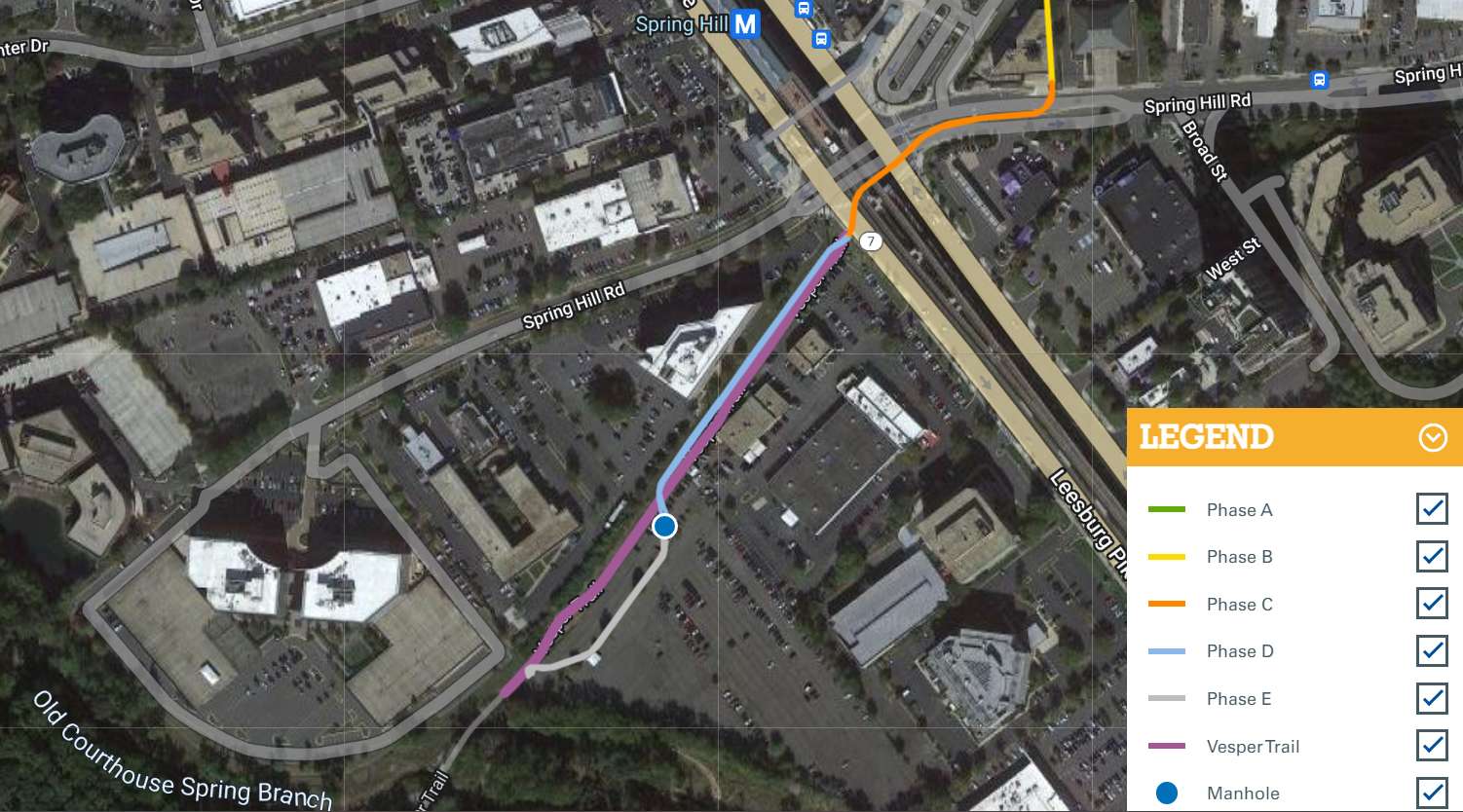
Construction is about to ramp up on Dominion Energy’s undergrounding of a power line near the Spring Hill Metro station in Tysons.
The project will require an extended closure of the entire Vesper Trail from Route 7 (Leesburg Pike) to Vesper Street at Higdon Drive, starting Nov. 1, the utility company recently told residents in the area.
Expected to last until February 2024, the closure is needed so crews can work within the trail path, Dominion Energy said, noting that signs alerting users to the closure will be placed at the trail.
“We appreciate your patience and understanding as we work in your neighborhood,” Dominion said in a postcard sent to residents. “We are committed to completing this work safely and expeditiously to minimize disruptions to the Vesper Trail and your community.”
Preliminary construction activities on the Spring Hill project began this spring, necessitating a roughly five-day trail closure in late April as crews installed a manhole.
To increase the capacity of its power grid as Tysons continues to grow, Dominion is moving part of an existing, overhead electric transmission line underground. The 230-kilovolt line will run a half-mile from a Tyco Road substation to a transition pole near a new substation around the Vesper Trail’s midpoint.
Construction on the new, 75-foot-tall substation will begin after crews finish undergrounding the power line. The overall project is currently on track to be complete and in service by the end of 2025, according to Dominion spokesperson Peggy Fox.
Dominion says the project will “generally” serve its customers south of Leesburg Pike and outside of the Capital Beltway (I-495).
Graphic via Dominion Energy
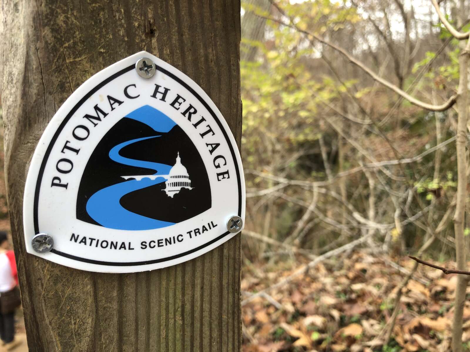
Fairfax County will add its voice to the chorus of local governments touting the presence and benefits of the Potomac Heritage National Scenic Trail.
The Board of Supervisors authorized staff on Tuesday (Oct. 10) to sign an agreement committing the county to developing, maintaining and promoting its segments of the trail, which spans almost 900 miles from the Allegeny Highlands in western Pennsylvania to the Potomac River’s mouth in Northern Neck.
The roughly 137-mile Northern Virginia section includes segments in Great Falls, McLean and along the George Washington Memorial Parkway and Route 1 (Richmond Highway) from the City of Alexandria to Lorton.
“This is a mostly unknown trail connection that we’ve all been working on, believe it or not, for years,” Mount Vernon District Supervisor Dan Storck said before the board’s unanimous vote.
Designated in 1983, the Potomac Heritage Trail is overseen by the National Park Service, but it has enlisted local governments to manage segments in their borders under the memorandum of understanding (p. 413), which was initially developed in 2020.
In addition to Fairfax County, participating localities include Arlington, Loudoun and Prince William counties, along with Alexandria and the towns of Dumfries, Leesburg and Occoquan.
Per the MOU, the county’s park authority and transportation and public works departments will maintain trail segments, place markers at key points like major trailheads, promote the trail with media and way-finding or interpretive exhibits, and report on “visitation, volunteerism, and challenges and needs for completed segments.”
“The purpose of the agreement is to recognize the Trail network in northern Virginia and to realize fully the benefits associated with such recognition, including increased opportunities for outdoor recreation and nonmotorized transportation; for education, health, and heritage tourism; and for contributions to a vibrant regional economy,” county staff wrote in a summary for the Board of Supervisors.
The MOU also directs trail managers to “consider requests to plan, acquire lands and easements for, and develop segments of the Trail within respective jurisdictions.”
Fairfax County recently filled some gaps with the Mount Vernon Highway Trail Project, which added a shared-use path from Route 1 to Southwood Drive and was completed in May.
Storck said at Tuesday’s board meeting that his office has been working over the last few months to adjust some of the new trail segments “so they’re not right on Route 1.”
Working with Fort Belvoir to move its segments off the road has proven to be a challenge due to Defense Department rules on “what you can do and where,” but Storck said there has been “great progress” made on the trail.
“We’ll need to continue [that progress],” he said. “This will be something that gets worked on long after I’m gone, to find better ways to have it be more scenic and less urban…We’re doing the right thing, and as you see, it’s taken 50 years just to get this far, so we’ll keep plugging away.”
According to a trail map maintained by the Northern Virginia Regional Commission, Fairfax County still has gaps in the Mason Neck Trail along Gunston Road, on Old Colchester Road to connect Route 1 to the Mason Neck Peninsula, and between Great Falls Park and Scott’s Run Nature Preserve.
The Great Falls-to-Scott’s Run segment is unfunded, though one needed easement has been obtained at the Madeira School in McLean. The Gunston Road segment will cost an estimated $9 million and has gotten $4 million funded so far.
The route connecting Route 1 and Mason Neck may be tweaked as the county updates its overall trails map as part of its ActiveFairfax Transportation Plan, which is “tentatively” expected to get adopted in 2024, according to NVRC.

