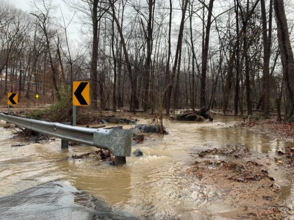
Waters from the Potomac River could spill over into Fairfax County, with the D.C. area expected to get almost nonstop rain tomorrow (Friday), the National Weather Service warns.
A Coastal Flood Warning will be in place for Northern Virginia, including Fairfax County, starting at 6 p.m. today (Thursday) until 8 a.m. Saturday (Oct. 30).
According to the NWS, showers and thunderstorms from the Midwest are moving east and could bring 1 to 2 inches of rain, along with the risk of flash flooding along the Potomac River and Chesapeake Bay.
Here is more from the NWS alert:
…COASTAL FLOOD WARNING NOW IN EFFECT FROM 6 PM THIS EVENING TO 8 AM EDT SATURDAY…
* WHAT…Two to four feet of inundation above ground level possible in low lying areas.
* WHERE…Prince William/Manassas/Manassas Park, Fairfax and Stafford Counties.
* WHEN…From 6 PM this evening to 8 AM EDT Saturday, especially around the time of high tide.
* IMPACTS…Numerous roads may be closed. Low lying property including homes, businesses, and some critical infrastructure will be inundated. Some shoreline erosion will occur.
The NWS has also issued a Flood Watch that will be in effect from 10 a.m. to 6 p.m. tomorrow, with rainfall potentially reaching 2 to 4 inches in some areas.
“Heavy amounts of rain will cause creeks and streams to slowly rise, possibly out of their banks as well as the potential for flooding in urban areas,” the NWS said.
Several Coastal Flood Warnings have been issued along the Chesapeake Bay and Tidal Potomac River. Water levels are already on the rise and will only rise more throughout the day today and into Friday. Tidal inundation levels of 2-4 feet are expected in low-lying coastal areas. pic.twitter.com/dObvOQdto8
— NWS Baltimore-Washington (@NWS_BaltWash) October 28, 2021
The Fairfax County Office of Emergency Management says the risk of rain will likely arrive in the county around midnight to 2 a.m. Friday, echoing the Fire and Rescue Department’s warning that flooding may lead to road closures.
“Low lying property, including homes, businesses and some critical infrastructure, may be inundated,” OEM said in a blog post. “Take the necessary actions to protect flood-prone property. If travel is required, do not drive around barricades or through water of unknown depth.”
The office also advised keeping children away from creeks or other bodies of water that may rise rapidly, and clearing leaves and other debris from downspouts and storm drains.
[10/28 at 8:35 AM] A Coastal Flood Warning will be in effect at 6 PM this evening to 8 AM Saturday.
🌊2-4 feet of inundation above ground level possible in low lying areas
🚧Numerous roads may be closed
⬆️Flooding will be the worst around high tide#TurnAroundDontDrown #VaWx pic.twitter.com/LDW8LfA8pw— Ready Fairfax (@ReadyFairfax) October 28, 2021


