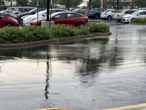
A Flood Watch is now in effect for the D.C. area, including Fairfax County.
The National Weather Service describes the chances of “slow-moving showers and thunderstorms” this afternoon into the early evening as “likely.”

A Flood Watch is now in effect for the D.C. area, including Fairfax County.
The National Weather Service describes the chances of “slow-moving showers and thunderstorms” this afternoon into the early evening as “likely.”
Fairfax County is pushing forward on a program that could have the county government split the bill for private stormwater projects with property owners.
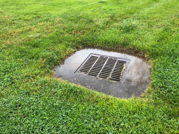
Flooding doesn’t end at the property line and the Local Stormwater Management Assistance Fund aims to help boost stormwater management on private property. At an environmental committee meeting of the Board of Supervisors on April 25, staff presented an update on the program.
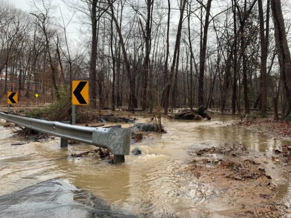
A major winter storm is headed for the D.C. area, just in time to disrupt holiday travel.
While the snow and ice created by a “bomb cyclone” is expected to stay further west, Fairfax County and the rest of the D.C. area are in for a downpour, according to the National Weather Service.
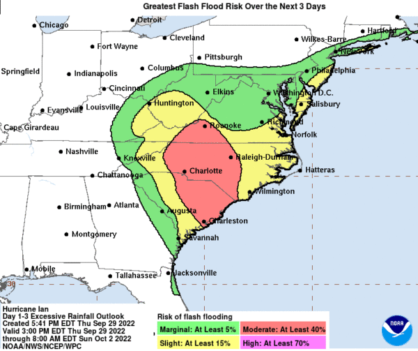
(Updated at 5:05 p.m.) An October weekend once filled with fall events is starting to clear out, as Fairfax County braces for Hurricane Ian.
The storm that devastated Florida after making landfall on Wednesday (Sept. 28) is expected to weaken as it heads north, but its rain and winds could still prove dangerous, the Fairfax County Department of Emergency Management and Security (DEMS) warns.
Fairfax County is considering making all existing and future development built to lessen flooding risks from huge, 100-year event storms, as opposed to a 10-year storm.
The risk of flooding in the county is rising due to climate change, staff told the Fairfax County Board of Supervisors environmental committee late last month. While preventing flooding is impossible, its impact can be mitigated, they said.

Fairfax County and areas nearby are under a Severe Thunderstorm Watch this evening.
The National Weather Service issued a Flood Watch earlier today (Monday), cautioning flooding may occur this evening, and a Severe Thunderstorm Watch is in effect until 10 p.m.
A Flood Watch has been issued for Fairfax County and the rest of the D.C. area.
The alert will be in effect from 11 p.m. today (Friday) through 2 p.m. tomorrow (Saturday), according to the National Weather Service, which warns that “excessive” rainfall may lead to flash flooding.
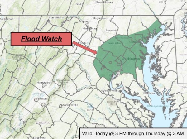
Updated at 2:25 p.m. — The Flood Watch has been extended to 5 a.m. tomorrow (Thursday), per Fairfax County.
Earlier: A Flood Watch is on the horizon for much of the D.C. area, including Fairfax County.
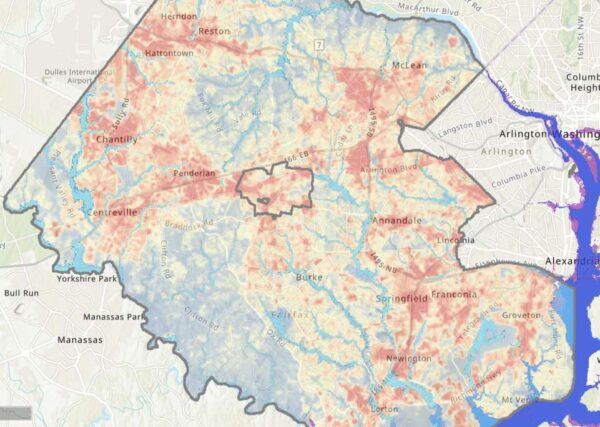
As Fairfax County finalizes its first-ever plan to address the future effects of climate change, community members can see how the phenomenon already affects them with a newly released interactive map.
Launched last week, the climate map depicts heat and flooding data that can be viewed in conjunction with maps of the county’s population and infrastructure, including roads, utilities, and public facilities.
Fairfax County is under a Flood Watch until midnight.
The National Weather Service issued the watch this morning, noting flash flooding caused by excessive rainfall is possible after 3 p.m.