

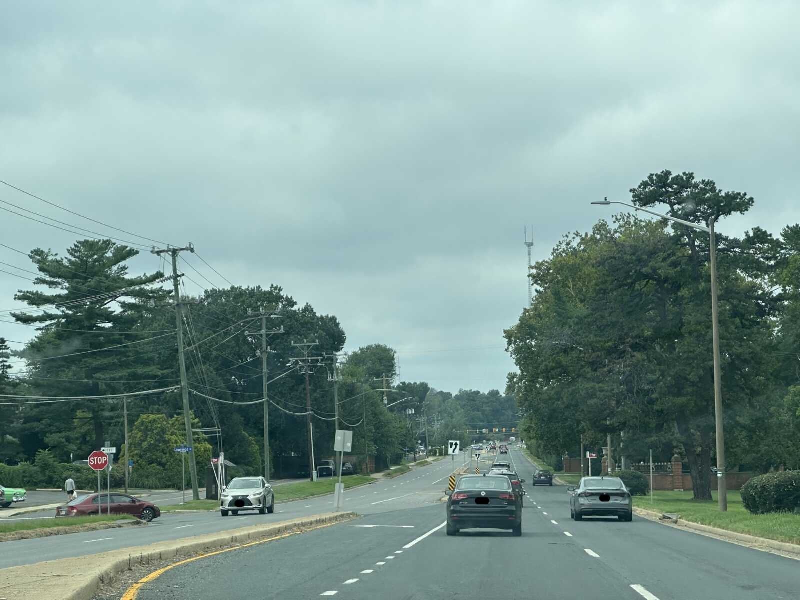
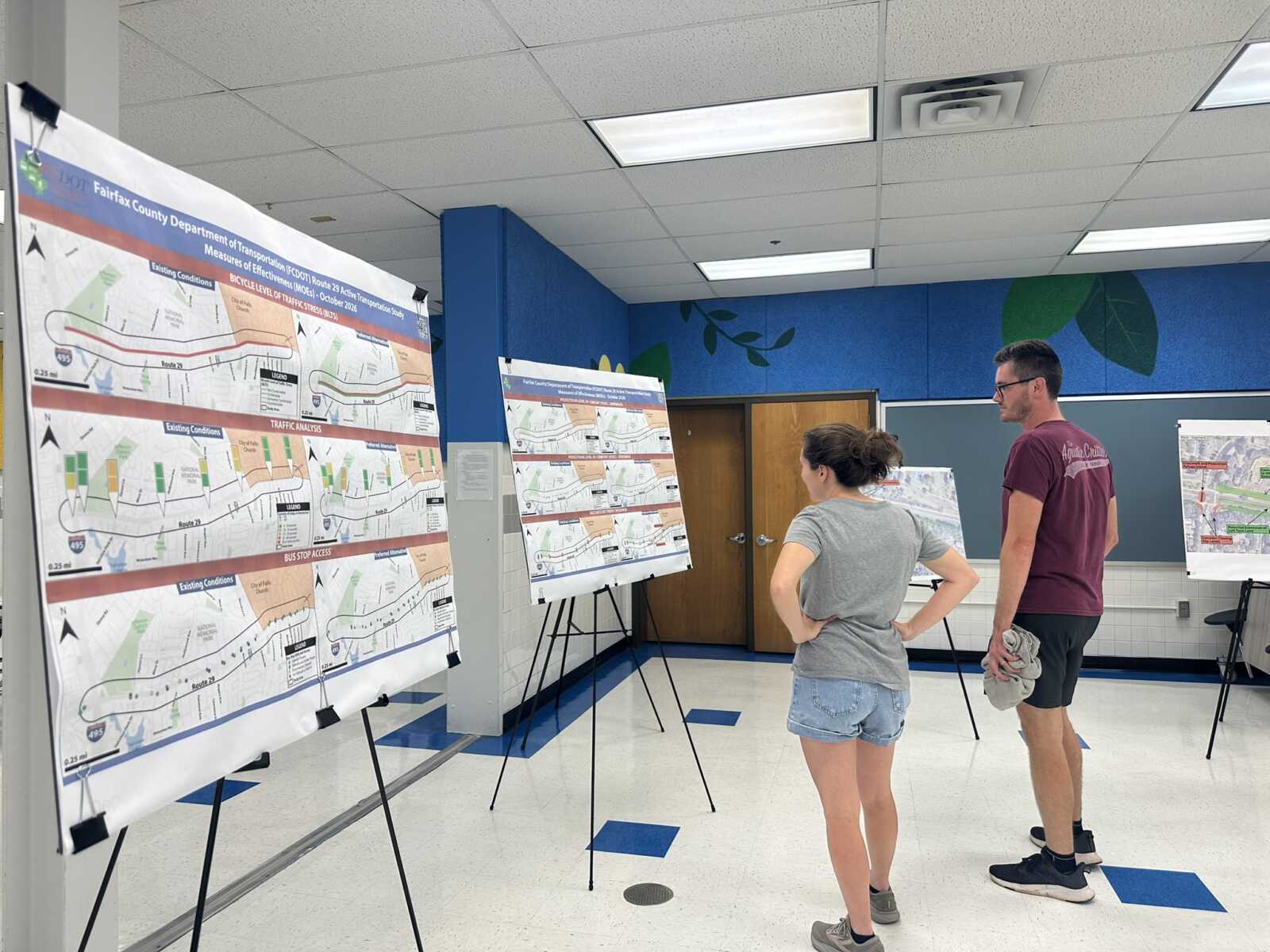
The Fairfax County Department of Transportation is recommending a number of improvements that it hopes will make the West Falls Church segment of Route 29 safer for all travelers, especially pedestrians and bicyclists.
Community members attending a public meeting at Timber Lane Elementary School last Wednesday (Oct. 14) generally seemed to embrace the proposed changes, which include new sidewalks, a shared-use path, and crosswalks, but some lamented the project’s limited scope and undefined timeline.
“It’s better than [what] we’ve got now, but that’s a pretty low bar,” said Keith Henning, a McLean resident who frequents the Route 29 corridor to visit the Mosaic District in Merrifield and nearby Falls Church City. “My thought is that, if you’re going to redevelop it, especially over a 20-year timeline, you might as well redevelop it how you fully want it instead of just a little better than now.”
Study seeks to reimagine Route 29’s future
FCDOT launched its Route 29 Active Transportation Study in fall 2025 after finding that the county’s longstanding vision for the corridor no longer makes sense. Plans to widen Route 29 east of Fairfax City to six lanes in the hopes of relieving gridlock date back to 1986, though in a somewhat ironic win for the sluggish pace of major transportation projects, they never came to fruition.
Now, Fairfax County is reevaluating Route 29 as part of a broader push to make its auto-centric roadways safer and more accessible for other modes of travel, including walking, cycling and transit.
In addition to the current study, which focuses on 2 miles of road between the Capital Beltway (I-495) and Tripps Run at the Falls Church border, local officials intend to revisit the Merrifield segment after dropping a widening project from the county’s long-term transportation plan in 2024.
“We’re trying to retroactively kind of plan for the facilities we need in a corridor that’s already built up,” Mike Garcia, chief of FCDOT’s transportation planning section, said. “We have very limited space that’s available, so how do we use the space in a different way that really goes about achieving the goal of making the area more walkable, more bikeable?”
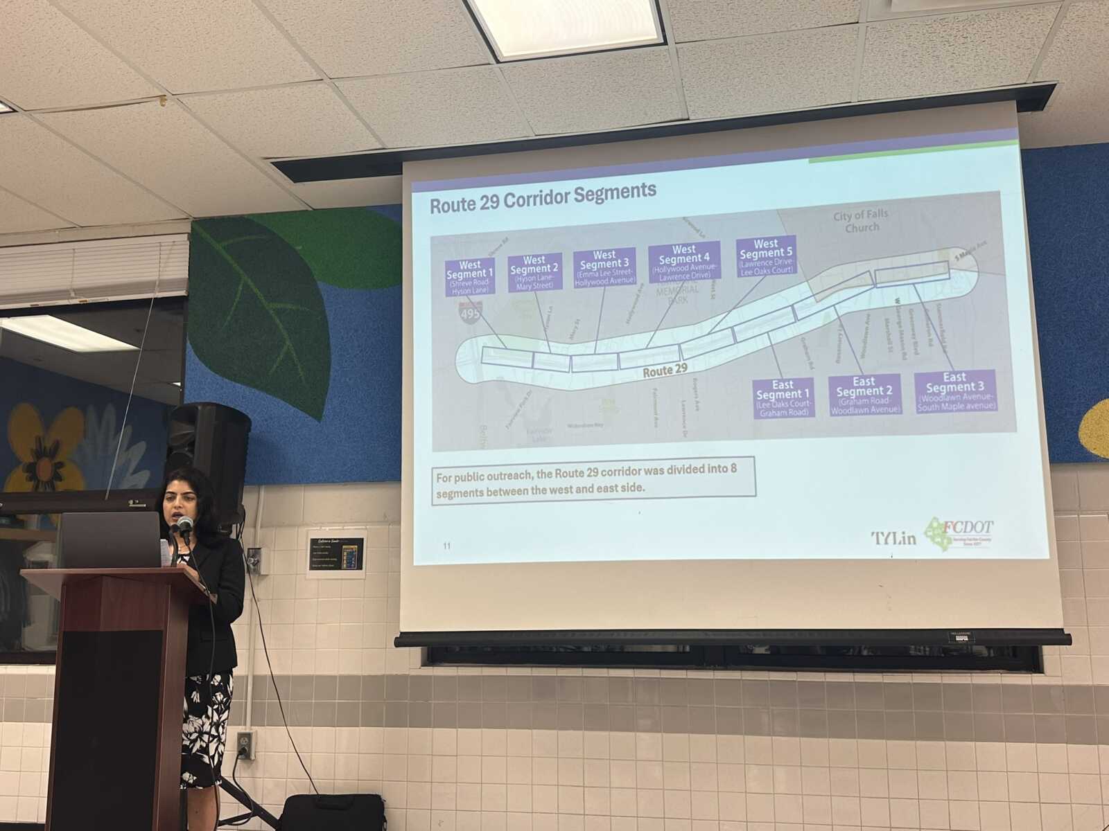
After soliciting feedback at two prior community meetings and through an online survey, FCDOT unveiled its proposed answer to that question last week.
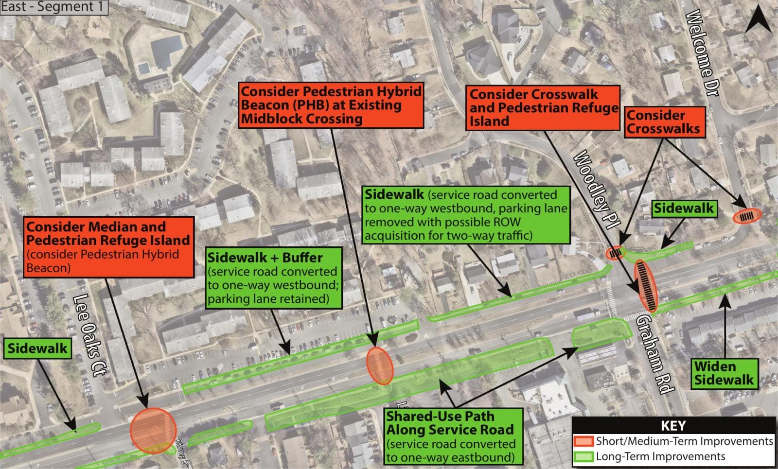
On the west end of Route 29, planners recommend building a shared-use path on the south side of the road, while widening sidewalks or filling in gaps on the north side. In some areas, the pedestrian facilities would either replace existing service roads or narrow them to a single, one-way lane, and some driveways would be closed off.
The shared-use path would end at the Graham Road intersection, with FCDOT instead proposing wider sidewalks for the remainder of the road’s eastern segment on both the north and the south sides.
Other potential changes include:
- Shreve Road: crosswalk and pedestrian refuge island with curb extensions
- Hyson Lane: crosswalk and pedestrian refuge island with a possible closure of slip lanes, along with an extension of the westbound left-turn lane
- Emma Lee Street: crosswalks if a traffic signal is warranted, potential removal of left turn lanes to allow a median extension to a midblock crossing just east of Windsor Drive, which would no longer provide access to Route 29
- Hollywood Road: a potential lane reconfiguration with curb extensions
- Segment fronting the National Funeral Home and Memorial Park: removal of eastbound left-turn lanes in favor of a tree-lined median, potential midblock crossing with a pedestrian refuge island
- West Street: bus stop improvements with a possible relocation to the east side of the intersection, along with a crosswalk; crosswalks could also be added along the south-side service road at Lawrence Drive and Rogers Drive
- Lee Oaks Court: median and pedestrian refuge island, possibly with a pedestrian hybrid beacon
- Graham Road/Woodley Place: crosswalks with a pedestrian refuge island
- Poplar Drive to Jackson Street: crosswalks at the Jackson and southern Rosemary Lane intersections with a potential median extension to Jackson Street
- Marshall Street to South Maple Avenue: intersection redesigns at Marshall and Greenway Blvd, with the former being undertaken by Falls Church City; replacement of a center, two-way left-turn lane with a landscaped median that includes left-turn “pockets” at Greenway and Summerfield Road
According to FCDOT project manager Nanditha Paradkar, the study recommendations would add 1.5 miles of bicycle facilities and approximately 2 miles of new sidewalk segments.
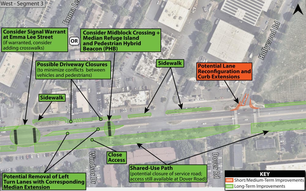
Though some of the corridor would remain challenging, the sidewalk and crossing improvements would significantly increase pedestrian comfort levels, the study found. The portion of the road outfitted with a shared-use path would also become less stressful for bicyclists.
A traffic analysis found “no substantial change” in rush-hour delays at the corridor’s signalized intersections compared to current conditions, and crashes are expected to be reduced, including those resulting in fatalities or serious injuries and ones involving pedestrians and bicyclists.
“No single improvement provides benefits on its own, but together, they provide a safer, more comfortable corridor,” Paradkar said at the conclusion of her presentation.
Residents stress urgency of safety improvements
Though the general sentiment among those attending the meeting was one of relief that improvements are being considered, some expressed disappointment that the shared-use path wouldn’t extend through the full study area.
One resident worried that changes to the service roads will lead to more drivers attempting tricky turns out of their neighborhoods instead of using the service roads to reach signalized intersections.
Another stressed the need for bus stop improvements, pointing to one on a hill outside the cemetery that can be slippery when the grass is wet.
“I’ve been paying taxes for 50 years. I want a little safety at least,” he said, noting that the road is nearly impossible for him to navigate as someone without a car. He said he has witnessed multiple crashes over the years, and he knows people who have been killed in the corridor.
Eliot Forster-Benson was among the attendees disappointed that only 1.5 miles of bicycle facilities are being proposed, but he was glad to see the missing sidewalk connections.
“It’s really dangerous that the sidewalks aren’t connected,” he told FFXnow. “There are areas where you have to trudge through mud or jump into Route 29 to get around bushes and things like that, and it’s honestly kind of disgraceful that the county or the state has the roads in that condition currently, so I’m glad they’re trying to address that.”
Forster-Benson also supported the proposed curb extensions at Shreve Road, the intersection he believes is most in need of improvements. He suggested that the county should add flex posts or another quick interim solution until the permanent redesign can be implemented.
A desire for more comprehensive improvements, but also projects that could be built as soon as possible emerged as the overarching, perhaps contradictory theme of the meeting, Garcia acknowledged.
Henning contended that traffic delays, typically measured in a matter of seconds, shouldn’t be viewed as a dealbreaker for changes that could make the road safer.
“I just see [Route 29] as a wasted opportunity that could be so much more if we developed it smartly and did it in a way that’s going to prioritize people instead of prioritizing cars,” he said, adding that he would ride his bicycle more for local trips if the necessary infrastructure existed.
FCDOT officials noted that their proposals need to be approved by the Virginia Department of Transportation, which continues to heavily consider congestion mitigation and travel reliability when prioritizing projects for funding.
The recommendations are also limited by the county’s right-of-way and the availability of funding, which hasn’t been identified yet. They’re split between short or medium-term improvements that could be addressed in two to five years, and long-term improvements expected to take 15 to 20 years, according to Paradkar.
For now, FCDOT is focused on finalizing the active transportation study, which is expected to be delivered to the Board of Supervisors for its approval by the end of this year.
An online survey to gather one last round of public comments on the proposed improvements will remain open until 5 p.m. on Monday, Nov. 6.
“We really would appreciate the community taking our survey,” Garcia said. “… We really value the feedback, the input. It’s really what helps us not only conclude this phase of the project, but look to move it forward so we continue to … implement projects in this corridor in the future.”
